Ancient Tombs of Saigon – Lam Tam Lang Tomb, 1841

The Lâm Tam Lang tomb in Tao Đàn Park

This article was published previously in Saigoneer http://saigoneer.com

Described by one local expert as “a rare surviving vestige of its era,” the tomb of Lâm Tam Lang and his wife in Tao Đàn Park is one of the city’s abiding mysteries.

The Nguyễn-dynasty style twin tomb, said to be the last resting place of Lâm Tam Lang and his wife, is located close to Trương Định street, next to the Tao Đàn Park office. It was classified as a municipal heritage site by the Hồ Chí Minh City Peoples Committee on 18 April 2014.

A screen conceals the front gate of the Lâm Tam Lang tomb

Situated on a plot of land measuring 12m by 7.5m and aligned in a northwesterly direction, the tomb was built using a special type of traditional plaster known as ô dước. Its architectural style, once reserved for royalty, became popular amongst the royal mandarins of the south during the rule of the Nguyễn, but the layout and dimensions of this particular twin tomb make it unique.

The tomb is surrounded by a low wall and access is achieved via a small front entrance, flanked by stone columns topped with lotus buds. In the front yard is a low screen (bình phong) which protects the main gate of the tomb compound. Beyond the main gate is a tiny worshipping yard, and behind that the twin tombs themselves, placed crossways one behind the other and fronted by shrines with small alcoves which once contained ancestral tablets. The tombs themselves take the form of small houses, topped with imitation yin-yang tiled roofs and featuring stylised elephant and tiger head roof-ridge decorations.

The shrines in front of the tomb houses at the Lâm Tam Lang tomb

Behind the tombs is a rear screen containing a eulogy which has been mostly worn away over the centuries, but what’s left is enough to identify the tombs as those of Lâm Tam Lang and his wife.

Using the archives of the Lâm family of Rạch Giá (now Kiên Giang) province, written in 1910 by 6th-generation family member Lâm Văn Giáp, some scholars have identified this Lâm Tam Lang as a Chinese settler of the Lâm (Lín 林) family from Guangdong province. Also known by the name Nguyên Thất, Lâm Tam Lang was married to a woman named Mai Thị Xã and died in the Autumn of the lunar year Ất Mão (1795).

However, also visible on the rear screen are the characters Đại Nam (大南), the name given to the nation by King Minh Mạng in the 19th year of his reign (1839), which suggests that the tomb may be of later construction.

A side view of the tomb houses at the Lâm Tam Lang tomb

Several years ago, archaeologist Đỗ Đình Truật conjectured that the tomb may in fact be that of an unnamed senior military commander in the army of General Trương Minh Giảng (?-1841), which played an important role in suppressing the Lê Văn Khôi revolt of 1833-1835. However, this thesis has never been proven.

In a recent interview, Dr Phạm Đức Mạnh, Head of Archaeology at the University of Social Sciences and Humanities (Việt Nam National University, Hồ Chí Minh City) confirmed that the ancient architecture and special configuration of this double tomb mark it out as one of the most important vestiges in the city. However, he stressed that “in order to obtain more accurate information, we must excavate the tomb.”

With no excavation currently scheduled, it would seem that the secrets of the Lâm Tam Lang tomb are safe for the time being.

You may also be interested to read these articles:

Forgotten Nguyen Dynasty Tombs of Phu Nhuan
Ancient Tombs of Saigon – Phan Tan Huynh Tomb, 1824
Ta Duong Minh – Thu Duc’s Founding Father 1860s

Tim Doling is the author of the guidebook Exploring Saigon-Chợ Lớn – Vanishing heritage of Hồ Chí Minh City (Nhà Xuất Bản Thế Giới, Hà Nội, 2019)

A full index of all Tim’s blog articles since November 2013 is now available here.

Join the Facebook group pages Saigon-Chợ Lớn Then & Now to see historic photographs juxtaposed with new ones taken in the same locations, and Đài Quan sát Di sản Sài Gòn – Saigon Heritage Observatory for up-to-date information on conservation issues in Saigon and Chợ Lớn.

Tourism in Indochina, 1931

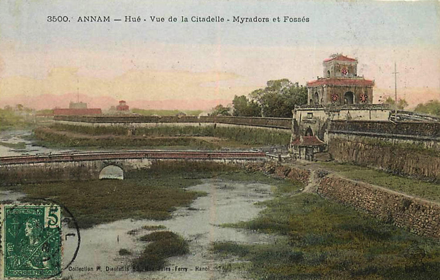
The royal citadel in Huế in the early 1900s

Published in l’Eveil économique de l’Indochine on 12 December 1931, “Tourism in Indochina” describes the attractions which awaited the adventurous colonial traveller 84 years ago in Việt Nam, Cambodia and Laos

Indochina certainly ranks among the leading countries in the world for “grand tourisme.” Above all, it boasts that curiosity of the first order, Angkor. That fact alone warrants much greater organisation to facilitate the realisation of private tourism initiatives in this still undeveloped land.

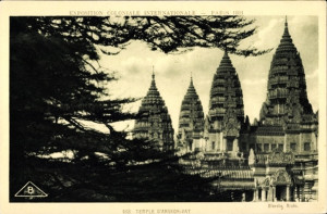
Angkor Wat, photograph from the Colonial exposition Paris, 1931

But we might jeopardise the success of the “Wonder of the World” if we place it on the same level as other tourist attractions, which at present are insufficient by themselves to attract the distant visitor. Hue and its royal tombs, big game hunting and Halong Bay are all second-class attractions which at the present time draw tourists only from Indochina and neighbouring countries, but on the other hand these places could attract visitors from Hong Kong, Singapore and Batavia who have already paid the fare to come to the Far East. Finally, there are many regional tourism attractions, interesting for locals and for foreign tourists who wish to know Indochina as a whole: for example, the Babé lakes, Khone waterfalls, Luang Prabang, Dalat, Chapa, Tourane, the Black River, etc.

The domain of tourism also comprises attractions which interest not just the colonial settler but also the affluent local population, not to mention the travel services which may be requested by those whose profession requires them to move to and reside in undeveloped regions, in localities which are currently too poor to accommodate the tourist.

It’s thus that, centuries ago, the Thai countries created the sala, a house which is made available to travellers at any significant location, or at various points along main roads, with the proviso that one must provide one’s own food and bedding. This institution is especially well developed in Siam. Although it’s very modest, the introduction of the sala in the Annamite lands would constitute appreciable progress.

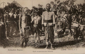
The people of the Bolovens plateau, Laos, in the colonial era

In fact, it might have been more appropriate for the authorities to start by upgrading that which already existed – to pave the mule tracks, add box culverts, pavements and roadside cafes – before undertaking costly projects like the construction of new roads. Similarly, they ought perhaps to have installed basic lodgings (salas or guest houses), before building luxury hotels, to have opened up the country using modest resources before investing millions to create high-altitude health spas.

But in this life of ours, events never follow a logical order: the war suddenly posed problems for the creators of the hill stations, and in the post-war period, which everyone had predicted would be a time of fabulous wealth, and which for a while led to abnormally high rice, tin and rubber prices, expectations became excessive. In order to take advantage of the economic boom which seemed to be enriching Hong Kong, Manila, Java and Singapore, we devoted considerable sums to the construction of luxury hotels.

Events once again dashed the expectations of those who had failed to learn from experience. The lean years showed up again suddenly, when we were least expecting them.

These days in Indochina, we rarely see the princes and billionaires on whose hospitality so much money was spent, while the prospector, the industrialist and the local official still experience the greatest difficulties when travelling in regions whose development is nevertheless desirable.

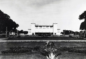
Dalat – the Grand Hotel in 1931

The crisis of 1930-1931 was a reminder to humanity of the old Bible story of the “seven fat cows and seven lean cows” of Egypt. The normal state of affairs is not that of yesterday before the crisis, it is that of today, with its hard labour law and the impoverishment of so many millionaires. And now, tourism in Indochina, which had been geared too much towards the latter, must turn towards a more modest, but perhaps more interesting customer. However much they scale down their operations, it will be a very long hard road for many of the large luxury hotels, until a new generation has become wealthy and more adequate means of transport and communication make it possible for those on more modest budgets to access our distant lands. But eventually these means will be created, the amenities procured and the burden alleviated.

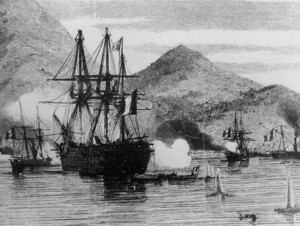
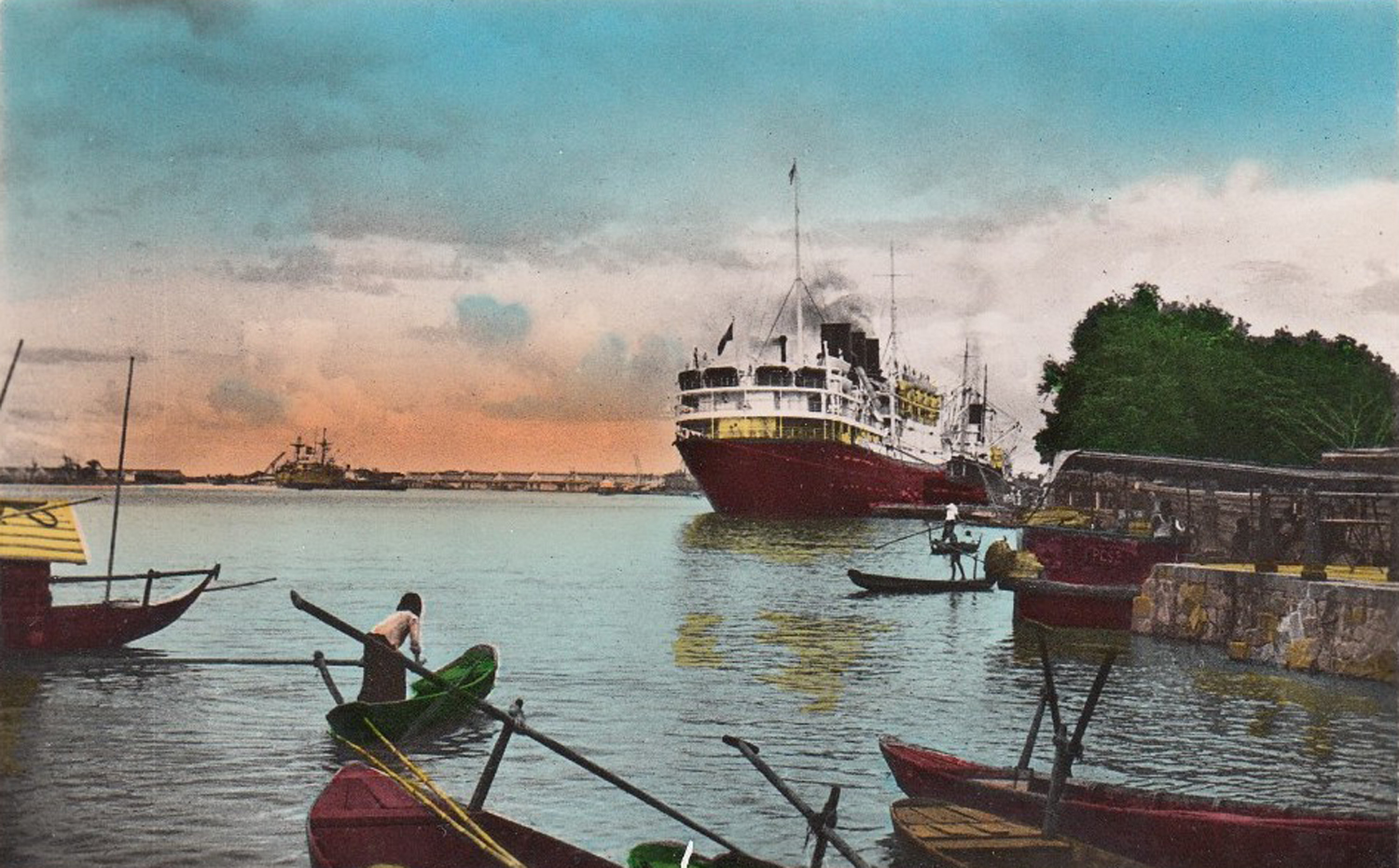
Indochina, with its two ports of Saigon and Haiphong, is out of the way of most foreign ships, but many of them graze the coast of Annam without stopping, due to the lack of a port. The administration is currently considering two draft projects: one, in Nha-Trang, will require 40 million francs and several years of construction to develop a port of call, while the other, in Cam-Ranh, will cost just one twentieth of that amount and will involve only a few months of construction. The latter project would seem to be the obvious choice; it should be easy to implement and its completion will remove a major obstacle to what is known as “le grand tourisme.”

Phnom Penh Railway Station in 1933

A second obstacle will disappear when the railway connects Saigon with Phnom Penh, Battambang and the Siamese border, because not everyone shares the snobbery of those who believe themselves to be “dishonoured” when they travel by rail, indeed, many travellers prefer the comfort and convenience of the express train. When Angkor, Phnom Penh and Saigon are eventually connected by that great railway line which already links those two major ports of call, Penang and Cam-Ranh, we will multiply the number of our visitors. Already, thanks to the Siamese railway network, Angkor profits in large measure from the huge numbers of tourists attracted by our Siamese neighbours to Bangkok. With twelve or thirteen thousand visitors, instead of just twelve or thirteen hundred, Indochina will be able to start recovering some of the costs it has incurred in attracting them.

In the meantime, it would seem wise to concern ourselves mainly with local tourism, to make new efforts to attract a larger number of people to our high altitude health spas. And really, was it not for all French people, large or small, and especially children, that these health spas were built? Already, a happy change has occurred in Dalat; the original idea of setting up a “Far Eastern Monaco” has been abandoned; a second class hotel and two high schools have been built, instead of casinos, theatres and dance halls, and when the railway reaches the city, it will lower considerably the cost of living there. Several thousand French women and children will benefit directly from this tremendous effort, which we hope will also help to attract foreign visitors. They are now as penniless in Singapore as we are in Saigon, and many are eager to visit, once Dalat is cheaper to access and stay in.

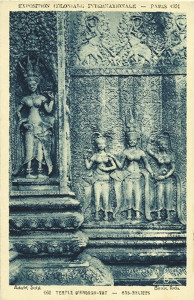
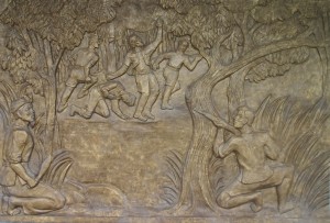
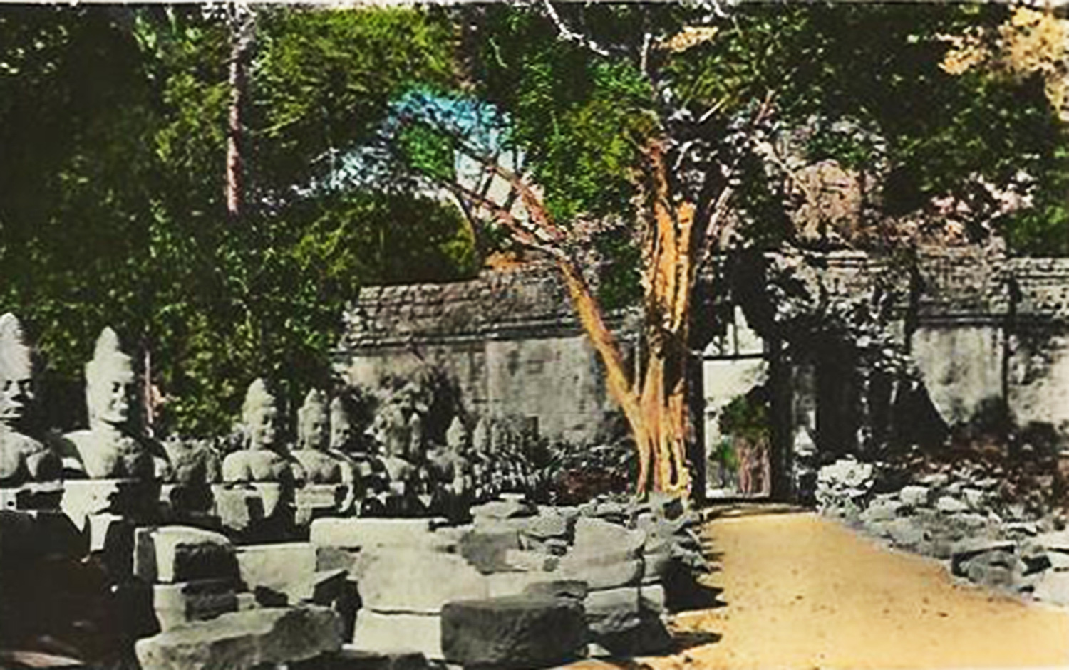
Bas-reliefs on the temples of Angkor

Finally, we should also think about the local people, who, as they develop and prosper, will acquire a taste for travel and will be encouraged by the new facilities.

The richest and most advanced of them will benefit greatly from the development of tourism facilities which were created for the French, in contrast to other colonies where racial prejudice prohibits the natives from enjoying such benefits. As for the less wealthy, and those who value their customs, they will be accommodated in guest houses in holiday resorts and particularly in the spas that one can already envisage developing in a country so rich in thermal springs.

If we have not yet done anything to develop tourism, it is because we never envisaged or planned for an indigenous clientele (they have long been steadfast in their disdain for the way we live) and because up to now the French clientele has always been insufficient.

If an effort is made in the popular sense that we have indicated, and above all in the development of tourism for local people, profit may accrue to those Europeans who need it.

In the light of these observations in relation to future development, we will now explain the interest which Indochina presents today, from the point of view of tourism and the resources it offers both to colonial settlers and foreign visitors.

As we have said, Indochina presents a wonder of the first magnitude, worthy of inclusion among the “Seven Wonders of the World” and comparable in beauty and curiosity to the most famous monuments, from the pyramids of Egypt and the ruins of Palmyra, Athens, Rome and Constantinople, to the most beautiful castles of the Rhine Valley and the most elegant cathedrals of France or England.

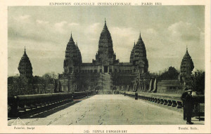
Angkor Wat, photograph from the colonial exposition, Paris of 1931

We’re talking, of course, about Angkor, for Angkor represents the best of what Indochina has to offer; none of the other sites, monuments and places of interest in Indochina are as valuable in terms of “grand tourisme” as Angkor.

So up to now it has been on Angkor that the administration’s tourism development efforts have focused: clearing the ruins (which was needed first), improving access roads, and building new hotels.

We must thank the Ecole Française d’Extrême-Orient (EFEO) for their formidable efforts in bringing to life this “sleeping beauty.” They have freed many of the ruins from the deadly embrace of trees and creepers, and carried out extensive restoration works. Virgin forest next to the ruins has been transformed into a park, and a network of approximately 40km of fine roads now permits traffic circulation with the minimum of time and effort.

Parallel to this physical clearance and restoration work, the scientists and architects of the EFEO have undertaken detailed research into the historical, archaeological, architectural, demographic, epigraphic and artistic questions posed by Angkor. The published works of all kinds which have been borne of this research already form an extensive bibliography, while many of the statues found scattered around the various ruins have enriched the collections of numerous museums, in Angkor and Phnom Penh and, to a lesser extent, in Saigon, Hanoi and Paris.

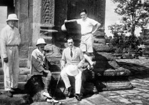
French archaeologists of the EFEO at Bakheng temple near Siem-Reap

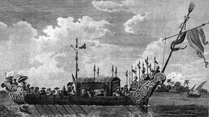
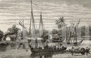
Since the start of the French clearance and restoration work in 1907, access to the ruins has been relatively easy during the high water season, via the Great Lake, the Siem Reap river and by steamship between Saigon, Phnom Penh and Siem Reap. This is an agreeable but very slow journey whose great fault is to be seasonal and also to be possible only from Saigon, a port which was not visited by foreign passenger ships.

For several years, Angkor has been connected with Phnom Penh by means of a good road of 320km, and with Saigon via another good road of 247km. The traveller has the choice between cheap and comfortable public bus services, car rental and even a seaplane service.

At the same time, there has been concern, both in Phnom Penh and Bangkok, to connect Angkor with the Siamese capital, which is so frequented by tourists. Cambodia has built a port at Réam [Sihanoukville] on the Gulf of Siam, and a Siamese company now runs a comfortable small steamer service between Bangkok and Réam.

Finally, things are beginning to move in the right direction. For some time now, the Siamese railway has connected Bangkok with Aranya on the Cambodian border. A new road of 150km is about to open between Siem Reap and Aranya, which will reduce the overall journey time from Bangkok to 12 hours. It’s therefore probable that in future, Angkor will continue to receive the largest number of tourists via Bangkok, comprising travellers coming by rail from Penang or Singapore, and, in a few years, Rangoon and Mandalay.
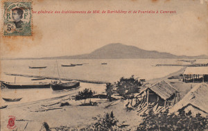
Cam-Ranh Bay

But Saigon should not lose out, because tourists don’t like to retrace their steps, and when the new Cam-Ranh port of call is realised (it will take just six months and $200,000), it is envisaged that English, Japanese, Italian, Dutch, American and other ships will willingly sacrifice three or four hours in their schedules to call in at Cam-Ranh and pick up/set down travellers coming from or going to Penang. From that time onwards, attractions of the second order will acquire a new interest and importance for “grand tourisme” – for example Phnom Penh, Saigon, Dalat, the hunting grounds of Kompong Thom and Lagna, and other attractions located on the route between Angkor, Saigon and Cam-Ranh, which will be visited in many possible variants within a period of eight days, a fortnight or three weeks, depending on the arrangements.

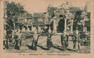
ANGKOR — We will not describe Angkor here. The abundant and diverse promotional material, and in particular the recent Vincennes Exhibition, have already made the ruins famous throughout the entire world, and there is surely not one large hotel, travel agency, consulate, or ocean liner that doesn’t have at least some literature on the subject.

Suffice it to say that travellers can now find there all the amenities they need: a comfortable hotel close to the ruins, and a modern luxury hotel in Siem Reap, just ten minutes away by automobile. The perfect tourist itinerary permits the visitor to vary his excursions at his discretion, placing at his disposal the most diverse forms of transportation, ranging from car to elephant and ox-cart.

Royal Cambodian dancers at Angkor Wat

Here, the visitor will find many distractions, from those beloved of every tourist to those which are special to Angkor: for example, the Angkor Wat illuminations, Cambodian court dance performances, and visits to ruins which have not yet fully emerged from the forest. Finally, one may buy, at prices which can be found nowhere else, all of those souvenirs which are so dear to the traveller.

KOMPONG THOM — Phnom Penh is 320km from Angkor, and the journey takes between six and eight hours by automobile; but the traveller who is not in a hurry can extend his journey over two days by spending the night in Kompong Thom (167km from Phnom Penh and 153km from Angkor), where there is a hotel with 10 rooms. This permits either the organisation of a hunt, or a visit to various interesting ruins, in particular a selection of old Khmer roads and bridges and imposing monuments such as the Roluos, 16km from Siem Reap, or Kompong-Kedey (bungalow) 61km from Siem Reap.

From Kompong Thom, travellers may also visit the ruins of Sambor (32 km). Finally, not far from Kompong Luong ferry, on the Ton-Le-Sap (32km From Phnom Penh), may be found the few remains of the ancient capital of Oudong.

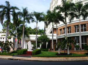
PHNOM-PENH — Phnom Penh is a major touristic centre. This is the first major city encountered by the traveller coming from Bangkok via Réam.

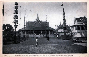
Phnom Penh – view of the Royal Palace

The city has two hotels, including a “palace” newly-built by the administration, and automobile and boat services connecting with all major centres in Cambodia, especially Battambang, Kampot and Réam. There are also connecting services to Saigon (automobile and boat) and Laos (boat only).

The capital of Cambodia, with its population of 90,000, it is a very active commercial centre. The tourist may visit the Royal Palace with its throne room, ceremonial hall and silver chapel; and the Khmer Museum, beautifully built, rich in its collections and very active as an art school. The latter also sells objects of the best artistic taste, such as mouldings and beautiful fabrics.

The city, with its bustling quays, its beautiful park surrounding various ancient and modern monuments, and native districts, is extremely interesting in itself.

Phnom Penh is the point of departure for the boats which go upstream to the Khone waterfalls and Laos, and, in the high water season, to Siem Reap and Battambang. They also depart at all times of year for Saigon and Mytho. The railway will connect Phnom Penh with Battambang in early 1933.

In the area around the city one can visit Oudong, which was capital of Cambodia several times between 1618 and 1866 and features monasteries and royal tombs.

Oudong – the tomb of King Norodom, 1914

Unhurried travelers, and those arriving or departing via Réam, will, in the vicinity of Kampot, be able to go for a swim in the sea at Kep (bungalow), or to sample the fresh air at Mount Bockor (comfortable hotel), situated at an elevation of 1,010m above sea level on a picturesque plateau.

The excursion to the Khone waterfalls is made entirely by boat at the time of high water (60 hours on the ascent, 20 hours on the descent.) The falls at this time offer little of interest; however, the route through the flooded forest makes for an impressive sight.

In the dry season, it is possible to travel by automobile to Khong (Laos), either from Siem Reap via Prakan (ruins) and Rovieng, or from Phnom Penh via Kompong Thom.

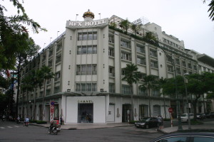
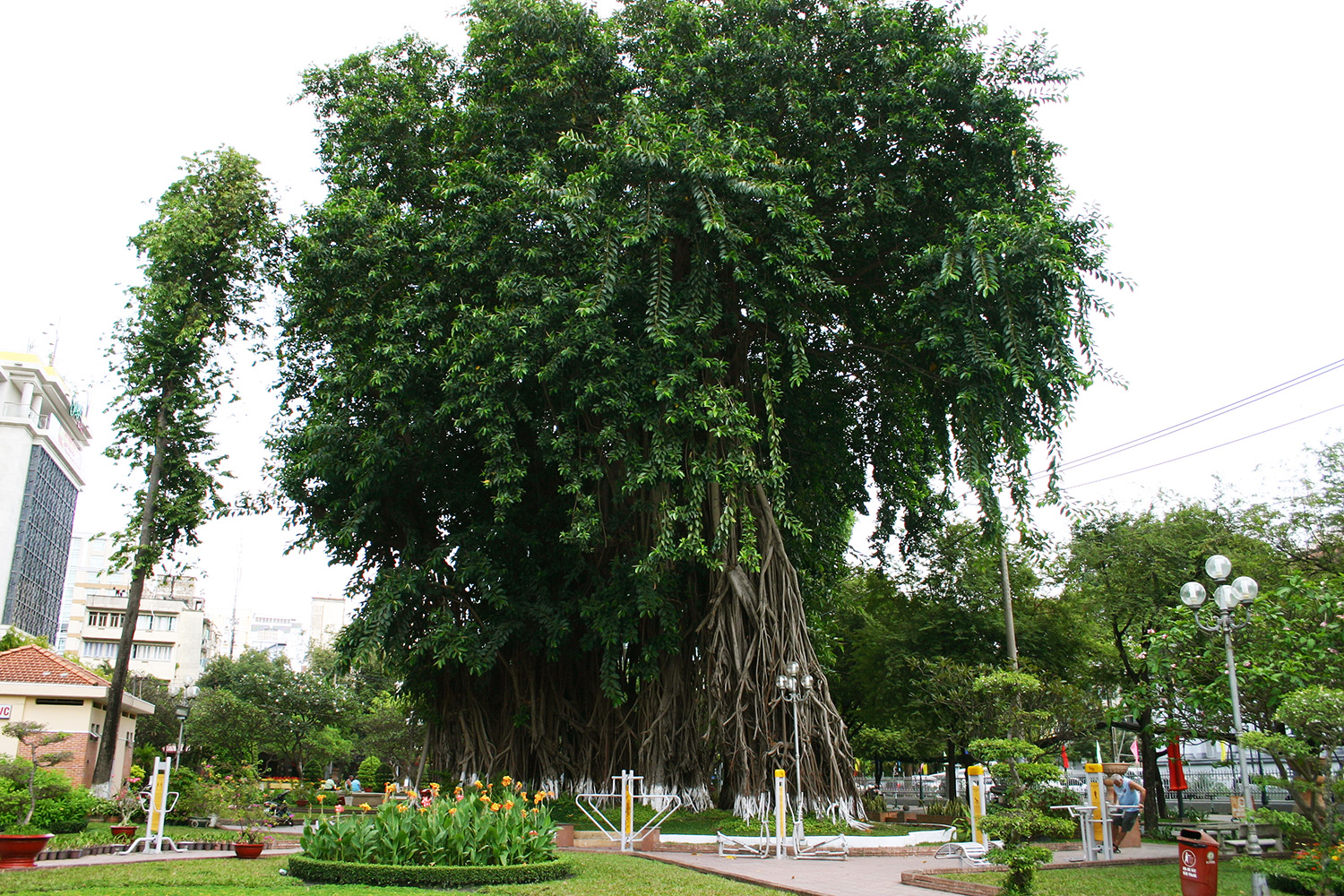
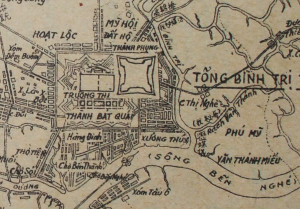
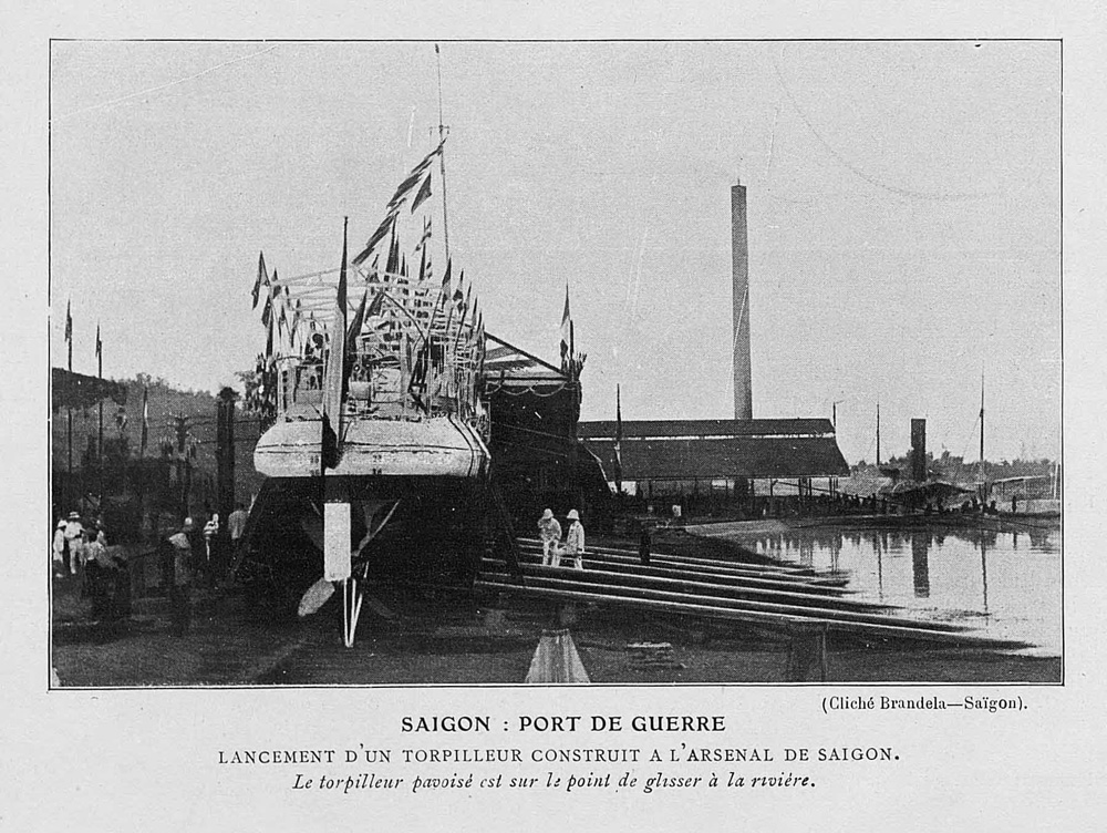
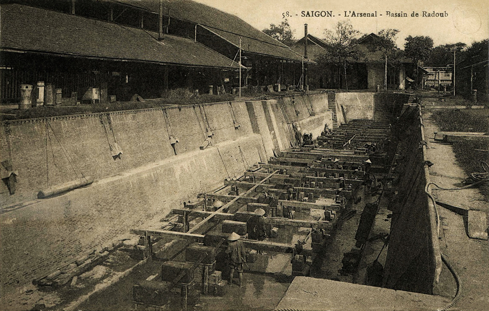
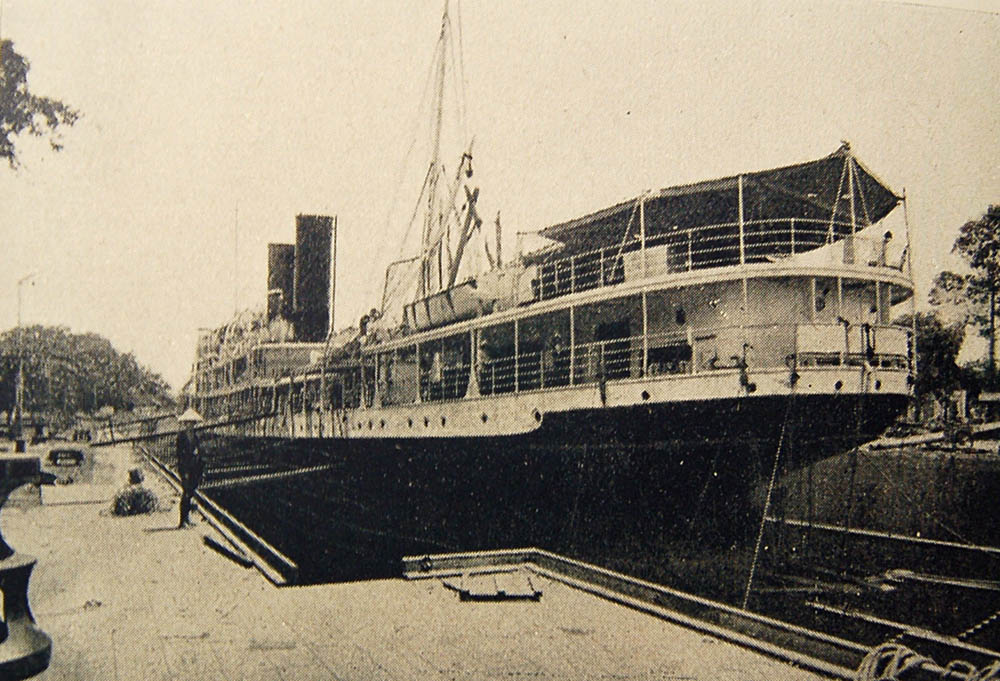
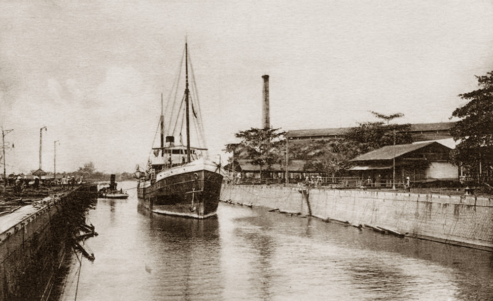
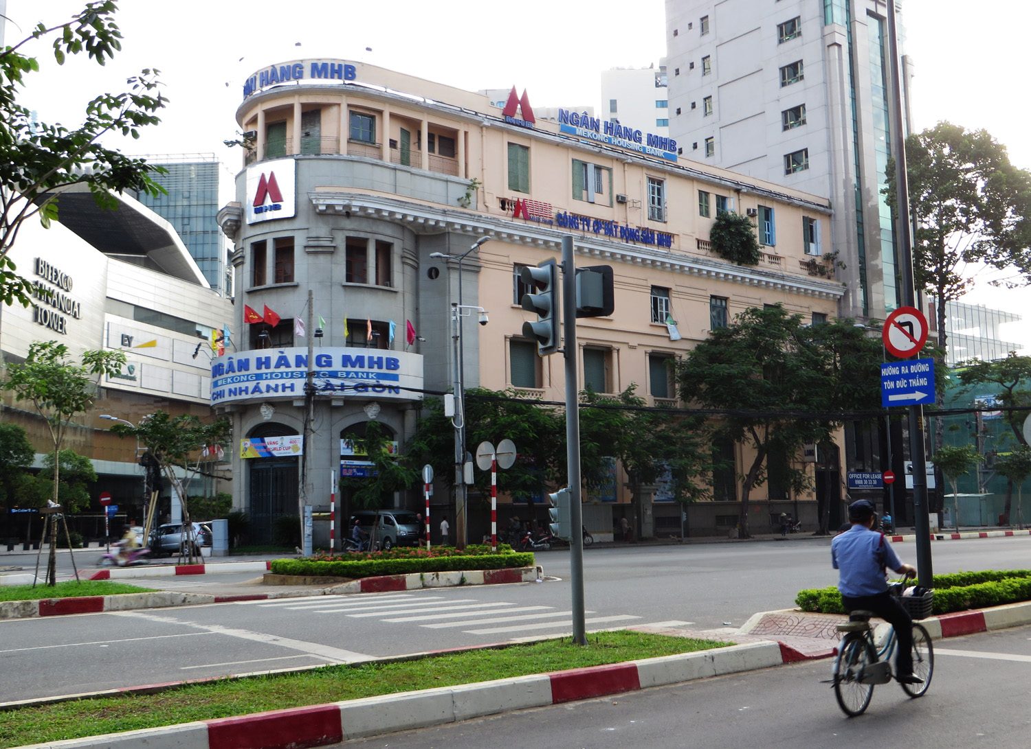
SAIGON — It is via Saigon that most tourists come to Indochina on our French ships, since the latter do not call at Penang.

When in future the pilgrims from Angkor make their way to Cam-Ranh to rejoin their ships, most will want to stop for at least one day in the city which everyone proclaims as the most charming of the Far East, with the French gaiety of its café terraces, the Chinese gaiety of its suburb of Cholon, the splendid botanical and zoological gardens, a young museum, delightful surroundings, and many comfortable hotels.

From Saigon, as in Kompong-Thom and Vinh (Annam), one can organise excellent hunting parties. However, this attraction, which imprudent propagandists have often placed at the forefront of their tourism promotion efforts, could easily cause disappointment to dedicated hunters coming exclusively for this purpose from France or America. Indochina is only a middle-rate hunting destination. Certainly, in several places one may find elephant and aurochs [wild cattle], but there is only a thousandth of a chance of seeing a rhinoceros.

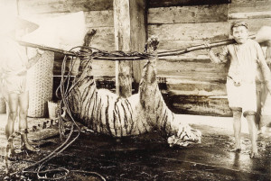
A dead tiger by Raymond Chagneau

In fact, unless you have many months to spare, the hunting here is only an attraction of the second order. But in the absence of big game, the hunter, thus warned, is guaranteed some beautiful tableaux featuring less sensational game such as deer, roe deer, agouti, crocodile, peacock, marabou stork, partridge and wild rooster, and even on occasions a tiger, a bear or a panther.

The large rubber plantations north of Saigon offer a most interesting destination to those who have never seen an institution of this kind, and experts may also be interested to visit them for comparison purposes. Visits to rubber plantations also offer an opportunity to make contact with the ethnic tribes, for those whose tourist intineraries do not offer the chance to visit the central highlands.

CAM-RANH — Cam-Ranh is a future port of call so indispensable from the point of view of the postal service as well as for tourism that there is a very good chance that the new project there will be realised; we therefore include it here. It will be of special benefit by cutting in two the trip from Hong Kong to Singapore (a route on which at present the ships are rarely full), thereby placing our high altitude resort of Dalat at the disposal of Europeans from these two major ports.

DALAT — In the meantime, two routes are available to the visitor to travel from Saigon to Dalat: the road via Phan Thiet and Djiring [Di Linh, Lâm Ðồng], 370km long and quite hilly; and the railway via Phan Rang (333km.) and the Langbiang branch, 87km long, partly a rack-and pinion railway and very picturesque.

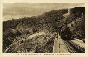
The Langbian cog railway, opened in 1933

A good road runs besides the railway and offers travellers coming from the north and central Annam the opportunity to travel by automobile, stopping on the way (if one is a traveller worthy of the name) to visit a beautiful plantation and agave orchard on the plain and a tea plantation on the plateau.

A new road cutting the distance from Saigon to Dalat to only 322 km will open in 1932. It will connect with the old road to Djiring, where there is a hotel and it’s possible to visit several interesting waterfalls in the area.

Dalat has little other interest for the “grand tourist” than the opportunity to rest in a cool, comfortable and pleasant environment. On the other hand, for the French of Indochina and probably in future for many English people from Hong Kong and Singapore who will use Cam-Ranh as a port of call, Dalat has considerable interest as a mountain resort.

Taking as a model the famous hill station of Baguio in the Philippines (which is reminiscent of Dalat in respect of both landscape and climate), the French authorities have expended considerable effort in developing the Langbiang plateau as the summer capital and garrison town of Indochina. Already there are three hotels in Dalat, one a “palace” and the two others providing comfort for a less affluent clientele. There are also large and small high schools, a hospital with a European pavillion and many residential villas. In the vicinity, several agricultural and forestry enterprises have begun to transform Dalat into a centre of colonisation, while local tourists find it a beautiful excursion destination.

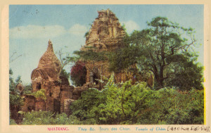
Nha Trang – the Cham temples of Thap-Ba

NHA-TRANG — The tourist who travels north, yet has no time to visit the Langbiang plateau, can go directly from Phan-Thiet to Nha-Trang via Phan-Rang, passing the famous Cam-Ranh Bay which stretches for about 20kms.

Nha-Trang, located 409kms from Saigon, is a provincial town in the gulf of the same name. It has a rather nice beach and also boasts the Po-Nagar Cham ruins, but what makes it especially interesting are the facilities of the Pasteur-Institut (both the institute itself and its plantation) and the Institute of Oceanography and Fisheries. Visitors will find two good European hotels in the town.

NHA-TRANG TO TOURANE — The journey of around 540km between the two ports can currently be made by automobile and the entire journey is extremely pleasant, thanks to the beauty and variety of the landscape. The route heads through Ninh-Hoa (60km from Nha-Trang) where the Darlac-Kontum road leads off to the northwest, then it passes the bay of Port Dayot and makes a very scenic crossing of the Cap Varella, followed by the small delta of Tuy Hoa (hotel), which has recently been equipped with an irrigation network. The crossing of the province of Phu-Yen is very agreeable, especially as the road passes the beautiful bay of Song-Cau (bungalow) and the Cu-Mong lagoon. Beyond the Cu-Mong pass, one arrives at the two chief towns of the rich province of Binh-Dinh. The native chief town has a citadel, and is the starting point of a direct route towards Kontum. Qui-Nhon, the European capital and principal port of the entire region, also has several Cham ruins. There the visitor will find a large, modern European hotel.

Qui-Nhon 1896 – Cham tower viewed from the north by André Salles

Nha-Trang is 322km from Tourane and Qui-Nhon is 240km from Tourane. On this section, one encounters the ruins of the Cham citadel of Chabari, the pretty coconut trees of Tam-Quan, the salt pans of Sa-Huynh, the capital of the province of Quang Ngai with its comfortable hotel, and, a little before Tourane, the ruins of the ancient Cham city of Singhapoura (Tra-Kieu).

TOURANE — Located in a large and picturesque bay where passenger ships call on their way to Tonkin, Tourane is an important touristic centre where one can usefully stop over for two or three days. Here one may find a big European hotel and a large, well equipped garage. Taking excursions from Tourane to the surrounding area, tourists can visit the caves and pagodas of the Marble Mountains; the ancient port of Faifoo [Hội An], capital of the province, the ruins of the ancient Cham cities of Singhapoura and My-Son, the picturesque hill station of Ba-Na, perched on a ridge at 1,350m above sea level, and in Tourane itself, the Cham Museum.

HUE — Hue is 107km from Tourane by rail and 105km by road; the railway follows the picturesque cliffs which line the bay of Tourane, and then the sea, while the road passes through the famous Col des Nuages (Pass of Clouds) at a height of 496m above sea level, offering a magnificent view of the bay.

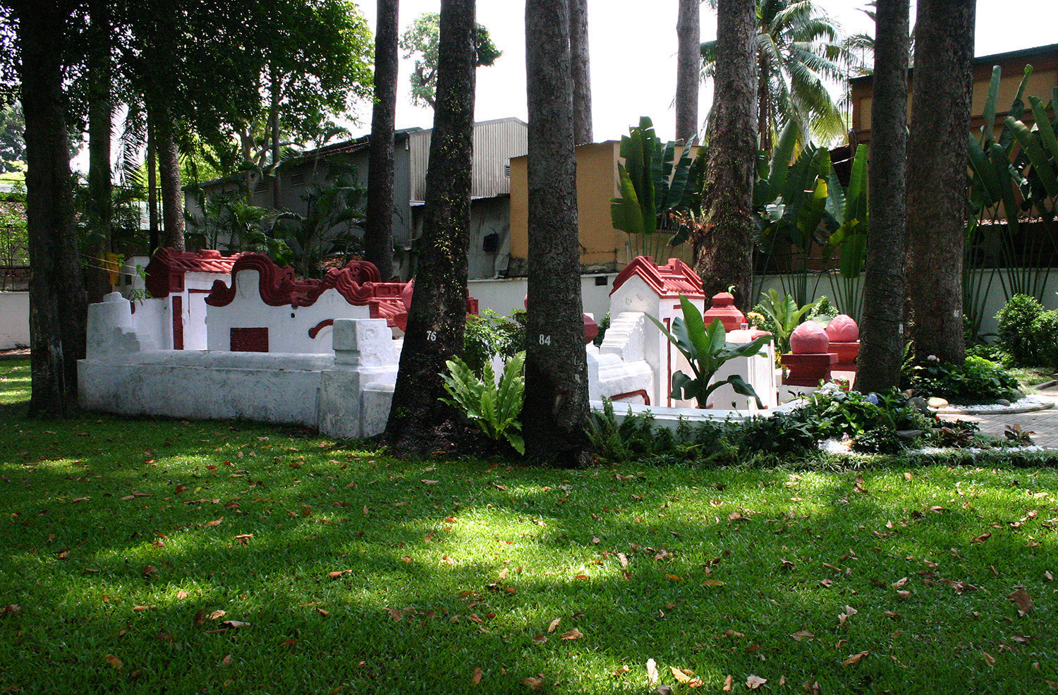
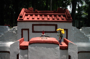
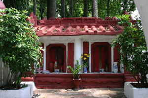
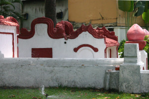
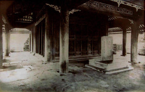
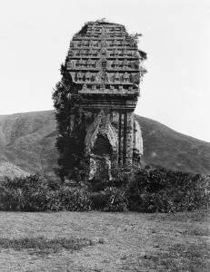
Hue, for two centuries the capital of the kingdom of Annam, is known for its beautiful location on the Perfume River, its Royal Palace and its Museum, but it is especially famous for its royal tombs. The kings of Annam seem to have considered their palaces to be simply guest houses in which they resided during their fleeting stay on earth. But to accommodate their everlasting souls comfortably and individually, each king built so-called tombs, which in fact resemble charming castles surrounded by graceful parks.

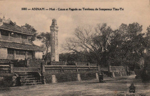
Hue – the tomb of King Thieu-Tri

Hue has a large modern hotel and one may find there all the resources of a big city.

HUE TO VINH — Either by road or by rail, the distance is about 370km.

Over the first 100km, road and rail hardly differ. From Dong-Ha (72 km from Hue), a main road leads to Laos (Savannakhet, 325km). At Dong-Hoi there is a hotel, a citadel, and a small woodcarving industry. At Bo-Trach, 17km from Dong-Hoi, a path leads to the deep caves of Phong-Nha, which one visits by boat, travelling inside the mountain over a distance of several kilometers. Road and rail split at Vinh. From here, the road follows the coast, the most picturesque point of which is the mountain pass called the Porte d’Annam (Door of Annam). The railway, meanwhile, enters a corridor formed successively by two picturesque valleys; it passes the Minh-Cam caves and runs between a series of large limestone rocks that remind one of Halong Bay.

In the corridor connecting the two valleys is the village of Tan-Ap, the starting point of a new railway currently under construction in the direction of Thakhek on the Mekong River. This route can now be partially traversed by the construction service line.

The line from Hue to Vinh then descends the Huong-Khe Valley.

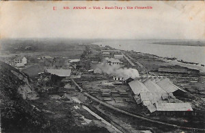
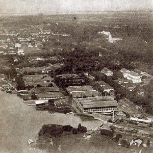
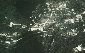
An aerial view of Vinh and Ben-Thuy

VINH AND BEN-THUY — This double agglomeration, comprising the administrative, commercial and military town of Vinh, and the port and industrial city of Ben-Thuy, is to become the second city of Annam and one of the country’s major ports. When the railway from Tan-Ap to Thakhek connects with the Mekong, that’s to say in five or six years, Ben-Thuy will become a potential trans-shipment point for travellers following the Hong Kong-Bangkok-Singapore route who fear sea-sickness.

In the meantime, Vinh and Ben-Thuy have some tourist interest as the starting point of two roads leading towards Laos, one via Napé to Thakhek, the other by the Tran-Ninh plateau to Luang Prabang (in part unfinished). The Tran-Ninh plateau, with its average altitude of 1200m, is very interesting from a touristic point of view, being a centre for forestry, agriculture and mining.

In addition, some 80km north of Vinh, are the hunting grounds of Phu-Qui (elephants and wild oxen).

VINH TO-HANOI. The 325km journey by train from Vinh to Hanoi is somewhat monotonous; it is best made by night train. In contrast, the road offers real interest to the motorist, particularly the section beyond Thanh-Hoa, provided one is happy to do a few zigzags. Thanh-Hoa, formerly a royal city and now the capital of a very beautiful province, possesses one of the most beautiful Vauban-style citadels. Here the traveller will find two guest houses – one of them European – and several garages. From Thanh-Hoa, one can visit: Sam-Son, a pretty and popular beach resort with a French hotel; Bai-Thuong, the starting point of one of the largest irrigation services; the ancient citadel of the Ho kings; the royal tombs of Trieu-Tuong; and the Pho-Cat Pagoda.

Limestone cliffs on the Day River, Ninh-Binh

Both road and railway travel across the border from Annam to Tonkin through a pass between limestone massifs, and in Ninh-Binh lead to the delta of Tonkin. Near Ninh-Binh the visitor will discover a veritable “Halong Bay on land” where, thanks to the high ground, rice fields have taken the place of the sea.

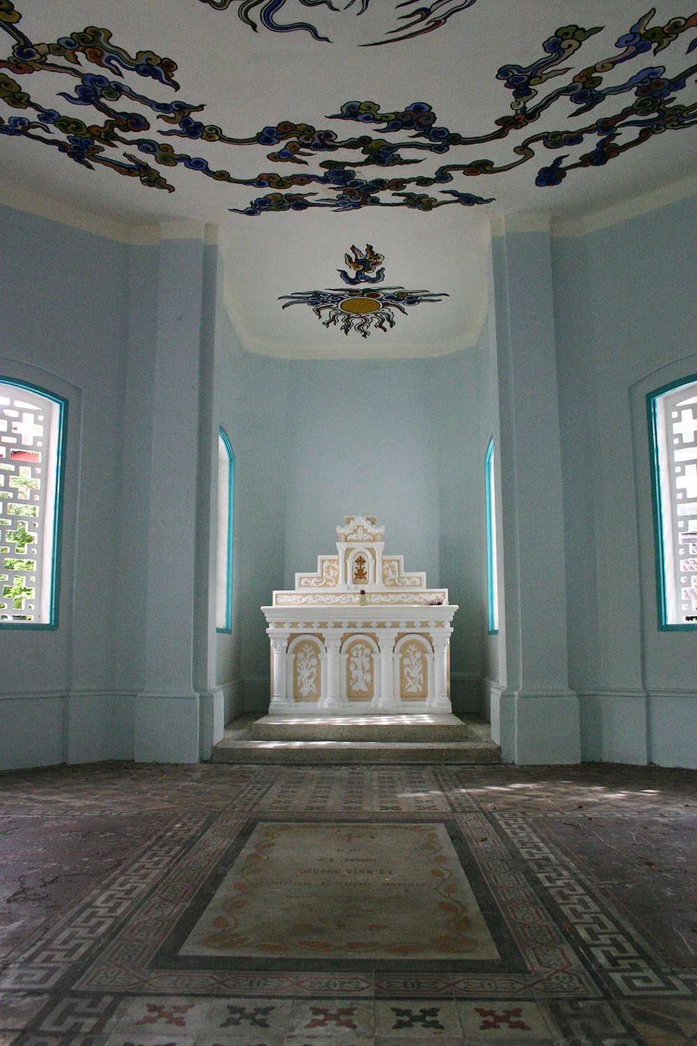
In Ninh-Binh, tourists may leave the main highway, making a 21km detour to visit the curious Phat-Diem Cathedral, built 30 years ago by an Annamite priest known as “Father Six,” and then retrace their steps to rejoin the road to the north, which, via Phu-Nho-Quan, connects with the road from Hoa-Binh to Hanoi.

It’s not the smoothest road, and it subjects both the automobile suspension and the travellers’ kidneys to a certain test. The landscape on either side of this little-known road, with its limestone rocks, is very picturesque, but what will impress the traveller most are the coffee plantations and mines which are testimony to over 30 years of hard work by the French settlers of the region.

The route we suggest between Thanh-Hoa and Hanoi involves a distance of 320km, instead of the more direct route of 150km. However, the traveller with insufficient time to do this longer route could still extend the direct route by about 30km, in order to visit the important manufacturing town of Nam-Dinh, the “Manchester of Tonkin,” with its mills and factories weaving silk and cotton, not to mention its distillery, rice mill, tile factory, numerous small native workshops and active river port on the deep arroyo which brings together two important waterways: the Red River and the Day River.

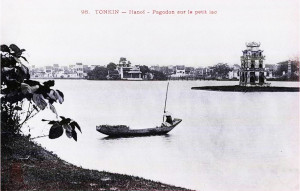
Hanoi – pagoda on the central lake

HANOI — We have just arrived in Tonkin from the South. The traveller coming from Hong Kong or the ones who were content to visit the south and perhaps Angkor, arrive here by passenger ship to Haiphong for a two- to five-day stopover in Tonkin. But other than the busy traveller whose limited time permits only a visit to Halong Bay, Hanoi, the capital of Tonkin and Indochina – that beautifully placed hub of all roads, railways and waterways – is an obligatory tourism centre for the visitor who wants to see Tonkin in detail.

The city of Hanoi itself is very attractive, with its enchanting central lake, its large green boulevards and its well maintained public gardens. Both European and Annamite trade here is very active; Hanoi’s shops offer all the resources of a large city in France, and its numerous hotels boast more than 250 rooms. It also has an opera house, five cinemas, native theatres, pavement cafés and dance halls, as well as numerous sports circles offering many amenities. There are also countless Annamite garages which lease automobiles.

The old indigenous town with its specialised streets, its Chinese and Annamite shops and small-scale industries, is perhaps the most curious in Indochina. The cultured tourist will also find several museums and libraries: the EFEO Archaeological Museum, a Geological Museum, a Commercial Museum, a Central Library, and an EFEO Library.

The surrounding areas are full of unusual pagodas and communal houses, located in villages devoted to picturesque industries. Some 25km from the city may be found some interesting caves with associated pagodas.

An aerial view of Cascade d’Argent (Tam Đảo) in colonial times

Around 50km west of the city, the delta gives way to dense forest populated more by wildcats than people, interspersed with coffee plantations. Continuing along this road leads the traveller, at km 110, into the beautiful valley of the Black River, almost unknown to the casual tourist, which is only ever frequented by that rare species, the “sports tourist.”

On the other side of the Red River, 80km from Hanoi, at 930m above sea level and connected to the road network of the delta by a beautiful highway, stands the hill station of the Cascade d’Argent [Tam Đảo], situated amidst a chain of mountains ranging in height from 1,250m to 1,400m which juts into the delta . There is a large hotel with 50 rooms, and some 50 villas permit hundreds of French families to go there tp escape the heat of summer.

In fact, Tonkin lacks nothing in summer resorts. Situated 290km by rail and 35km by automobile from Hanoi, Chapa [Sapa], situated at 1,600m above sea level in front of a mountain of 3,150m, offers two military hotels, two civilian hotels and many villas.

At the Chinese border, 25km from Langson (140km from Hanoi by rail), the small hill station of Mao-Son is situated 1,500m above sea level.

Lai Châu on the Black River

Hongay, in Halong Bay, and Doson, situated 27km from Haiphong, also have comfortable hotels.

We must also include among Tonkin’s tourist attractions the picturesque but inaccessible valley of Song-Chay, which will interest the sports tourist. Meanwhile for the soft tourist, we recommend an easy circuit which can be made by automobile. Leaving the Delta at Thai-Nguyen, the road climbs up the beautiful valley of Song-Cau to Bac-Kan and beyond continues towards Lai-Chau on the Black River (Tonkin), Reached via the Pia Ouac massif, the beautiful province of Cao-Bang offers several excursions, including the spectacular Ban-Gioc waterfalls.

From Cao Bang, return via Lang-Son and Phu-Lang-Thuong. This tour will take four days if from Bac-Kan one makes a small detour to the beautiful Babé Lakes with the Pung caves and Song Nang falls; if one explores a little the Pia Ouac massif to visit various tin mines; and if from Cao-Bang one tours a little to the north of this picturesque province. In Cao-Bang one may find a pretty good guest house, and in Lang-Son a European hotel.

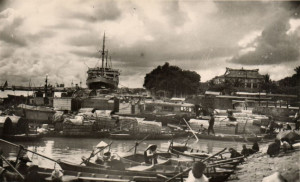
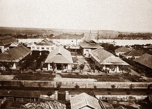
HAIPHONG — Haiphong is new, modern, and perhaps a bit severe, but it certainly doesn’t deserve the scorn of M Dorgelès, who described it as “a small sub-profecture arisen from the mud.”

That small sub-prefecture is in fact a large manufacturing and commercial city of 110,000 inhabitants, clean, well-designed, with four or five medium-range hotels, a theatre, two cinemas, several garages, many modern shops, five very well installed banks and numerous cement factories (output 200,000 tonnes per year). It also boasts two glassworks, four or five rice mills, several mechanical, shipbuilding, spinning and weaving workshops, oil factories and tanning mills.

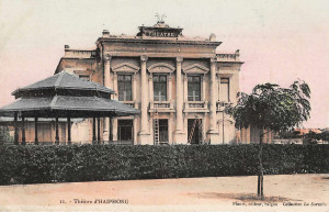
Haiphong Municipal Theatre

As for emerging from a swamp, this is precisely what this port of Tonkin boasts. The hub of several shipping lines from Hong Kong, Canton, Saigon, Marseille, Dunkirk and Nantes, Haiphong, though not favoured by nature, is very well equipped and very active. It was the French who created it. And it is certainly worth seeing.

But Haiphong is also close to Halong Bay, and the latter will in future be of great interest to global tourism. The day will surely come when the number of Tonkin-Hong Kong passenger ships visiting the bay will be less modest, and the facilities in Hongay will be sufficient to persuade the major tourist companies to include Halong Bay in their round-the-world cruises.

From Haiphong one travels to Hongay, the port of Halong Bay, either by road or by comfortable boat, both within two hours. This slowness adds to the charm of the trip, because part of the journey is through the famous bay.

Hongay has a large hotel, and opposite the town, in the village of Va-Tchay [Bãi Cháy] on the île au Buissons, one may find a good clean Japanese restaurant with several rooms. It is also at Va-tchay that the Cercle Nautique is based; it makes available its squadron of motorboats and sailing boats to members of the circle and their guests. The Hôtel des Mines in Hongay also owns a few boats which are made available to tourists; but if the group is large enough, visitors may rent in advance one of the larger vessels owned by the Société anonyme de Chalandage et Remorquage d’Indochine (SACRIC) – these are real cruise ships in miniature, and very comfortable.
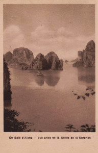
Halong Bay

Halong Bay, praised in both verse and prose by countless writers, photographed endlessly, and subject to intensive propaganda, ranks among the most beautiful places in the world; Unfortunately, the tourism organisation there has long been too rudimentary; links with Hong Kong are by small steamships that contrast greatly with the large passenger vessels which bring most tourists to Tonkin. It is not advised to visit the bay during hot season (early May to October).

We will not describe Halong Bay here. Suffice it to say that, during the right season, from October to late April, one can zigzag through its islands and fjords for at least two or three days without tiring of the ever changing landscape.

On the other hand, Halong Bay, with its open cast coal mines, also provides economic interest of the highest order.

LAOS — Having traveled through all of maritime Indochina, the curious tourist who wants to know the country in detail will want to see the land on the other side of the mountains, this Laos which he has heard to be one of the most interesting countries of Indochina. Interesting, certainly – by virtue of its gentle and indolent population, more inclined to pleasure than to work, and their customs and picturesque costumes. As for the landscape, if you believe the enthusiastic claims of certain tourism company advertisements, you may be disappointed.

Above all, one should avoid travelling up the Mekong, the great river which passes through that country over a distance of nearly 2,000km. If one wishes to see the highlights of Laos, and in particular the kingdom of Luang Prabang, which is the most interesting region, one should first go to Bangkok in Siam and take the train to Lampang.

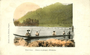
Fishermen in northern Laos

Then take a three-day automobile trip to the Mekong in Xieng Sen, opposite Ban Houei Sai. From Ban Houei Sai one can descend the Mekong, either by raft or by motor boat, to Luang Prabang (hotel) and Vientiane (hotel), where a steamship may be taken to Khone (waterfall) and Phnom Penh.

One may also join the Mekong in Thakhek (hotel), starting from Vinh (northern Annam), either via Napé or by taking the service road of the future Tan-Ap-Thakhek railway.

Finally, one can leave the coastal railway at Dong-Ha to join the Mekong in Savannakhet and catch the steamboat there. Downstream from Thakhek, the Kemmarat rapids are interesting to see during the descent, even if they are rather tedious to climb. But the most scenic spot in this part of Laos is undoubtedly Pakse, with its beautiful road which leads up onto the Bolaven Plateau (1,250m above sea level) and the ruins of Bassac.

From Pakse, one can either continue to Phnom Penh and Saigon by boat, or, in the dry season, by car. Alternatively, one can return to Siam (125km by automobile) via the city of Oubon, on the Bangkok and Penang railway.

We will conclude by making some recommendations to the tourist coming to Indochina.

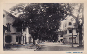
Savannakhet in colonial times

Make sure that you allow enough time to see everything, and try to schedule your trip in such a way that you can see every country in the cool season – this means avoiding Cochinchina and Cambodia in March, April, May and June, Tonkin from the end of April to September, and Annam from late September to late November.

Finally, make sure you take along a good guidebook – we recommend the Madrolle guide to Indochina – To Angkor in English, and Baie de Halong, Saïgon et Tourane, Indochine du Nord, Indochine du Sud, Siam et Angkor in French. These works, designed by the famous Boedecker, are the most complete and the most accurate.

Ruins at Angkor

The Grand Hotel in Phnom Penh

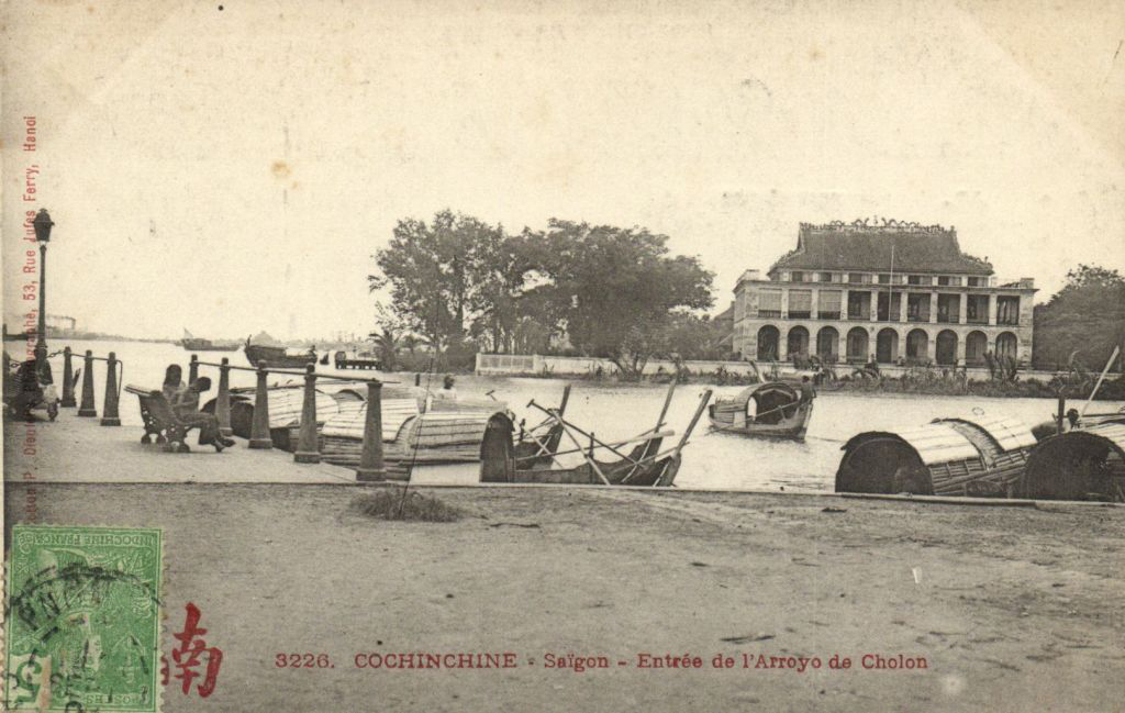
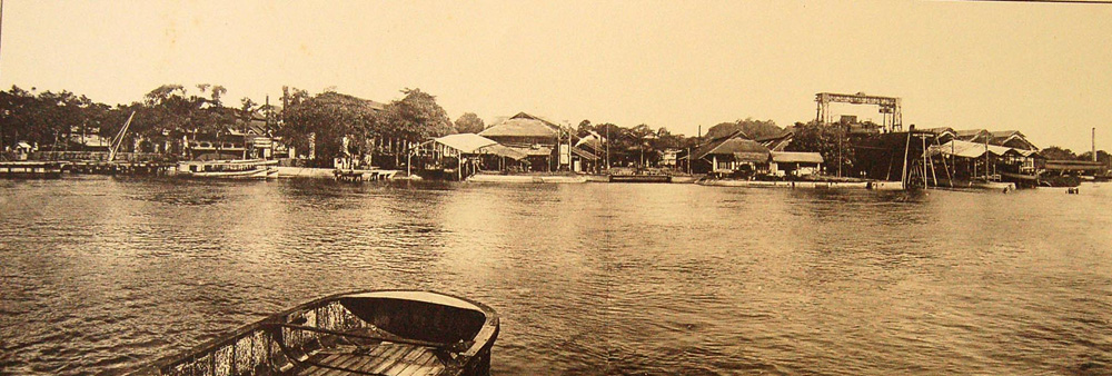
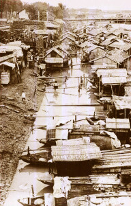
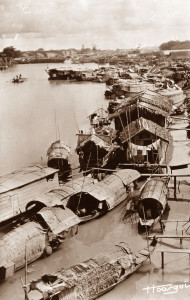
Saigon – entrance to the arroyo Chinois

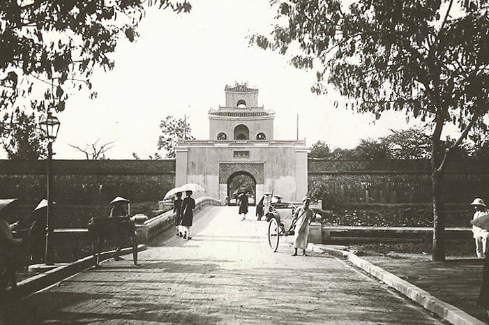
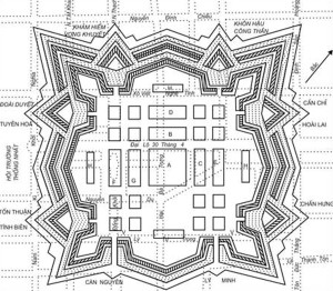
One of the gates into the Huế citadel in the 1920s

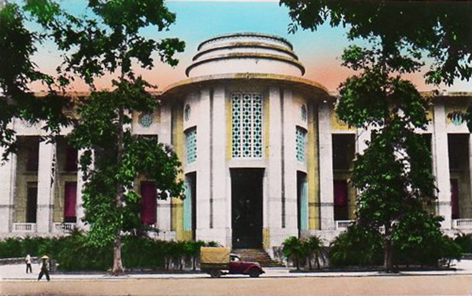
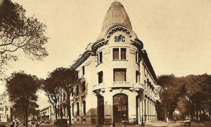
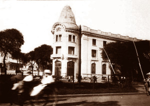
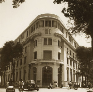
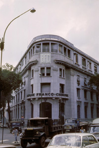
The Bank of Indochina, Hanoi

Buddhas in the Ky-Lua caves at Lang-Son by Dieufils

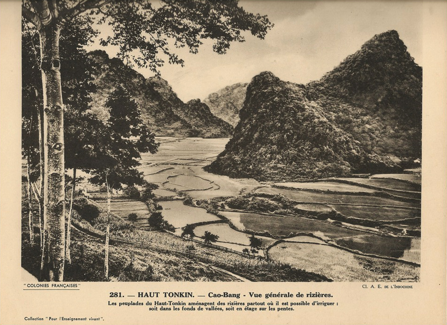
Cao-Bang province in colonial times

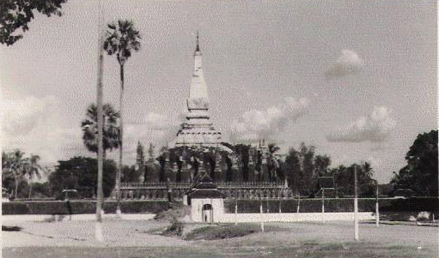
That Luang in Vientiane, Laos

Tim Doling is the author of the guidebooks Exploring Huế (2018), Exploring Saigon-Chợ Lớn – Vanishing heritage of Hồ Chí Minh City (2019) and Exploring Quảng Nam (2020), published by Nhà Xuất Bản Thế Giới, Hà Nội

A full index of all Tim’s blog articles since November 2013 is now available here.

Join the Facebook group pages Saigon-Chợ Lớn Then & Now to see historic photographs juxtaposed with new ones taken in the same locations, and Đài Quan sát Di sản Sài Gòn – Saigon Heritage Observatory for up-to-date information on conservation issues in Saigon and Chợ Lớn.

In Search of Saigon’s American War Vestiges

The second US Embassy building at 4 Thống Nhất (Lê Duẩn) in 1974 (photographer unknown)

As the international media descends on the city for the 40th anniversary of the fall of Saigon, travel companies report a growing demand from returning American veterans for tours which point out the buildings and installations they once occupied.

Over the past few weeks, tour companies in Hồ Chí Minh City have reported an ever-increasing number of requests by former US military and civilian personnel for bespoke city tours taking in the offices and bases in which they once worked.

A typical starting point for most “US Vestiges tours” is a drive along Lê Duẩn (the former Thống Nhất) boulevard past the United States Consulate, which was built in 1998-1999 on the site of the historic 1967 American Embassy. In fact, the American diplomatic presence in Saigon may be traced back over 100 years, and several of the older US mission buildings still stand today.

The Catinat building at 26 Lý Tự Trọng, once home to an American Consulate which was car bombed by “Japanese gendarmerie” on 23 November 1941

As early as 1907, a US Consulate could be found operating out of the old Denis Frères trading company headquarters at 4 rue Catinat (4 Đồng Khởi). Sadly, that old colonial edifice was demolished in 1985, but later US consulate buildings at 25 rue Taberd (25 Nguyễn Du, behind the Hotel Sofitel Saigon Plaza) and 26 rue de La Grandière (the Catinat building at 26 Lý Tự Trọng) may still be viewed today. On 23 November 1941, the latter became the target of a devastating bomb attack – said to have been perpetrated by “Japanese gendarmerie” – which caused extensive damage to the Catinat Building. Just over two weeks later, Japan bombed Pearl Harbor and all US diplomats were expelled from Indochina. When the Americans returned in 1945, the US Consulate relocated yet again to 4 rue Guynemer (now 4 Hồ Tùng Mậu), before the opening of the first purpose-built US Embassy on boulevard de la Somme (Hàm Nghi boulevard) in 1950.

The first US Embassy building at 39 Hàm Nghi, bombed on 30 March 1965

The first US Embassy building at 39 Hàm Nghi was the model for the “American Legation” where CIA agent Alden Pyle worked in Graham Greene’s The Quiet American. On 30 March 1965, it became the target of another car bomb attack, this time by NLF Special Forces Team F21, which killed 22 and injured 183, prompting the relocation of the US Embassy in 1967 to a more secure location at 4 Thống Nhất (now Lê Duẩn) boulevard. Today, the building at 39 Hàm Nghi houses the Hồ Chí Minh City Banking University.

The second US Embassy building at 4 Thống Nhất (now the site of today’s US Consulate General at 4 Lê Duẩn) – a US$2.6 million fortress opened on 23 September 1967 – was famously breached in the early hours of 31 January 1968 by NLF Special Forces Team 11, as part of the wider Tết Offensive which involved attacks on over 100 towns and cities. A monument to this attack still stands today on the sidewalk outside the US Consulate compound.

“Last day of Vietnam War: Evacuees mount a staircase to board an American helicopter near the American Embassy in Saigon” (Hubert van Es/AFP/Getty Images). Hubert van Es’s iconic image of people scrambling up a rooftop ladder to a helicopter at 22 Gia Long (now 22 Lý Tự Trọng)

Images of the second US Embassy were once more beamed around the world on 30 April 1975, when the destruction of the Tân Sơn Nhất Air Base runways by the approaching People’s Army obliged Ambassador Graham Martin to order a helicopter evacuation, and would-be escapees began thronging outside its gates trying to get in.

However, contrary to popular belief, the iconic image by Dutch photographer Hubert van Es of people scrambling up a rooftop ladder to a helicopter was taken not of the Embassy, but rather of the CIA’s “Pittman Apartments” at 22 Gia Long (now 22 Lý Tự Trọng).

Apart from the locations of former consulates and embassies, other extant former US installations in Hồ Chí Minh City include the headquarters buildings of the Military Assistance Command Việt Nam (MACV or “Macvee”) and its predecessor, the Military Assistance Advisory Group (MAAG).

The former SAMIPIC villa at 606 Trần Hưng Đạo, which served successively as MAAG, MACV and Korean Forces HQ

Before 1962, the US military advisory effort in Việt Nam was co-ordinated by MAAG, which initially occupied the former SAMIPIC villa at 606 Trần Hưng Đạo in District 5. In February 1962, following the arrival of the first US Army aviation units, MAAG became part of the Military Assistance Command Việt Nam (MACV), which was set up to provide a more integrated command structure with full responsibility for all US military activities and operations in Việt Nam. MAAG survived until May 1964, when its functions were fully integrated into MACV. In May 1962, when MACV relocated to larger premises, the villa at 606 Trần Hưng Đạo became known as MACV II. Then in 1966, following the transfer of MACV operations to Tân Sơn Nhất Air Base, it was vacated by the Americans and became the headquarters of Republic of Korea Forces Vietnam, which remained there until the signing of the Paris Peace Accords in 1973. Today, 606 Trần Hưng Đạo is home to a number of local businesses, but the old villa is currently under threat of redevelopment – see Date with the Wrecker’s Ball: 606 Trần Hưng Đạo. UPDATE – This building was demolished in August 2018

The second MACV headquarters at 137 Pasteur

The second MACV headquarters in Saigon – an unassuming three-storey apartment building at 137 Pasteur in District 3 – has an interesting history. Before being taken over by the US military in May 1962, it served from 1955 to 1959 as the headquarters of the Michigan State University Group (MSUG), which was controversially engaged to advise President Ngô Đình Diệm on the reorganisation of his feared secret police. By 1966, MACV had outgrown this building too, so on 2 July 1966 it was relocated to the new purpose-built “Pentagon East” complex, adjacent to Tân Sơn Nhất Air Base. Between 1966 and 1972, 137 Pasteur functioned as the headquarters of the MACV’s Studies and Observations Group (MACV-SOG), a special operations unit tasked with covert warfare operations. When the last active-service US military units departed in 1972, all MACV operations in the south, including MACV-SOG, were subsumed within the Defense Attaché’s Office (DAO), a branch of the US Embassy. In the following year all DAO operations were transferred to the “Pentagon East” complex and 137 Pasteur was returned to civilian use.

The former Dodge City Bachelor Enlisted Quarters (BEQ) and a surviving building of the MACV Annex near Tân Sơn Nhất International Airport

Nothing now remains of the huge “Pentagon East” complex, which was formerly situated on the east side of modern Trường Sơn boulevard (the Tân Sơn Nhất International Airport approach road), between the Cửu Long and Hồng Hà street junctions. In its place today stand the CT Plaza Tân Sơn Nhất shopping mall and cinema complex, and next to it a very large building site. However, on nearby Hồng Hà street, visitors can still see the former Dodge City Bachelor Enlisted Quarters (BEQ) and one surviving building of the MACV Annex, both currently used by the Southern Airport Services Company (SASCO). UPDATE – The MACV Annex building was demolished in 2015.

In addition to the former MAAG and MACV buildings, the Saigon residences of the US generals who ran these two organisations have also survived intact.

The villa at 60 Võ Văn Tần (known before 1975 as 60 Trần Quý Cáp) in District 3 is said to have been built originally for a wealthy French wine importer, but it was later acquired by Prince Nguyễn Phúc Ưng Thi (1913-2001), founder of Vikimco Steel, who also built the Rex Hotel. In the late 1950s, he made the villa available to the United States of America to house its military commanders-in-chief.

The MACV chiefs’ villa at 60 Võ Văn Tần

Thereafter it became the residence of two consecutive MAAG Chiefs – Lieutenant General Samuel T Williams (November 1955-September 1960) and Lieutenant General Lionel C McGarr (September 1960-July 1962). In 1962, when MAAG was integrated into MACV, the head of MAAG was found new lodgings at 121 Trương Định (see below), while 60 Trần Quý Cáp became home to successive MACV Chiefs, including General Paul D Harkins (February 1962-June 1964), General William C Westmoreland (June 1964-July 1968), Admiral Elmo Zumwalt, Commander of Naval Forces Việt Nam and Chief of the MACV Naval Advisory Group (July 1968-1970), General Creighton Abrams (1970-June 1972) and latterly General Frederick C Weyand (June 1972-March 1973).

After MACV took over the mansion at 60 Võ Văn Tần/Trần Quý Cáp, the last MAAG Chief, Major General Charles J Timmes (July 1962-May 1964) was rehoused in another grand old colonial pile, just up the road at 121 Trương Định. Originally constructed as a managerial residence for the Diethelm import-export company, this building is now in poor condition, but it is still in use as the Hoa Mai Kindergarten (Trường mầm non Hoa Mai).

The former at US Naval Support Activity Saigon (NSAS) building at 218 Nguyễn Đình Chiểu

Midway between those two former residences, on the east side of the Trương Định/Nguyễn Đình Chiểu street junction, stands another relic of the US presence. In the late 1960s, the down-at-heel apartment building at 218 Nguyễn Đình Chiểu (formerly 218 Phan Đình Phùng) briefly functioned as the headquarters of US Naval Support Activity Saigon (NSAS). Unfortunately its close neighbour, the former Naval Forces Việt Nam (NAVFORV) building at 117 Nguyễn Đình Chiểu, didn’t fare quite so well – it was demolished a few years back to make way for a luxury apartment block.

At the outset, the United States devoted considerable resources to information and culture programs in South Việt Nam, and by the late 1950s the United States Information Service (USIS) Saigon office was one of the largest posts of its kind in the world. From 1956 to 1962, USIS Saigon was housed in the large grey building designed by modernist architect Arthur Kruze which still stands on the eastern corner of the Hai Bà Trưng/Lý Tự Trọng intersection, originally 82 Hai Bà Trưng but now designated as 37 Lý Tự Trọng.

The former USIS building at 37 Lý Tự Trọng

According to an American report of 1956, “The USIS occupies excellent, roomy quarters in three floors of a street corner building at a prime location in downtown Saigon, about a mile from the Embassy. It is completely air-conditioned. The facilities include a library (ground floor); 150-seat auditorium; radio studios; and film editing and recording rooms. The square footage totals 33,454.”

In 1962, the USIS expanded its operations, moving its administrative offices and Abraham Lincoln Library into the new Rex complex and transforming the building at 82 Hai Bà Trưng into an annex.

Built by Prince Nguyễn Phúc Ưng Thi (see above) in 1959, the Rex Hotel Complex at 141 Nguyễn Huệ was snapped up on completion by the American government. Down to 1964, it not only housed the USIS offices and Abraham Lincoln Library, but also provided hotel accommodation for many US military advisers. During this period it was also home to the first broadcasting studio of Armed Forces Radio Vietnam (AFRVN), which went on air for the first time at 6am on 15 August 1962. Two years later, AFRVN was found larger facilities at the nearby Brink Bachelor Officers’ Quarters (BOQ, see below).

The Rex Hotel

As the insurgency got under way and it became clear that US culture and information programs had failed to win widespread support for the Ngô Đình Diệm regime, the United States began to switch to a primarily military strategy. By 1964, the Abraham Lincoln Library had been relocated to a quiet villa at 8 Lê Quý Đôn (demolished in 2010), and in the following year, as the first US combat troops set foot on Vietnamese soil, the USIS operation at the Rex was subsumed into the Joint US Public Affairs Office (JUSPAO, also incorporating the Communications Media Division of USAID Việt Nam). The annex at 82 Hai Bà Trưng was then redesignated “JUSPAO 2.” Meanwhile the Rex Hotel became a BOQ for US military personnel.

At its height in the late 1960s, the Rex complex had around 600 employees and was frequented regularly by over 450 international journalists covering the US war effort.

The Caravelle Hotel

Between 1965 and 1972, JUSPAO and the MACV Information Office jointly hosted daily press briefings for foreign correspondents, which became known as the “Five O’Clock Follies” because, according to one cynical reporter, “they seldom bore any resemblance to the facts in the field.” Initially held in a 200-seat conference room on the ground floor of the Rex, these press briefings were moved in 1969 to the National Press Center building at 15 Lê Lợi (since redeveloped as the Opera View complex) opposite the Caravelle.

During the same period, the Caravelle Hotel, also opened in 1959, became the hostelry of choice for the US media. By the late 1960s it was home to the Saigon bureaux of numerous American news agencies, including NBC, ABC, CBS, the Washington Post and the New York Times, while its rooftop bar (now Saigon Saigon Bar) famously became an unofficial “press club” to which journalists such as Walter Cronkite, Neil Sheehan and Peter Arnett would retreat in the evenings.

A monument outside the Park Hyatt Hotel commemorates the car bombing of the Brink residence by NLF Special Forces on Christmas Eve 1964

The Park Hyatt Saigon Hotel, located behind the Municipal Theatre, also stands on a site of historical interest. An earlier hotel, constructed on this site in the late 1950s, was acquired by the American military and later transformed into the Brink BOQ at 103 Hai Bà Trưng. A residential block for US army officers with its own mess hall and in-house bakery, Brink also became home to the studios of AFRVN from 1964 to 1967. While the BOQ building no longer exists today, a monument on the corner outside the Park Hyatt Hotel commemorates the car bombing of the Brink residence by NLF Special Forces on Christmas Eve 1964, an event which killed two and injured around 60. The Brink BOQ and its radio station were subsequently repaired, and it was from here in 1965-1966 that the real Adrian Cronauer – immortalised by Robin Williams in the Hollywood film “Good Morning, Vietnam!” – broadcast his radio programmes to American troops.

The Kỳ Hoà Hotel at 238 Ba Tháng Hai in District 10, once the headquarters of the Free World Military Assistance Organization (FWMAO)

The Kỳ Hoà Hotel at 238 Ba Tháng Hai (formerly 12 Trần Quốc Toản) in District 10 is another building with a fascinating story to tell. In the 1960s and early 1970s, it served as the headquarters of the Free World Military Assistance Organization (FWMAO), which housed the various country liaison offices for allied operations during the Việt Nam War. In addition to co-ordinating the activities of military personnel sent to Việt Nam by Australia, New Zealand, South Korea, the Philippines and Thailand, FWMAO also managed the flow of non-military (medical, transportation, construction, agriculture) support by a variety of other nations. All of the “Free World Forces” received logistical support and operational guidance from the United States Military Assistance Command Việt Nam (MACV).

For foreigners who lived and worked here before 1975, the streets of Saigon remain a treasure trove of faded reminders of the American presence – from the old USAID buildings at District 1’s Cách mạng Tháng 8 and Nguyễn Khắc Nhu streets and District 3’s Ngô Thời Nhiệm street, to the former Pershing Field Ball Park (now the Military Zone 7 Stadium) near Tân Sơn Nhất International Airport, the so-called “Thieves’ Market” on Tôn Thất Đàm street and the numerous former BOQ and BEQ buildings dotted all over the city.

Many veterans have spent years trying to forget the horror and futility of the Việt Nam War, but tour guides report that those who have made the effort to return have found great solace in seeing for themselves just how much the country and its people have recovered and grown in the intervening years.

You may also be interested to read these articles:

American War Vestiges in Saigon – 60 Vo Van Tan
American War Vestiges in Saigon – 606 Tran Hung Dao
American War Vestiges in Saigon – 137 Pasteur
American War Vestiges in Saigon – Former “Free World” HQ
American War Vestiges in Saigon – Former USIS Headquarters

Tim Doling is the author of the guidebook Exploring Saigon-Chợ Lớn – Vanishing heritage of Hồ Chí Minh City (Nhà Xuất Bản Thế Giới, Hà Nội, 2019)

A full index of all Tim’s blog articles since November 2013 is now available here.

Join the Facebook group pages Saigon-Chợ Lớn Then & Now to see historic photographs juxtaposed with new ones taken in the same locations, and Đài Quan sát Di sản Sài Gòn – Saigon Heritage Observatory for up-to-date information on conservation issues in Saigon and Chợ Lớn.

The Story of Saigon’s “Jardin d’Espagne”

The former “Jardin d’Espagne,” now the Lý Tự Trọng Park

In 1927, after being abandoned for more than 60 years by its Spanish owners, the “Jardin d’Espagne” (today’s Lý Tự Trọng Park) seemed set to become the new home of the British Consulate General in Saigon… but it was not to be.

The participation of Spanish naval forces in the 1859 French conquest of Cochinchina is well documented. The event which had triggered the expedition was the execution on 20 July 1857 of the Spanish bishop of Tonkin, Monsignor José Sanjurjo Diaz, and in response, the invasion fleet incorporated a large contingent of Spanish troops drawn largely from the Philippines.

Saigon 1923

The “Jardin d’Espagne” on a 1923 map of Saigon

In the aftermath of the conquest, several streets in Saigon were named in honour of Spain, including rues Isabella, Isabella II and Palanca.

The French authorities also granted the Spanish government a plot of land on which to build a consulate. According to the Colonial Council minutes dated 8 November 1928, the Conventions of 15 May 1864 signed by Spanish Acting Consul Manuel M Caballero, and of 31 January 1866 signed by his successor Fédérico Taque, ceded to the Spanish government “a 3,000m² plot of land on the north side of the junction between rues Lagrandière and Mac-Mahon [now Lý Tự Trọng and Nam Kỳ Khởi Nghĩa].” The concession of this land, now part of Lý Tự Trọng Park, was “made free of charge, but under the provision that the land is allocated solely for installation of a Spanish consulate and cannot be used for any other purpose.”

For a short while, an “old Annamite house” on the site was occupied by a group of Spanish naval officers. However, when the Spanish delegation eventually departed from Saigon, it had “failed to take effective possession of this land and abandoned the project of constructing a consulate in Saigon.” Thereafter, Spanish diplomatic affairs in Cochinchina were handled through the Consular Agent of Portugal.

The “Jardin d’Espagne” may be seen on the right of this early 20th century postcard of the Lieutenant Governor’s Palace

Over the next half-century, as the surrounding streets were transformed into the so-called “Triangle of Power” (comprising the Law Courts, the Central Prison and the Palace of the Lieutenant Governor), this little piece of Spanish territory was christened the “Jardin d’Espagne.” During this period, it was looked after carefully by the staff of the Botanical and Zoological Gardens, who installed lawns and flowerbeds and took great care of its ancient banyan tree.

By 1919, the Consulate-General of Great Britain had outgrown its premises at 4 rue Georges-Guynemer [Hồ Tùng Mậu], and the search began for a suitable plot of land on which to build a larger diplomatic mission. The Jardin d’Espagne seemed to fit the bill perfectly, and later that year the British Consul-General wrote to the Director of Local Administration asking if the French government “would be disposed to give its consent to the cession of this land from the Spanish government to the British government, which proposes to build a consulate there.”

The three-way negotiations between France, Spain and Great Britain continued for another eight years, but finally on 10 November 1927, “the Consular Agent of Portugal, M Brodeur, in the name of the Spanish government, ceded and abandoned to the Consulate General of Great Britain represented by Mr F Grosvenor Gorton, its rights to the Jardin d’Espagne.”

The “Jardin d’Espagne” may be seen on the left of this early 20th century postcard of the Lieutenant Governor’s Palace

For its part, the Cochinchina government agreed that Great Britain would be substituted for Spain in the conditional rights to the land, which were once again linked exclusively to the construction of a consulate.

Had things proceeded as planned, the British Consulate in Hồ Chí Minh City might now be in a very different location and Saigon would have lost a valuable green space to redevelopment. But that wasn’t quite the end of the story.

After commissioning a long-overdue survey of the Jardin d’Espagne in December 1927, the British “encountered problems and communicated these to the Cochinchina authorities.” On 21 January 1928, Cochinchina Governor Paul Blanchard de la Brosse wrote to Grosvenor Gorton: “On the occasion of the transfer, you pointed out to me the inadequacy of the said land area with regard to its function, which is the construction of your consulate, and informed me that you would consider favorably the principle of exchange against another city lot administered through the Domaine locale.”

A subsequent report to the Colonial Council by Blanchard de la Brosse sheds further light on the problems encountered, and also reveals the alternative lot which had been identified:

A plan of the 3,548m² Lot 7 on boulevard Norodom, which the British Consulate General was granted in exchange for the “Jardin d’Espagne”

“The Consul General of Great Britain has noted that the area of this land is too small for construction of a [consulate] building, and secondly that the Jardin d’Espagne does not seem favorable for the installation of a consulate. For our part, the local administration believes that there is interest in maintaining the current function of the Jardin as a convenient square for walkers and children’s games in the very central area where it is located. Therefore, the principle of exchange of this land against Lot 7 of the subdivision plan of boulevard Norodom is being considered. This latter terrain, situated between boulevard Norodom [Lê Duẩn] and the rues de Massiges [Mạc Đĩnh Chi] and Lucien Mossard [Nguyễn Du], has an area of 3,548m² and its market value is equal to that of the land known as the Jardin d’Espagne.”

A formal offer was made, and on 25 April 1928, British Consul General F Grosvenor Gorton wrote to the Governor accepting the substituted plot on boulevard Norodom. This undoubtedly pleased the French – another report dated 26 November 1928 says of the Jardin d’Espagne that “its situation right in front of the Governor of Cochinchina’s Palace, from which it is separated only by the rue Lagrandière, is not appropriate for the installation of a consulate.”

“Saigon – Perspective du Boulevard Norodom”

On 6 October 1928 Les Annales coloniales carried an article entitled “The future British Consulate in Saigon,” reporting the exchange of the Jardin d’Espagne for the new plot on boulevard Norodom, and explaining that “the plans, drawn up in London, will be executed in Saigon under the supervision of one or more architects who will come all the way from England. The design will be a reproduction of those buildings already constructed to serve the same purpose in Bangkok and some major cities in China; or rather, it will be a ‘Cochinchina adaptation’ of the commonly adopted type.”

The replacement lot was formally ceded by the Domaine locale on 21 December 1928, but the new British Consulate General at 21 boulevard Norodom [now 25 Lê Duẩn] took several years to construct and was not inaugurated until 1934. Sadly, no photographs have survived of this building.

In 1944, this building was severely damaged by Allied bombing. Then in the 1950s, it became the British Embassy to the State of Việt Nam and later to the Republic of Việt Nam. In 1959, it was completely rebuilt according to an attractive modernist design by architect Phạm Văn Thâng of the famous Hoa-Thâng-Nhạc architectural partnership. It served until 1975 as the British Embassy in Việt Nam.

The 1958-1959 British Embassy building designed by modernist architect Phạm Văn Thâng, now the British Consulate General in Hồ Chí Minh City

Crucially, the land exchange of 1928 returned the Jardin d’Espagne to the Domaine locale and it became a small municipal park.

After 1955 it was renamed Công Vien Liên Hiệp (Union Park) and after 1975 Công Vien Lý Tự Trọng. Then in the early 1980s, the buildings which had stood on the adjacent plot of land were demolished and the park was doubled in size, so that today it stretches the entire length of the block between Nam Kỳ Khởi Nghĩa and Pasteur streets.

Abandoned by the Spanish and rejected by the British, the Jardin d’Espagne was eventually transformed into one of Saigon’s best-loved parks.

In the early 1980s, the buildings which had stood on the adjacent plot of land were demolished and the park was doubled in size, so that today it stretches the entire length of the block between Nam Kỳ Khởi Nghĩa and Pasteur streets

The view of the former Lieutenant Governor’s Palace, now the Hồ Chí Minh City Museum, from Lý Tự Trọng Park. Note the ancient banyan tree.

Lý Tự Trọng Park marked on the modern city map

Tim Doling is the author of the guidebook Exploring Saigon-Chợ Lớn – Vanishing heritage of Hồ Chí Minh City (Nhà Xuất Bản Thế Giới, Hà Nội, 2019)

A full index of all Tim’s blog articles since November 2013 is now available here.

Join the Facebook group pages Saigon-Chợ Lớn Then & Now to see historic photographs juxtaposed with new ones taken in the same locations, and Đài Quan sát Di sản Sài Gòn – Saigon Heritage Observatory for up-to-date information on conservation issues in Saigon and Chợ Lớn.

What Future for Petrus Ky’s Mausoleum and Memorial House?

The Pétrus Ký Mausoleum

This article was published previously in Saigoneer http://saigoneer.com

Not yet recognised as a heritage site, the Mausoleum and Memorial House of Pétrus Ký, one of Việt Nam’s greatest intellects, has fallen into a state of disrepair.

Jean-Baptiste Pétrus Trương Vĩnh Ký (1837-1898)

Jean-Baptiste Pétrus Trương Vĩnh Ký (1837-1898) is widely recognised as one of the greatest Vietnamese scholars of the 19th century.

Having initially trained for the priesthood, Ký was employed in the early 1860s as an interpreter by the Société des Missions Étrangères de Paris (MEP). He later entered colonial service, becoming professor of oriental languages at the Collège des Interprètes, the École normale and the Collège des administrateurs stagiaires in Saigon.

Said to be fluent in at least 10 languages, Pétrus Ký left a remarkable legacy of over 100 works of literature, history and geography, as well as various dictionaries and translated works. He also wrote grammar study books on a wide range of oriental languages, including Chinese, Khmer, Lao, Malay, Siamese (Thai), Cham, Burmese, Tamil and Hindustani. As early as 1873-1874, Ký was cited by the Grand Larousse du XIXe siècle encyclopaedic dictionary as one of 18 world-famous writers of the 19th century.

Pétrus Ký’s house in Chợ Quàn, drawn in 1889

Ký was the editor of the academic journal Miscellanées and helped lay the foundations for the development of Vietnamese-language newspaper journalism.

After his death, Pétrus Ký was buried in the garden of his wooden-framed house in Chợ Quán which he had built in 1861.

In 1927, a bronze statue of Pétrus Ký by French sculptor Constant Roux was unveiled in the park behind the Saigon Cathedral. Then in 1935-1937, as the centenary of his birth approached, the Société d’enseignement mutuel de la Cochinchine built a western classical-style Mausoleum in Ký’s honour, enclosing his grave. During this period, his old wooden residence was restored and transformed into a Memorial House – for more details see Petrus Ky Mausoleum and Memorial House.

The same view of Pétrus Ký’s house in Chợ Quàn today, with a café blocking the view

Since 1975, the Memorial House has been occupied by two families, and in recent years a café has been installed in the Mausoleum grounds.

After Reunification, the Pétrus Ký statue behind the Cathedral was removed, but it has survived intact and currently stands in the rear compound of the Hồ Chí Minh City Fine Art Museum. The remains of its plinth, which suffered extensive damage during removal, are now stored in the front garden of the Hồ Chí Minh City Museum.

Over the past few years, the Pétrus Ký Mausoleum and Memorial House has become an increasingly popular destination for foreign visitors, due to its historical significance and the quality of its ancient architecture. In particular, the 154-year-old Memorial House is now one of the oldest surviving traditional-style houses in southern Việt Nam. However, the site has not yet been recognised by the Vietnamese authorities as Municipal or National Heritage and is currently in poor condition.

The Mausoleum and Memorial House roofs have both suffered serious damage from moisture and mould

Speaking for one branch of Pétrus Ký’s family, great grandson Richard Trương Vĩnh Tông, who lives in France, pointed out that the wooden frame of the Memorial House and the roofs of both buildings have suffered serious damage from moisture and mould and are in urgent need of repair. Many antique tiles have been broken or displaced, encouraging further water infiltration. The walls of both buildings and the outer wall of the compound also require urgent maintenance.

Legal documents passed down by Richard Trương’s grandfather Nicolas Trương Vĩnh Tông (the youngest of Ký’s nine children, who died in France in 1974) show that the “usufruct” rights to this site were granted to family members only for hương hoa (ceremonial offerings for the purposes of ancestor worship), and not for the purpose of residence.

“The Pétrus Ký Mausoleum and Memorial House should be preserved only as a place of tranquility, memory and respect.” (Pétrus Ký’s great grandson Richard Trương Vĩnh Tông)

“The café and adjacent motor cycle parking area, with all their associated detritus, are unsightly and noisy,” he said. “They contribute to the ongoing problem of deterioration and degredation. The Pétrus Ký Mausoleum and Memorial House should be preserved only as a place of tranquility, memory and respect.”

Over the years, overseas family members have contributed generously to the upkeep and repair of the compound, but its current lack of heritage status makes it difficult to prevent inappropriate usage. Richard Trương believes that recognition of the compound as a Municipal or National Heritage Site could not only afford legal protection but also make it possible to develop the Mausoleum and Memorial House as a visitors’ centre where cultural tourists can learn about the life and works of Pétrus Ký. Such a scheme could include the relocation of the 1927 bronze statue of Ký to the Chợ Quán compound.

Pétrus Ký made an important contribution to Vietnamese scholarship. It is to be hoped that a way can be found to preserve his Mausoleum and Memorial House as a heritage site for future generations to appreciate.

For other articles relating to Petrus Ky, see:
“A Visit to Petrus-Ky,” from En Indo-Chine 1894-1895
Old Saigon Building of the Week – Petrus Ky Mausoleum and Memorial House, 1937
Petrus Ky – Historical Memories of Saigon and its Environs, 1885, Part 1
Petrus Ky – Historical Memories of Saigon and its Environs, 1885, Part 2
Petrus Ky – Historical Memories of Saigon and its Environs, 1885, Part 3

A large part of the compound is used for motorcycle parking

Moisture and mould has damaged the wooden house frame

This official nomination (sắc phong) of King Bảo Đại consecrating the mausoleum and memorial house is in poor condition

The Mausoleum and Memorial House roofs have both suffered serious damage from moisture and mould

The damaged plinth of the Pétrus Ký statue is currently stored in the front garden of the Hồ Chí Minh City Museum.

The Pétrus Ký statue, currently located in the rear compound of the Hồ Chí Minh City Fine Art Museum

The interior of the Pétrus Ký Memorial House

The interior of the Pétrus Ký Mausoleum

Tim Doling is the author of the guidebook Exploring Saigon-Chợ Lớn – Vanishing heritage of Hồ Chí Minh City (Nhà Xuất Bản Thế Giới, Hà Nội, 2019)

A full index of all Tim’s blog articles since November 2013 is now available here.

Join the Facebook group pages Saigon-Chợ Lớn Then & Now to see historic photographs juxtaposed with new ones taken in the same locations, and Đài Quan sát Di sản Sài Gòn – Saigon Heritage Observatory for up-to-date information on conservation issues in Saigon and Chợ Lớn.

Historical Note on Saigon, 1917

Plan of the city of Saigon, 1790

Published in 1917 by the Saigon municipal government, Notice historique, administrative et politique sur la ville de Saïgon includes this colonial perspective on the history of Saigon.

Writers do not agree on the origins of the name “Saigon.” Some say that the name comes from the two words “Sai,” the Chinese character that means wood, and “Gon,” the Annamite word for cotton. “This name,” wrote Pétrus Ky, “comes from the quantity of cotton which the Cambodians planted around their ancient earthworks, traces of which still remain in the vicinity of the Cay-Mai pagoda.”

A Vietnamese farm outside Saigon

According to others, Saigon is derived from the term “Tai-Ngon,” the name given by Chinese settlers from My-Tho to the city later known as Cholon, which they founded on the arroyo-Chinois in around 1775, when, frightened by the depredations and cruelties of the Tay-Son, they thought it prudent to live closer to the capital “Ben Nghe” (current Saigon), where they would be safer.

Nevertheless, all agree – and we should note this in order to avoid confusion – that until the Franco-Spanish expedition to Cochinchina, the name “Saigon” designated the Chinese city (now Cholon), while the current city of Saigon was known as Ben-Nghe, “after the rach Ben-Nghe which the French named the arroyo-Chinois, having noticed that this arroyo led to the city of Cholon whose most numerous inhabitants were Chinese traders.” (Pétrus Ky).

The name Ben Nghe-applied to the area between the arroyo-de-l’Avalanche [Thị Nghè creek], the Saigon river and the current arroyo-Chinois [Bến Nghé creek]. It was also called Gia-Dinh, a name which, by extension, also served for a time to designate the entire eastern part of Lower Cochinchina.

Pétrus Ký

According to Pétrus Ky, before the reign of Gia-Long, Saigon was nothing more than a Cambodian village. However, it must have been quite an important centre, for history relates that towards the end of the 17th century, and during the course of the 18th century, it was the residence of the Second King of Cambodia.

Indeed, until 1684, Lower Cochinchina, which was part of the Khmer kingdom, was governed by its second king, while the first king resided in Udong, which had become the capital of the kingdom.

At that time, civil war broke out in Lower Cochinchina. The king of Annam, at the request of the second king of Cambodia, who, as we have said, lived in Ben-Nghe (Saigon), became the arbiter of the dispute between the Cambodian sovereign and the Chinese settlers in My-Tho and Bien-Hoa. He dispatched to the area the Annamite Governor of Khanh-Hoa, who, after defeating the Chinese at My-Tho, concluded a treaty with the king of Cambodia. However, when the latter was unfaithful to the treaty, the king of Hue sent the mandarin Nguyen-Huu-Hao to Lower Cochinchina to bring him to justice.

The campaign did not last long. The first king of Cambodia was taken prisoner and died shortly after his arrival in Saigon. The second king, gripped by fear, killed himself.

A two-masted Chinese junk, from the Tiangong Kaiwu of Song Yingxing (1637)

Before his death, the king of Cambodia had to accept the overlordship of the court of Hue, and also lost his nominal sovereignty over Lower Cochinchina, which was later (1689) definitively taken from him.

In the meantime, eager to escape the Manchu domination, three Chinese generals of the imperial Ming army, followed by several thousand soldiers, asked to settle in Cochinchina in order to exploit its vast uncultivated lands. In fact, they came with the approval of the court of Hue, with the hidden intention to conquer the country on behalf of the king of Annam. They settled in the provinces of Bien-Hoa and My-Tho, where they wasted no time driving out the indigenous population in concert with the Annamite infiltrators. Another Chinese, the adventurer Mac Cuu, seized the country of Ha-Tien, simultaneously paying homage to the emperor of Annam.

Thus was formed the Annamite colony of Lower Cochinchina, its population bolstered by the mass transportation of all the vagabonds of the kingdom. At the head of its administration was placed a kinh-luoc (viceroy), who established his residence in Ben-Nghe (Saigon), from which the Cambodian community were expelled.

Pigneau de Béhaine, Bishop of Adran

During the Tay-Son war, Saigon was taken and retaken several times, sometimes by Nguyen-Anh, legitimate heir of the Nguyen, and sometimes by the Tay-Son. Eventually, thanks to the support of Bishop Pigneau de Béhaine and the brave French officers who came after him, the chua (lord) of Cochinchina could definitively chase out the usurpers and consolidate his power over all of Lower Cochinchina (1790).

Nguyen-Anh – who later proclaimed himself emperor of Annam under the name Gia-Long – chose Saigon as his imperial residence until 1811, when he left to settle in Hue, leaving as governor of Cochinchina the ta-quan (left marshal) Lè-Van-Duyet, a grand dignitary of the court of Annam, known to history as the “great eunuch.” It was also in Saigon that Le-Van-Duyet established his residence.

Saigon under Gia-Long

“The city was laid out and fortified in 1790 by Colonel Victor Olivier. It stretched, as today, from the right bank of the river, between the rach Ben-Nghe and the rach Thi-Nghe (which we named the arroyo-Chinois and the arroyo-de-l’Avalanche). Laid out regularly, there were over forty straight roads, 15 to 20 metres wide and generally perpendicular or parallel to the riverbank. Two canals advanced into the heart of the city, and naturally, there were some wetlands, particularly in the terrain which later became rue de Canton, and also between the old route de Cholon and the arroyo-Chinois (the marais Boresse).

Plan of Saigon, 1793

In the centre was the citadel, a huge square bastion with a perimeter of 2,500 metres. Access was gained through two gates on each side, and the main axis of the structure was in line with the present-day road leading to the Third Avalanche bridge, the rue Paul Blanchy [Hai Bà Trưng].

The citadel walls enclosed many buildings. In the middle was the royal palace, and in front of that were the military parade ground and the field artillery park. A monumental flagpole stood in the centre of the bastion, looking out towards the river. On the left of the royal palace was the residence of the crown prince. At its rear was the residence of the queen. On the right of the royal palace were the arsenal, the forges and ten workshop buildings. The bastions at the centre of the northeast, northwest and southwest faces contained the powder magazines. Between the residence of the queen and the northwest powder magazine was the hospital. On the left, behind the royal palace and the residence of the crown prince, were the army stores (nine buildings).

With its ramparts, ditches and glacis [earthen banks], the citadel covered an area of about 65 hectares; moreover, on the northwest side, at the foot of the glacis, were barracks, straddling the road to the Third Avalanche bridge [the Kiệu bridge].

Plan of the 1790 citadel

The city itself was also encircled by a fortified wall – probably an earthen embankment – with forts at regular intervals. Facing the Plain of Tombs, it ran from the Second Avalanche bridge [the Bông bridge], following the right bank of the river and then heading west, intersecting the route de Thuan-Kieu and continuing to Cholon.

Down river from Saigon, on both banks, stood strong bastions which we called the “fort du Sud” (on the right bank), and the “fort du Nord” (on the left bank) – the second more important than the first – which defended the approaches to the city.

On the bank of the arroyo-de-l’Avalanche, before reaching the First Avalanche bridge [Thị Nghè bridge], were the shipbuilding yards. It was lower down from here, on the Saigon river, that after our arrival we set up the naval barracks and artillery. Among the workshops on the arroyo-de-l’Avalanche we installed a dry dock.

Towards the location of the current central prison was the royal treasury. It was on the site of the royal brick kilns that we built our market, which will soon be abandoned. The food stores were in Cho-Quan.

The Pigneau de Béhaine mausoleum, demolished in 1983

Since we are trying to describe the Saigon of Gia-Long and Victor Ollivier – the Saigon which saw the uprising of Khoi and the subsequent destruction by Minh Mang, just a dozen years after the death of Gia-Long – we may be permitted to add a few more interesting details for those who are concerned about the past of our Indochina.

This Gia-Dinh (Saigon) had about 50,000 souls, living in forty villages or hamlets clustered around the citadel, in the territory that extended as far as Cholon (big market). Between the northeast face of the Citadel and the arroyo-de-l’Avalanche there was a community of native Christians, clustered around the house of the bishop of Adran; this community was located around 200 metres beyond the glacis, not far from the land on which our first general food stores were later built. It was to here in 1799 that the coffin of Pigneau de Béhaine was brought to be placed on view, and it was from here that the funeral procession, with Gia-Long at its head, processed along the northeast and northwest sides of the citadel to the place of burial, now the national monument that we all know [see Lăng Cha Cả – from mausoleum…. to roundabout!].

Marshal Lê Văn Duyệt

After the recapture of Saigon by the troops of Minh-Mang, the Christian community and the house of the Bishop of Adran were destroyed and the Christians were driven across to the left bank of rach Thi-Nghe, where there is now a hospital of the Sisters of the Sainte-Enfance.” (Extract from Revue Indochinoise: “l’Insurrection de Giadinh,” by M J Silvestre).

Saigon under Minh-Mang, Thieu-Tri and Tu-Duc

On the death of Gia Long (1820). Le-Van-Duyet, who was then still the governor general of Lower Cochinchina, went to Hue for the coronation celebrations. Minh Mang thought to get rid of Le-Van-Duyet because his actions thwarted the accomplishment of the king’s designs, and especially because he knew Le-Van-Duyet to be favourable to the French and the Christians. Having failed in his criminal enterprise, he let him go back to Saigon. But when he learned of his death, the Emperor abolished his charge and divided Lower Cochinchina into six provinces, with as many Governors. That of Saigon (Gia-Dinh) instituted a court under the king’s presidency for the posthumous trial of the deceased.

This outrage deeply wounded the officers of the old marshal. In addition, the governor of Gia-Dinh accused one of those officers, Pho-Ve-Huy (Lieutenant Colonel) Le-Huu-Khoi, of having exploited the forests for his own use, and demoted him. This was the signal for revolt.

King Minh Mạng

Minh-Mang sent troops by land and sea to fight the rebellion, and on 8 September 1835, the imperial army took by storm the citadel of Saigon, where the besieged were entrenched. The repression was terrible. More than a thousand people were massacred, with the exception of the five main leaders and the French missionary Father Marchand, who, found in the citadel, was considered to be an accomplice of the rebels.

These six prisoners were locked in cages and sent to Hue, where they were tried. After enduring torture, they were sentenced to the “execution of one hundred cuts.”

“The taking of the citadel of Gia Long, called Phan-Yen, had been very difficult and the siege had lasted two years. Afterwards it was razed to the ground by order of Minh Mang, and in its place was built the fortress of lesser dimensions which we captured when we took Saigon in 1859.

In 1879, one could still see the remains of ditches behind the old Camp des lettrés, close to the rue Chasseloup-Laubat, and by marking the location of these half-filled ditches, one could trace the footprint of Gia-Long’s huge 1790 citadel. One of its faces, starting from a point located to the northeast of the Pagode Barbé and descending southeastward to the residence of the Director of Engineering, measured approximately 900 metres in a straight line. The northwest bastion extended outwards from the spot which today forms the intersection of rue Chasseloup-Laubat [Nguyễn Thị Minh Khai] and rue Pellerin [Pasteur].

The Franco-Spanish fleet in Tourane, 1859

During the construction of the Saigon Cathedral, we had to remove a considerable amount of rubble to lay the foundations for that monument, and when we did so, we discovered a layer of ash and charred debris, thirty centimetres thick. This was probably the remains of Khoi’s supplies stores, burned to the ground when the citadel fell. Amongst this debris, we found masses of copper coins, welded together by the heat, plus large quantities of iron and stone cannon balls, as well as the bodies of children buried in sealed jars. In fact, the Cathedral site is located in the area between the south and west bastions of the ancient citadel, close to the southwest face.” (M J Silvestre).

Saigon from conquest to the present day

Under the Emperors Minh-Mang, Thieu-Tri and Tu-Duc, foreigners were systematically rebuffed and Christians persecuted. “After the murder of Spanish bishop Monsignor Diaz and the outrageous reception prepared for the French ship Catinat in the Bay of Tourane, France and Spain decided to act in a forceful way.” (Géographie générale de l’Indochine by P. Alinot).

The capture of the second Gia Định Citadel in 1859

An expedition entrusted to Admiral Rigault de Genouilly was sent to Cochinchina (1857). After occupying Tourane (1858), the Admiral, at the head of a naval division, went to Lower Cochinchina and arrived on 15 February 1859 in the city of Saigon. The citadel, which was taken on 17 February, gave us possession of considerable matériel.

The following 1 November, Admiral de Genouilly, recalled to France at his own request, was replaced by Rear Admiral Page. Sent shortly after to China, he left in Saigon a garrison of 800 men, including 200 Spanish Tagals and a small fleet of two corvettes and four sloops. The command was given to Captain Ariès, supported by Spanish Colonel Palanca Guittierez.

The Annamites, profiting from our numerical weakness, tried by incessant skirmishes to tire the expeditionary force. It was besieged in Saigon and not until the end of the China campaign could we resume operations with vigour.

Vice Admiral Charner arrived in Saigon on 7 February 1861, and a few days later, after brilliant feats of arms by his soldiers, he took the famous “Lines of Ky-Hoa,” where the Annamites had been entrenched.

The capture of the “Lines of Ky-Hoa” in 1862

The siege of Saigon finally raised, we could devote attention to the organisation of the conquest.

“The retail trade and the mooring of large junks gave a certain significance to our Saigon: many shops were established in Ben-Nghe and in Cho-Moi. At that time, along the banks of the Saigon river and the arroyo-Chinois, there existed two long streets lined with houses with tiled roofs. Today these buildings have disappeared and the country certainly has no reason to complain. We made a clean sweep of the old town and its location. Everything has changed: we levelled heights and filled ponds, dug canals, and replaced the waterside huts with large forty metre quays. European houses gradually succeeded the old Annamite huts. Today, the beautiful trees planted along our main streets make us forget the verdant groves of areca which were slaughtered for the purpose of building and sanitation. Soon, iron bridges will replace the old wooden ones.

Saigon port in the early 20th century

Although only five years separate us from the era when this transformation began, it would be very difficult today, even for those who have not left the colony since 1861, to find traces of the ancient city, to recognise the terrain and to replicate exactly the original look of the place.” (M H Blaquière, writing in the Courrier Saigonnais on 20 January 1868).

These lines were written, nearly fifty years ago. How many more changes have taken place since then?

M H Blaquière continues: “Fifty years ago, the Saigon area was a muddy plain, crossed by meandering arroyos, the natural result of the Boresse marsh, and dominated by an Annamite citadel enclosed by walls of earth and foul ditches.”

“Today,” add the Annales coloniales, “Saigon is the ‘Pearl of the Far East,’ with many roads leading to other pretty towns such as Bien-Hoa, Cholon, My-Tho, Baria, etc. If we take into account the relatively short time of our occupation compared to the neighbouring British colonies which date back more than a century, or the Dutch colonies which have already celebrated their tercentenary, one will be amazed at the progress that our ancestors have achieved in a region once so unhealthy, where every task was the task of Titan.”

Tim Doling is the author of the guidebook Exploring Saigon-Chợ Lớn – Vanishing heritage of Hồ Chí Minh City (Nhà Xuất Bản Thế Giới, Hà Nội, 2019)

A full index of all Tim’s blog articles since November 2013 is now available here.

Join the Facebook group pages Saigon-Chợ Lớn Then & Now to see historic photographs juxtaposed with new ones taken in the same locations, and Đài Quan sát Di sản Sài Gòn – Saigon Heritage Observatory for up-to-date information on conservation issues in Saigon and Chợ Lớn.

Date with the Wrecking Ball – Ba Son Shipyard, 1790

BASON

Ba Sơn Shipyard, photograph kindly supplied by Alexandre Garel

This article was published previously in Saigoneer http://saigoneer.com

According to a recent article in Thanh Niên newspaper, the Ba Son Shipyard – Saigon’s oldest and most important maritime heritage site, recognised by the Ministry of Culture and Information in 1993 as a National Historic Monument (Decision 1034-QĐ/BT) – is likely to be sold off to a South Korean investor for redevelopment.

Nguyễn Phúc Ánh, founder of the Chu Sư royal naval workshop in Bến Nghé (Saigon)

The site, which has been under threat for many years and has already been partially demolished to make way for the new Thủ Thiêm Bridge, was described in the book Di Tích Lịch Sử-Văn Hóa Thành Phố Hồ Chí Minh (Nhà Xuất Bản Trẻ, 1998) as “an important vestige of one of Saigon’s earliest industries and the cradle of the working class struggle movement in Saigon.”

The shipyard’s founder was Nguyễn Phúc Ánh who, after reoccupying Gia Định in 1790, established the Chu Sư royal naval workshop in Bến Nghé (Saigon) to assemble a fleet of modern warships. Military mandarin and local hero Võ Di Nguy (1745-1801) is believed to have presided over its early development and masterminded the subsequent successful Nguyễn naval campaigns against the Tây Sơn, which paved the way for the final victory of 1801.

After Nguyễn Phúc Ánh ascended to the throne as King Gia Long (1802-1820), Chu Sư was expanded into a large shipbuilding facility and cannon foundry, which at its height employed several thousand workers of various professions.

“Xưởng Thủy” (Naval Workshop) was marked prominently on this 1815 map by Trần Văn Học

In his Geography of Gia Định (Gia Định thành thông chí, 嘉定城通志), penned during the final years of Gia Long’s reign, Trịnh Hoài Đức wrote:

“The Chu Sư workshop, located approximately 1 li [c 500m] east of the Citadel along the Tân Bình [Saigon] river, next to the Bình Trị river [Thị Nghè creek], is a factory which makes seagoing ships of the navy, a military workshop 3 li in length.”

During this same period, the “Xưởng Thủy” (Naval Workshop) was marked prominently on an 1815 map by Trần Văn Học.

Visiting Gia Định in 1819, American mariner John White was so impressed by the facilities of the royal shipyard that he “made frequent visits” and devoted considerable space to it in his memoirs, A Voyage to Cochinchina (1824):

An early Nguyễn dynasty warship

“In the north-eastern part of the city, on the banks of a deep creek, is the navy yard and naval arsenal, where, in the time of rebellion, some large war-junks were built; and two frigates of European construction, under the superintendance of French officers. This establishment does more honour to the Annamites than any other object in their country; indeed, it may vie with many of the naval establishments in Europe. There were no large vessels built, or building, but there were simple materials of the most excellent kind, for several frigates. The ship-timber and planks excelled anything I had ever seen….
There were about one hundred and fifty galleys, of most beautiful construction, hauled up under sheds; they were from forty to one hundred feet long, some of them mounting sixteen guns of three pounds calibre. Others mounted four or six guns each, from four to twelve pounds calibre, all brass, and most beautiful pieces. There were besides these about forty other galleys afloat, preparing for an excursion that the viceroy [Le Văn Duyệt] was to make up the river on his return from Hue…

The right bank of the Saigon river

The Annamites are certainly most skilful naval architects, and finish their works with great neatness…
Cochin China is perhaps, of all the powers in Asia, the best adapted to maritime adventure; from her local situation in respect to other powers; from her facilities towards the production of a powerful navy to protect her commerce; from the excellence of her harbors; and from the aquatic nature of her population on the seaboard, the Annamites rivalling even the Chinese as sailors.”

However, the fact that the French were able to sail up the Sài Gòn river in 1859 and capture the town with little resistance has led some scholars to conclude that after 1820, under the centralising policies of Gia Long’s successors, there was a slow deterioration in the condition of both the Chu Sư arsenal and the naval fleet stationed there.

Soon after the arrival of the French in 1859, Chu Sư was upgraded. As early as 1861, Admiral-Governor Bonard ordered the construction of a 72m dry dock facility, but because of difficulties encountered (due to the nature of the soil), it was not completed until 6 April 1864.

l'Arsenal, vue générale

A view of the Arsenal in the late 19th century

On 28 April 1864, the French formally established the “Arsenal de Saigon” which, according to P Cultru’s Histoire de la Cochinchine française des origines à 1883 (1910), initially incorporated a metal workshop, a rope-making atelier, a kiln, a carpentry workshop and a boat repair dock. The nearby Naval Artillery supplied a 10-tonne crane and set up a machine centre and forge.

On 16 August 1866, in order to cope with increasing demand from the French navy, the Arsenal acquired a floating dry dock made from iron and measuring 91.44m L x 28.65m W. It was supplied by Randolph Elder and Co of Glasgow, which had just delivered a similar one to the Dutch arsenal in Surabaya. Embarrassingly, according to Leon Caubert (Souvenirs chinois, 1891), this installation sank on 1 September 1881.

For many years, in the absence of a dry dock large enough to accommodate its heavy cruisers and battleships, the French navy in the Far East was obliged to rely on the British Navy’s facilities in Singapore and Hong Kong.

The dry dock under construction in 1886

Finally in May 1884, additional land “between the jardin Botanique and the route de Bien-Hoa” was ceded, in order that a new dry dock facility could be built. It took nearly four years to construct and was inaugurated on 3 January 1888.

According to Eugène Bonhoure (Indo-Chine, 1900), “The dry dock is 168 metres long and can receive the largest ships of war, ensuring our squadrons a perfectly safe and convenient refuelling and rehabilitation point.” The French name for dry dock, “bassin de radoub,” is said to have given rise to the Arsenal’s Vietnamese name, “Ba Son.”

From the mid 1880s onwards, the Arsenal’s workshop facilities were completely rebuilt and re-equipped. In the words of Bonhoure: “The Arsenal has all the tools necessary for the most difficult repairs – there is a power hammer of two tonnes which can even forge a propellor shaft…. The new work that has been implemented significantly increases the defensive value of this installation.”

The École des mécaniciens Asiatiques, opened on 20 February 1906

Further expansion followed the reorganisation of the French navy in 1902, which created the “Naval Forces of the Oriental Seas” under the control of a Vice Admiral, comprising 38 vessels, 183 officers and 3,630 troops. In 1904-1906, the Arsenal “received many improvements,” including new facilities for the construction of S-type destroyers and a replacement floating dock, rendering it “able to meet all the demands of the full squadron of the Far East” (Situation de l’Indo-Chine de 1902 à 1907, ed Imprimerie M. Rey).

In 1906 the School of Asian Mechanics (École des mécaniciens Asiatiques, now the Cao Thắng Technical College) was set up to train its staff.

By 1913, the Arsenal was even being promoted as a “place of interest” in the Madrolle tourist guidebook:

An aerial view of the Arsenal de Saigon in the early 20th century

“The Naval Arsenal stands at the confluence of the arroyo-de-l’Avalanche [Thị Nghè creek] and the Saigon river, on the site of the ancient Annamite shipyard. This property is the main base of the French fleet in the Far East and has an area of 22 hectares, including a 168 metre dry dock.
The workshops, forges and power-hammers here are used to perform major repairs and even to build destroyers. Its employees include 1,500 Annamite and Chinese workers under the supervision of specialist foremen. On the river, several warships are anchored.” (Claudius Madrolle, Vers Angkor. Saïgon. Phnom-penh, 1913)

Yet another major upgrade was carried out 1918, enabling the Arsenal to build ships of up to 3,500 tonnes. The first of these “giants of the sea,” the Albert Sarraut, was launched with great fanfare in April 1921.

However, plans for the construction of a second large dry dock facility never materialised, and after the French government signed the “Pacific Pact” in 1922 (the Washington Naval Treaty, which limited the construction of battleships, battle cruisers and aircraft carriers by the signatories), the steady reduction in the French Far East fleet and increasing concerns about the Arsenal’s cost (by 1920 it was incurring an annual deficit of around 280,000 piastres) marked the start of a long period of decline. In the late 1920s, several attempts were made to privatise the Arsenal, but these failed, and in subsequent years, lacking investment, it became increasingly run-down.

The launch of the Albert Sarraut (85 metres) in 1921

However, the 1920s were a period of increased activity among the growing Vietnamese working class, and it was at the Arsenal de Saigon, from August-November 1925, that naval mechanic and revolutionary activist Tôn Đức Thắng (1888-1980) organised a major strike which delayed the repair of the French flagship Jules Michelet, then on its way to China.

According to the book Di Tích Lịch Sử-Văn Hóa Thành Phố Hồ Chí Minh (Nhà Xuất Bản Trẻ, 1998), “The mechanical workshop at 323 road 12 in the Ba Son compound was the workplace of mechanic Tôn Đức Thắng (later President of Việt Nam from 1969 to 30 August 1980), who took part in the Revolution during the years 1915-1928.”

Tôn Đức Thắng subsequently made a crucial contribution to the Revolution in the south by founding the Southern Executive Committee of the Việt Nam Revolutionary Youth League (Ủy viên Ban Chấp hành Kỳ bộ Nam Kỳ) in 1926-1927.

An aerial reconnaissance photograph taken in advance of the 1944-1945 Allied bombing campaign

Parts of the Arsenal de Saigon suffered damage during the Allied bombing campaign of 1944-1945, but repairs were carried out in 1948-1949.

In the wake of the Geneva Convention of 1954, the French fleet withdrew from Sài Gòn, and on 12 September 1956, the Arsenal de Saigon was transferred to the Republic of Việt Nam Ministry of National Defence. After Reunification in 1975 it was renamed the “Ba Son Federated Enterprise” (Xí nghiệp Liên hiệp Ba Son). However, over the past few years, ship repair and construction has been gradually relocated to Thị Vải (Bà Rịa-Vũng Tàu).

Today, the Ba Son Naval Arsenal preserves many original French workshop buildings, including several excellent examples of industrial architecture dating from the 1880s. On 12 August 1993, because of its historical, architectural and revolutionary importance, it was recognised as a national historic monument by the Ministry of Culture and Information in accordance with Decision 1034-QĐ/BT.

The Ba Son Naval Arsenal Heritage Centre, set up in the 1990s and closed in around 2005

In the 1990s, the Ba Son Naval Arsenal Heritage Centre (Nhà truyền thống Hải quân công xưởng Ba Son) was set up outside the compound to document the history of the shipyard and its association with the young revolutionary Tôn Đức Thắng. However it was closed in around 2005 and all of its contents have since been relocated to the Tôn Đức Thắng Museum at 5 Tôn Đức Thắng.

In recent years, several travel and tourism experts have expressed the hope that the old buildings of the Ba Son naval shipyard might one day be transformed into an important leisure and heritage complex, along the lines of New York’s South Street Seaport. The latest news appears to dash all hopes that this will happen.

Tim Russell, former Việt Nam tour operator and Thailand-based Marketing Director for luxury Asia travel specialist Remote Lands, gave his reaction to the news that the site would be completely redeveloped:

“I’ve been saying for years that Ba Son shipyard would make a perfect heritage zone for Saigon. The city lacks a dedicated entertainment district, and Ba Son would be perfect – colonial buildings ideal for converting into bars, restaurants, shops and cafes; city centre/riverside location; and a fully-enclosed area perfect for pedestrianisation.

The main entrance to the Ba Son Shipyard today

It would also be the perfect location for exhibits on the city’s history, which is in danger of being completely forgotten in the insane rush to modernise. Sadly, none of the above is likely to happen – as usual, money will talk, the old shipyard buildings will be demolished, and we’ll get more high-rise office buildings and empty shopping malls, and one of the last few drops of Saigon’s charm will disappear into the river…”

Mark Bowyer, founder of respected independent travel website Rusty Compass, added:

“Ba Son shipyard is the last opportunity Saigon’s leaders have to create a downtown space of scale with a strong heritage sensibility and strong public amenity. But this isn’t just a heritage issue, it’s an economic issue. Saigon’s reckless heritage destruction hurts tourism – but even worse, it hurts the city’s liveability, its global brand and in turn, its long term economic interests. Heritage is no longer a niche interest for foreigners in Vietnam. Vietnamese people are now very concerned about the destruction of their city. The next generation will rue these decisions.”

Time is now running out for this historic site. According to Thanh Niên, the city authorities are awaiting the state government’s opinion on the US$5 billion project proposed by South Korean developers, who hope to begin work on 2 September 2015.

The main gate of the Arsenal de Saigon in the early 20th century

Another view of the main gate of the Arsenal de Saigon in the early 20th century

The Arsenal de Saigon viewed from the river in the early 20th century

Construction of a torpedo boat in 1906

The dry dock at the Arsenal de Saigon in the early 20th century

The Albert Sarraut, built at the Arsenal de Saigon in 1920-1921

A ship under repair in the dry dock at the Arsenal de Saigon in 1931

A ship entering the dry dock at the Arsenal de Saigon in the 1930s

Tim Doling is the author of the guidebook Exploring Saigon-Chợ Lớn – Vanishing heritage of Hồ Chí Minh City (Nhà Xuất Bản Thế Giới, Hà Nội, 2019)

A full index of all Tim’s blog articles since November 2013 is now available here.

Join the Facebook group pages Saigon-Chợ Lớn Then & Now to see historic photographs juxtaposed with new ones taken in the same locations, and Đài Quan sát Di sản Sài Gòn – Saigon Heritage Observatory for up-to-date information on conservation issues in Saigon and Chợ Lớn.

House of Horrors – Bot Day Thep

IMAGE 1

The main building of Bót Dây Thép

It’s surely only a matter of time before the Bót dây thép (“Steel Wire” Police Station), situated next to a main road in Hồ Chí Minh City’s District 9 east of Thủ Đức, joins the pantheon of so-called “dark tourism” destinations along with other infamous places of torture like the Medieval Crime Museum in Rothenburg, the Prison Gate Museum in The Hague and the Tuol Sleng Genocide Museum in Phnom Penh.

IMAGE 2

Inside Bót Dây Thép

The complex originated in the 1920s as a French radio communications station, popularly known in Vietnamese as Nhà dây thép (literally “steel wire house”). The three 70m high steel antenna which once stood outside the complex have long since disappeared, but an old French water tower may still be seen near the entrance to the compound, which currently belongs to the District 9 People’s Committee.

The main former police station building has been converted into a small museum, while its rear ground floor section is currently used as the District 9 Public Library.

IMAGE 3

The entrance to the temporary internment cellar

Bót dây thép was placed under the command of one Lieutenant Pirolet and his psychopathic deputy Ác râu (“Evil Beard”), who in 1946-1947 is said to have tortured and killed over 700 hundred Vietnamese political prisoners within its walls. The plaque outside the main building may be translated as follows:

After taking over the station in 1945, at the start of 1946 Lieutenant Pirolet transformed it into a police station which would bring horror to the people of Tăng Nhơn Phú and neighbouring districts.

IMAGE 4

The exterior of Bót dây thép

Under the authority of Pirolet and the bloodthirsty “Evil Beard,” the French set out every morning to the villages where they searched, pillaged and raped; they used barbed wire to bind together groups of innocent villagers, then they brought them back to the police station where they were imprisoned and subjected to various savage and barbarous tortures, turning this place into a hell on earth. They poured soapy water into the victims’ noses and mouths, hung them upside down from the ceiling and used red hot iron chopsticks to burn their bodies, hoping to find out about the activities of revolutionary soldiers. Though often tortured to death, the stubborn spirit of loyalty and steadfastness helped prisoners to remain silent to the last, making the French soldiers all the more furious because they could not achieve their objective. The bodies of the dead prisoners were decapitated and carried to Bến Nọc Bridge, where they were thrown into the river. Their severed heads were displayed on bamboo stakes outside the main gate of Bót dây thép to frighten the local community into submission. The remaining prisoners were then forced to lick the blood and eat the ears of the dead. Whoever refused to do this was also beheaded….

IMAGE 5

An ox cart used by the French to convey the decapitated bodies to the river for disposal

The main ground floor exhibition area incorporates a stairway which leads down into a small surviving section of the Hầm tạm giam (temporary internment cellar) and also displays a barrel used to hold the soapy water which was poured into the prisoners’ mouths and noses during interrogation sessions, a piece of wood (formerly part of a bed) used to hold prisoners’ heads in place so that “Evil Beard” could decapitate them, an ox cart used by the French to convey the decapitated bodies to the river for disposal and a boat used by local people to recover the bodies for burial.

IMAGE 6

The Special internment cellar

To the rear of the building is a small room which provides access to another former chamber of horrors, the Hầm biệt giam (Special internment cellar). The Vietnamese sign here reads:

This is a place in which the crimes of the French colonialists against the people of Tăng Nhơn Phú Ward and neighbouring areas have left a dark imprint.
A cover was installed over the cellar with a hole measuring 0.4m x 0.4m, just large enough for someone to be lowered in. Whenever they conducted interrogations, the French would lower the prisoners into this cellar with a rope lasso around their necks. Although the space below was very small, the French also held many people here at one time, in humid and putrid conditions, so that their bodies quickly became debilitated, then they were pulled up by ropes around their necks so that they could not breath.
The savage acts perpetrated by the French caused much tragic pain and injury to innocent people.

The upper floor of the building, which served from 1945 to 1947 as the main offices of the French police station, houses a meeting room and two small exhibition areas – one dedicated to District 9’s “Heroic Mothers” and the other to the victims of Pirolet and “Evil Beard.”

IMG_2369

The final bas-relief on the wall of the Bến Nọc Memorial Temple shows Pirolet and “Evil Beard” being shot by revolutionary forces

Here visitors can see ropes, barbed wire and other items used to torture prisoners, spikes on which prisoners’ heads were impaled and personal details of many of the revolutionaries who died within the walls of the compound. This room also presents photographs, maps and artefacts outlining the anti-French revolutionary campaign conducted within the Thủ Đức area.

Around two kilometres east down the hill, next to the modern Bến Nọc Bridge, stands the Bến Nọc Memorial Temple (signposted Đền tưởng niệm Bến Nọc), erected in the 1990s in memory of the victims of Bót dây thép. The exterior walls of the temple are decorated with eight bas-reliefs which illustrate the entire story of the police station under Pirolet and “Evil Beard.” In the final panel we learn that they eventually got their come-uppance – both were killed by revolutionary forces during an attack on the compound.

Getting there
Address: Bót Dây Thép, Khu phố 2, Đường Lê Văn Việt, Phường Tăng Nhơn Phú A, Quận 9, Thành phố Hồ Chí Minh
Telephone: 84 (0) 8 3897 3064 (Mrs Thu Vân), 84 (0) 98 545 0654 (Mr Hưng)
Opening hours: On request 7.30am-11.30am, 2pm-5pm daily

Tim Doling is the author of the guidebook Exploring Saigon-Chợ Lớn – Vanishing heritage of Hồ Chí Minh City (Nhà Xuất Bản Thế Giới, Hà Nội, 2019)

A full index of all Tim’s blog articles since November 2013 is now available here.

Join the Facebook group pages Saigon-Chợ Lớn Then & Now to see historic photographs juxtaposed with new ones taken in the same locations, and Đài Quan sát Di sản Sài Gòn – Saigon Heritage Observatory for up-to-date information on conservation issues in Saigon and Chợ Lớn.

Old Saigon Building of the Week – 32 Ham Nghi, 1926

SFFC-BFC B ii

32 Hàm Nghi today

This article was published previously in Saigoneer http://saigoneer.com

Notwithstanding its early 1940s makeover, the flat iron building at the corner of Hàm Nghi and Hồ Tùng Mậu street is still one of the city’s most attractive colonial relics.

IMAGE 2

Octave Homberg, pictured in New York in 1915

The building at 32 Hàm Nghi was originally constructed in 1925-1926 as the headquarters of the Société financière française et coloniale (French and Colonial Finance Corporation, SFFC), a large holding company founded in 1920 with capital of 30 million Francs by billionaire businessman and former diplomat Octave Homberg (1876-1941).

At its height before the economic crash of 1929, Homberg’s SFFC had nearly 30 affiliates. Working mainly in the fields of agricultural and forestry exploitation, mining, utilities and credit, they included the Société des Caoutchoucs de l’Indochine, the Société française des Distilleries, the Société des Anthracites du Tonkin, the Société des Eaux et Electricité de l’Indochine, the Société des Sucreries et Raffineries de l’Indochine, and Energie Electrique Indochinoise.

IMAGE 3

The Société Financière Française et Coloniale (SFFC) building in the late 1920s

Such was the economic power and influence of the man they called the “Midas of the Colonies,” that in 1926, a publication entitled La France devant le Pacifique. La Comédie Indochinoise jokingly asked: “Indochina: French colony or Homberg’s colony?”

SFFC’s first Saigon office was at 93 boulevard de la Somme, but on 18 April 1926, its new building at 32 boulevard de la Somme [Hàm Nghi boulevard] was inaugurated.

According to an article in the newspaper L’Éveil économique de l’Indochine, “This important building will permit the SFFC to house in its own premises a certain number of its affiliates, amongst others the Crédit Foncier de l’Indochine.”

IMAGE 4

Another view of the SFFC building in the late 1920s

The article also noted that the SFFC’s new premises would permit the company to expand its operations by offering personal and commercial banking services.

“This inauguration marks the starting point of a new phase, the development of the SFFC’s Saigon operations. Previously, because of the smallness of its premises, the SFFC’s activities were almost exclusively for the benefit of companies in its own group. Now, it is able to serve the Saigon public by offering full banking operations in its own premises, with maximum facilities. In this connection, it should especially be noted that the SFFC now rents safes to its customers, housed in vaults of excellent design. This is a very welcome development, since no such service has previously existed in our banks.”

According to the Bulletin économique de l’Indo-Chine, the building also incorporated a plant analysis laboratory to assist its affiliate companies with crop management.

IMAGE 5

The Banque Franco-Chinoise pour le commerce et l’industrie (BFC) building in around 1945

The SFFC  was hit very hard by the Great Depression, and in 1930 it narrowly avoided insolvency thanks to the intervention of French prime minister André Tardieu, who persuaded the Banque de l’Indochine to save it. In the general downsizing which followed, it ceased to operate as a bank.

During the 1930s, the name of the Crédit Foncier de l’Indochine (CFI), former affiliate of the Société financière française et coloniale (SFFC), replaced that of SFFC on the façade of the building.

Then in 1939, the SFFC headquarters building was sold to the Banque Franco-Chinoise pour le commerce et l’industrie (the Franco-Chinese Commerce and Industry Bank, BFC, 法国和中国 工商银行), which had formerly been based at 160 rue Mac-Mahon [Nam Kỳ Khởi Nghĩa]. Relocating all of its Saigon operations to 32 boulevard de la Somme, the BFC took the opportunity to expand its operations, subsequently removing the building’s old domed roof to make way for an additional floor. The “BFC” logos which still form part of the building’s ornate wrought-iron gateway and window grills date from this period.

Even after the BFC took over the building, the SFFC (known after 1949 as the Société Financière pour la France et les pays d’Outre-mer, SOFFO) and some of its affiliates continued to rent offices on the upper floors of the building until the end of the colonial era.

IMAGE 7

The BFC building in 1965 (Michael Mittelmann Collection, Vietnam Center and Archive)

The Banque Franco-Chinoise remained at this address (known from 1955 onwards as 32 Hàm Nghi) until 1975. After Reunification, the building was occupied by a variety of organisations, including numerous departments of the Ministry of Agriculture and Rural Development.

Since 1997, 32 Hàm Nghi has functioned principally as the headquarters of the Mekong Housing Bank (MHB).

As rumours circulate of plans to construct a 40-storey tower on the site, the future of this old building – like that of so many others in Saigon –currently hangs in the balance.

The author would like to thank Elvis Chan and Huỳnh Trung for their assistance in researching this article

IMAGE 8

Another view of 32 Hàm Nghi today

IMAGE 9

The “BFC” logos which still form part of the building’s ornate wrought-iron gateway and window grills date from 1939-1940

IMAGE 10

The view looking up from the rear yard of 32 Hàm Nghi

IMAGE 11

A stairway in 32 Hàm Nghi

IMAGE 13

A corridor within 32 Hàm Nghi

Tim Doling is the author of the guidebook Exploring Saigon-Chợ Lớn – Vanishing heritage of Hồ Chí Minh City (Nhà Xuất Bản Thế Giới, Hà Nội, 2019)

A full index of all Tim’s blog articles since November 2013 is now available here.

Join the Facebook group pages Saigon-Chợ Lớn Then & Now to see historic photographs juxtaposed with new ones taken in the same locations, and Đài Quan sát Di sản Sài Gòn – Saigon Heritage Observatory for up-to-date information on conservation issues in Saigon and Chợ Lớn.

What’s Wrong with Saigon Tourism – A Colonial View, 1919

115_001

Saigon port in the 1920s

Though arrogant and condescending in its tone, A Desbordes’ 1919 assessment of what’s wrong with tourism in Saigon – published in his journal Les Affiches saïgonnaises on 10 October 1919 – nonetheless sheds light on the appalling conditions suffered by many poor people in the “Pearl of the Orient”

How many cruise ships of the large foreign shipping lines ever stop in Saigon? Not one! Shouldn’t there be some way to reroute them, so that they bring us their tourists? In theory, yes. But given the current state of our port, no!

480_001

Sampan boatmen in Saigon

We must develop our port, dredging the river and building new docks, so that these giants of the seas can moor. Better still, we should to reduce the horrifying five hour journey up river from Cap-Saint-Jacques by digging a direct canal from the Cap to Saigon, in order to facilitate the journeys of these ships. After all, they not only bring travellers, but also come to load up with our products. We must give proper consideration to commercial needs and create what does not currently exist – modern equipment for loading and unloading ships, and above all, the facilities of a large, modern commercial port.

We have already addressed this matter in previous issues, and we promised to return to it. However, we’ll stop there and say no more about it. Instead, let’s ask ourselves, do we really want to carry out all these works?

When our tourist wants to venture beyond Saigon and go on an excursion, will he be able to find the level of physical comfort he can enjoy on board the steamships of the Messageries maritimes and in our Saigon hotels? Again, we must say, no, a thousand times, no. Far from it.

So, away from our beautiful roads which lead nowhere, let’s review the means of transport at our disposal. Comfort, we must admit, is rather absent.

Continental Terrace interior i

The interior of the Continental Hotel, early 20th century

Outside Phnom Penh, in what other centre of Cochinchina, Annam and Cambodia visited by the tourist can he hope to find the comfort he needs? In Angkor, and also in Dalat, such comfort is unknown; even more so in Tourcham [Tháp Chàm], a place where our tourist may be forced to spend a night or day. There, he will have to stay in a one-room apartment without water or shower, make use of a dubious laundry service and suffer the vulgar cuisine of a spoil-the broth Chinese cook. The train which will convey him from Saigon to Langbian [Đà Lạt] doesn’t even offer him facilities to quench his thirst or sate his hunger. Can we call that comfort?

But let’s return to Saigon, for it could be that the tourist has decided not to go any further, not to stay here any longer, but to leave quickly.

Let’s consider what awaits our great tourist when his ship arrives.

If he arrives on a Messageries vessel, it moors in the quay of the Messageries, but if he arrives on a foreign vessel, it is moored in the open river against a buoy and he is transferred to land by sampan (first trouble).

We meet him and join him on his journey to the hotel, which he has chosen at random. At our exit of the “seigneurial domain” of the Messageries maritimes, we find the path leading to the swing bridge crowded with vehicles of all kinds, so instead, we continue straight on.

Bords de l´Arroyo chinois

Housing alongside the arroyo-Chinois

On his left, the tourist – who after all came here to take in the sights – sees a few remnants of the earliest European homes, of the kind one often encounters in and around the equatorial ports, adding a bit of local colour. There is a house and an attractive restaurant on stilts; but our tourist’s attention is immediately drawn by the wild shouts and savage screams of a group of children on his right, more or less dressed, but each dirtier than the other. His olfactory nerve having detected a disagreeable aroma, he spies in the damp mud in front of the row of “compartments” (a word consecrated by the owners to designate buildings slightly taller but little more comfortable than a cowshed) a ditch full of sewage.

The ditch is loosely covered with boards, and into the gaps between them, local residents throw everything they can no longer keep in their homes. Part of what lies underneath is visible through the gaps, and further scrutiny reveals that there are children under there, buried up to their waists in the filthy mud. As they stir it, the mud emits sufficient stench to generate an outbreak of plague. They are fishing with both hands for crabs and small fish, which are either eaten, taken to the market, or sold to restaurants, some of which occupy riverside dwellings alongside fruit merchants, tailors and hairdressers.

Our tourist suppresses the urge to retch and leads us on quickly, not without noticing that each of the houses contains an average of 15 to 20 people, a number which at night is doubled if not tripled, in an area of just 20 square metres and a height of just 3 metres!

Saïgon - L´Arroyo Chinois

More housing alongside the arroyo-Chinois

A little further along the left, the spectacle is more or less the same, except that the buildings are made of wood and have at their rear a large cesspit, into which all kinds of rotting carcasses –dogs, cats, pigs, etc – are constantly thrown.

Our first contact with the “Pearl of the Orient” is, as we confess with shame, rather painful, and our tourist, who remembers having heard that cholera and plague are latent in Saigon, begins to be convinced.

Arriving on the bridge [pont des Messageries maritimes], our view of the banks of the arroyo (the name applies well) suggests to us that their maintenance does not much encumber the budget. The ramp which we follow to descend the bridge presents the curiosity of two tiny sidewalks, unusable for pedestrians from one end of the year to the other, since they are always crowded with heaps of garbage – that is, when the latter, in all its forms, is not scattered everywhere, which is far from being an attractive sight.

To avoid this spectacle, we take instead the staircase which descends from the other side of the bridge to the quai de Belgique [Võ Văn Kiệt]. Here we find our steps less congested, but unfortunately, the smell of ammonia is such that even a blind man could identify this as the quarter’s public urinal.

Saigon - Quai de Belgique - Pont Tournant

The swing bridge, viewed from the ramp of the pont des Messageries maritimes

We stop for a moment at a bank on the corner of rue d’Adran [Hồ Tùng Mậu], and then we immediately head out onto that street again, to avoid the dust on the quayside produced by vehicles travelling from the ship.

However, since the pavement on our right hand side is crowded, we are obliged to walk in the street, where mud reigns from one end of the year to the next, even in the driest period.

Hardly have we resumed our journey than another awful, unbearable smell seizes our nostrils. Our friends the Chinese merchants, selling dried or rotting fish, force us to run away as fast as possible. These gentlemen of special refinement have chosen our banking and consulates district as the location for their warehouses and shophouses!

By now, our companion – a tourist, let’s not forget – can bear it no more and asks to be taken away from all of these noxious and unhealthy odours. We rejoin the quayside as quickly as possible, heading for the rue Catinat [Đồng Khởi], the name of which is not unknown to him.

Saigon rue Catinat

A view looking up the rue Catinat

Wanting to see everything, our companion choses the left pavement, onto which we step slowly. As we walk, we pass countless money changers, tailors and shoemakers, which follow each other almost without interruption.

I have nothing to say about this – except firstly that there are far too many of them and they would be better accommodated in the smaller adjacent streets. They certainly do not embellish our main city artery in which, every day, the European element is seen to be increasingly repressed.

Secondly, the foreigner does not hide his surprise to observe in this street some rather dirty groups of children playing on the sidewalk, and also to breathe the puffs of air wafting from the back rooms of these shops. The latter is nothing to celebrate, because it reminds us uncannily of the smell that emanates from a pigsty. That is not surprising, because everyone knows that the Chinese like to raise ducklings and piglets in their own back yards.

A stop near the Theatre and a short visit to his apartment appears to satisfy our tourist, but despite his politeness, he can’t conceal from us the fact that his stay in Saigon hasn’t made him smile a great deal and he has the urge to get back on the boat.

883_001

The road to Thủ Đức

Yet, the hot hours having ended, and wishing to see more of Saigon, we decide to take a trip by car. This hunting promenade seems to compensate for the bad impression given to him on our arrival, but the next morning, everything seems to have been compromised again.

Our tourist does indeed want to go back on board ship. We ask to accompany him. We hire a pousse-pousse, and this time we take the swing bridge. Alas for this crossing! The view of the ditch which borders the street leading to the Messageries, and the awful smell emanating from the stagnating mud which workers are at that moment attempting to move, blocking the pathway reserved for pedestrians, once more evokes a negative reaction. Again, we fear that our visitor will decide to leave us at the earliest opportunity.

We will not dwell longer on these curiosities of our “Pearl,” but can we really believe that such a state of things, with such a lack of moral comfort and the constant apprehension of an epidemic, is any way to recommend a city which is so nice and welcoming in other ways. It’s not for us here to identify those responsible for all this, nor to suggest ways to address it, but a local government worthy of the name should aim to rectify the problems as quickly as possible.

SAIGON 1920s - Le pont tournant by Leon Ropion

The swing bridge in the 1920s by Leon Ropion

Let’s just say that, as long as all these drawbacks remain, Saigon will never be thought of as a favourite stopover for tourism or grand touring. How much effort, how many initiatives will be needed by the tourist office and the official tourism bureau in order to change all of this, and how many years will it take to get there, taking into account all of the various vested interests.

Of all necessity, however, these pestilential nests must be destroyed and sanitised, because like it or not, such warts never constitute an attractive sight. Despite the authorities’ lack of concern about public health, and despite of all the difficulties as well as the indifference of some, are we prepared to act?

We ask this question, and if we are afraid to encroach on the political field, we should say that this must be the first programme of any candidate in the upcoming elections. The voters can speak and say what they want: a clean and comfortable city, a modern port or an Asian city!

A Desbordes

Tim Doling is the author of the guidebook Exploring Saigon-Chợ Lớn – Vanishing heritage of Hồ Chí Minh City (Nhà Xuất Bản Thế Giới, Hà Nội, 2019)

A full index of all Tim’s blog articles since November 2013 is now available here.

Join the Facebook group pages Saigon-Chợ Lớn Then & Now to see historic photographs juxtaposed with new ones taken in the same locations, and Đài Quan sát Di sản Sài Gòn – Saigon Heritage Observatory for up-to-date information on conservation issues in Saigon and Chợ Lớn.