By Tram to Hoi An

Annam, Tourane, 1906 – Le train en gare (Fonds Sallet)

One hundred years ago, visitors to Tourane (Đa Nẵng) could alight from their train right outside the Hàn Market and, after crossing the Hàn river by ferry, take a steam train all the way to Hội An.

When the French secured control over Tourane in 1888, Faifo was still an important trans-shipment point for trading goods sourced from the interior, but the steady silting of the Cổ Cò River during the 19th century had made it increasingly difficult to transport these goods by boat to Tourane for export.

The idea of building a steam tramway from Tourane to Faifo to replace the Cổ Cò River was first proposed in the late 1890s by Faifo-based tea merchant Dérobert. His plan received the full backing of the Tourane Municipal Trade Office, but was subsequently rejected by the Annam Protectorate authorities because it envisaged a line running due south from the Hàn Market along the west bank of the Cổ Cò River, a path already reserved for the future North-South railway line.

Annam – Tourane – L’Îlot des docks – La rade

Then in 1901, the idea of building a steam tramway between Tourane and Faifo was revived by Ulysse Pila and his business associate J B Malon, whose company the Société des docks et houillères de Tourane (Tourane Docks and Collieries Company, SDHT) had recently taken over the Nông Sơn coal mines and also acquired a concession to create a deepwater port facility at Observatory Point (îlot de l’Observatoire).

In that year, the Observatory Point port project received a boost when the Annam government agreed that it would build the new wharf facilities there. Buoyed by this news, SDHT resolved to build a Tourane-Faifo tramway line at its own expense, along a new path which connected the future deepwater port at Observatory Point with Faifo via the Tiên Sa (Sơn Tra) peninsula.

In 1903, the colonial government authorised SDHT to proceed with construction of the 35.5km line, granting the company a 60-year concession and also donating a large quantity of redundant 0.6m gauge Decauville track, signalling, rolling stock and other equipment from the Phủ Lạng Thương-Lạng Sơn line in Tonkin (Northern Việt Nam), which had been upgraded in 1899-1902 from a tramway into a 1m gauge railway. However, delivery of this equipment was delayed, and when it did arrive it was found to be in very poor condition.

The track plan of the Îlot de l’Observatoire station and depot at Tiên Sa port area

SDHT had proceeded with the tramway project in the anticipation that, by the time it opened, the deepwater port facility at Observatory Point would be operational, but unfortunately this did not happen. Despite the best efforts of the Annam government, the port project never received ministerial approval, and without funding, the Observatory Point port facilities could not be built.

SDHT opened a preliminary 9.5-kilometre stretch of the new tramway line from Observatory Point to Tourane Mỹ Khê on 9 November 1905, but with no way of offloading freight at Observatory Point, traffic on the line only ever comprised a small number of local passengers and their hand baggage.

Unfortunately for SDHT, Nông Sơn’s anthracite coal proved difficult and costly to extract, and the combined impact of trade disruption caused by the Russo-Japanese War (1904-1905) and an increasingly saturated global coal market left it unable to compete effectively – in early 1906, the company was declared bankrupt. For some time after this, the partially-built tramway lay abandoned, and its track and buildings were subsequently devastated by a typhoon. However, in October 1906, after extensive discussions, the tramway line was placed under the control of the state railway company, Chemins de fer de l’Indochine (CFI), which immediately set to work laying the remaining 26km of track, refurbishing the rolling stock and building new stations. CFI also added a short spur from Tourane Mỹ Khê to Tourane Fleuve on the east bank of the Hàn River, where ferries carried passengers and freight across to the main line terminus at Tourane Marché.

One of the second-hand Decauville 0-4-4-0 “Mallet” patent compound jointed locomotives which once pulled trains to and from Faifo (Hội An)

The “Tramway de l’Îlot de l’Observatoire” opened to the public under state management on 1 October 1907. The line incorporated 10 stations: l’Îlot de l’Observatoire (km 0), Tien Sha (Tiên Sa, km 1), Plantation Guérin (km 5), Tourane Mỹ Khê (km 9.5, with a 0.5km spur to Tourane Fleuve or Tourane Rive-droite), Montagne de Marbre (Marble Mountain, km 17.5), Cẩm Sa (km 26), Có Lưu (km 28), Thanh Hà (km 31) and Faifo (km 35.5). A locomotive maintenance depot was built at Tien Sha. Three round-trip train services were offered daily – two in the morning and one in the afternoon. Most of its business came from passengers headed from Tourane to Faifo, who crossed the river from Tourane Marché to Tourane Rive-droite to make the journey by tram in preference to travelling along bumpy roads in a horse-drawn carriage or pousse-pousse.

Steam trams entered Hội An along modern Nguyễn Tất Thành and Lý Thương Kiệt streets, terminating at a tramway station on the northeast corner of the modern Lý Thương Kiệt/Nguyễn Trường Tộ street junction, just across the road from what was then the spacious compound of the Résidence de France in Quảng Nam. Though very convenient for the handful of French administrators who worked there, this terminus was some distance from the wharf area, the final destination for what little freight was carried by the tramway.

However, the inconvenient location of the Faifo terminus was the least of its problems. Like other Decauville lines in Indochina, the Tramway de l’Îlot de l’Observatoire was beset by technical problems, and its frequent failures soon made the tramway something of a laughing stock.

Tourane Marché station on the west bank of the Hàn river

In subsequent years, as road transportation became increasingly popular, usage of the line declined and costs spiralled. When the track bed around Montagne de Marbre (Ngũ Hành Sơn) was destroyed by another typhoon on 27 October 1915, the government of Annam suspended operations. The line was closed permanently on 31 December 1915, after just eight years of service. Soon after this, the track was removed and the rolling stock and other equipment placed on the market. Much of the tramway trackbed was transformed into roads. However, that wasn’t quite the end of the story.

In 1951, the first bridge was constructed across the Hàn River. Designed and built by Établissements Eiffel, the 520m bridge, known initially as the Pont Maréchal-de-Lattre-de-Tassigny, served both road and rail traffic – a military rail spur was installed, running from the main North-South rail line across the bridge to the east bank of the river, where a 3.5km stretch of track was then relaid north along the old tramway trackbed to serve the army base in An Đồn (An Hải).

In 1955-1956, to make way for the expansion of Đà Nẵng Air Base, the main North-South rail line leading south from Đà Nẵng Central Station was rerouted by the South Vietnamese authorities along the new “déviation de Phông Lê,” west of the city centre. However, a short section of the original southbound main line was retained in order to facilitate access to the military rail spur which ran across the river bridge, by this time known as Trình Minh Thế Bridge (Cầu Trình Minh Thế), and north to An Đồn army base and depot.

Part of the old tramway trackbed repurposed in the 1950s and 1960s and again in 1975 as a freight spur may still be seen today next to Yết Kiêu street, east of Tiên Sa port

After the arrival of US combat troops in 1965, the amount of American military traffic using the road-rail bridge increased significantly, so in 1966-1967, the US construction consortium RMK-BRJ built an additional road-only bridge known as the Nguyễn Hoàng Bridge, right next to the existing Trịnh Minh Thế Bridge.

The rail line across Trịnh Minh Thế Bridge continued in use until the late 1960s, when it was abandoned, leaving just the access line from Đà Nẵng Central Station to the west bank of the river.

After 1975, the old Eiffel bridge was once more renamed, this time as the Trần Thị Lý Bridge (Cầu Trần Thị Lý) after revolutionary martyr Trần Thị Lý (1933-1992), a native of Điện Bàn District of Quảng Nam province. The new government then reinstated the rail track on the bridge and also extended the line on the Tiên Sa side along the former tramway trackbed, this time as far as the deepwater port area at Observatory Point. This branch line operated for just over a decade, but was eventually abandoned in favour of road haulage. All of the rail track was finally removed in the early 1990s.

A map of the “Tramway de Îlot de l’Observatoire” while it was still under construction

Rail and tram lines in Tourane-Đà Nẵng, 1910, 1940 and 1960

Tim Doling is the author of The Railways and Tramways of Việt Nam (White Lotus Press, Bangkok, 2012) and gives talks on Việt Nam railway history to visiting groups.

Tim is also the author of Exploring Quảng Nam (Nhà Xuất Bản Thế Giới, Hà Nội, 2020)

A full index of all Tim’s blog articles since November 2013 is now available here.

Join the Facebook group Rail Thing – Railways and Tramways of Việt Nam for more information about Việt Nam’s railway history and all the latest news from Vietnam Railways.

You may also be interested in these articles on the railways and tramways of Việt Nam, Cambodia and Laos:

A Relic of the Steam Railway Age in Da Nang
Date with the Wrecking Ball – Vietnam Railways Building
Derailing Saigon’s 1966 Monorail Dream
Dong Nai Forestry Tramway
Full Steam Ahead on Cambodia’s Toll Royal Railway
Goodbye to Steam at Thai Nguyen Steel Works
Ha Noi Tramway Network
How Vietnam’s Railways Looked in 1927
Indochina Railways in 1928
“It Seems that One Network is being Stripped to Re-equip Another” – The Controversial CFI Locomotive Exchange of 1935-1936
Phu Ninh Giang-Cam Giang Tramway
Saigon Tramway Network
Saigon’s Rubber Line
The Changing Faces of Sai Gon Railway Station, 1885-1983
The Langbian Cog Railway
The Long Bien Bridge – “A Misshapen but Essential Component of Ha Noi’s Heritage”
The Lost Railway Works of Truong Thi
The Mysterious Khon Island Portage Railway
The Railway which Became an Aerial Tramway
The Saigon-My Tho Railway Line

“Exploring Saigon-Cho Lon – Vanishing Heritage of Ho Cho Minh City” – new book by Tim Doling

Thế Giới Publishers announces the launch of Tim Doling’s latest guidebook, Exploring Saigon-Chợ Lớn – Vanishing Heritage of Hồ Chí Minh City. This is Tim’s second guidebook to the built heritage of the southern metropolis, and takes the form of a much expanded and improved version of his 2014 book Exploring Hồ Chí Minh City.

Now comprising over 680 pages, the book starts with an expanded overview of the historical development of Saigon-Chợ Lớn and a short section entitled “Saigon-Chợ Lớn built heritage under threat,” which considers the systematic destruction of built heritage in recent years and ways in which this issue might be tackled.

The book then presents no fewer than 21 self-guided tours aimed at independent travellers. These include 10 tours of Saigon and its suburbs, six tours in and around Chợ Lớn, and separate chapters on Gò Vấp, Thủ Đức & District 9, and Cần Giờ. It also includes a new chapter on nearby Biên Hòa, which has a long shared history with Saigon-Chợ Lớn. Each tour chapter includes larger and easier-to-follow route maps.

Throughout the book, historical material is supplemented by special box features on specific topics like Architect Marie-Alfred Foulhoux, Wang Tai and the Cochinchina Opium Monopoly, A History of Saigon Port, Saigon Tramway, Hui-Bon-Hoa (“Uncle Hoa”) and his family, A History of the Naval Port, Jean-Baptiste Louis-Pierre, Father of Saigon’s Greenbelt, the Spectacular Rise and Fall of Madame de la Souchère, The Tour de l’Inspection, Jean-Baptiste Pétrus Trương Vĩnh Ký (1837-1898), Quách Đàm – Chợ Lớn’s “King of Commerce,” The Canal Bonard and the “Three-Arch Bridge,” Trương Văn Bến and the Story of Cô Ba Soap, Dinner with “Tổng Đốc” Đỗ Hữu Phương, Tạ Dương Minh – Thủ Đức’s Founding Father, and Biên Hòa ceramics.

For art lovers, there’s also a short feature on “The Art Scene in Hồ Chí Minh City,” kindly contributed by Sophie Hughes.

As always, the book ends with a directory of modern and historical street names of Saigon-Chợ Lớn.

Exploring Saigon-Chợ Lớn – Vanishing Heritage of Hồ Chí Minh City is on sale now at FAHASA and other major bookstores in Việt Nam, priced at VNĐ450,000 per copy. Customers overseas may order copies direct from Thế Giới Publishers in Hà Nội – please contact Ms Vũ Thanh Thủy, Marketing & Distribution Department, 0168 955 5666, email vuthuynxbtg@gmail.com.

Saigon-Cho Lon Built Heritage Under Threat

“Half a villa” in its death throes at 51 Phạm Ngọc Thạch

An excerpt from Tim Doling’s latest guidebook, Exploring Saigon-Chợ Lớn: Vanishing Heritage of Hồ Chí Minh City (Nhà Xuất bản thế giới, Hà Nội, 2019), which is on sale now in most major bookshops in Việt Nam.

In recent years, Hồ Chí Minh City has experienced rapid economic growth, which, while improving the lives of many, has impacted heavily on the city’s built heritage. Over the last five years in particular, the destruction of historic structures has reached an alarming rate – hardly a day now passes without some valuable old villa, apartment block or public building being razed to the ground.

A land use master plan for 2025, submitted in 2007 by the Japanese firm Nikken Sekkei Civil Engineering Ltd and approved in March 2008 by the Hồ Chí Minh City People’s Committee, resolved that “the historic core of the city in Districts 1 and 3 should be protected.” However, in recent years, with many high-end development projects east of the river in District 2 taking longer than anticipated to progress, approval has been given for the construction of a spate of new high-rise office, retail and residential projects in the low-rise city centre, leading to the destruction of many existing historic buildings. In many other parts of Asia, the recent boom in high-end property construction has stalled, but at the time of writing, the “emerging market” of Việt Nam, and in particular of Hồ Chí Minh City, is still being touted as a real estate hot spot, posing an ongoing threat to unprotected historic buildings and streetscapes.

Throughout District 1, new reinforced concrete, glass and steel structures designed in the International Style are steadily supplanting many of the iconic buildings which once made Saigon the “Pearl of the Far East.” At a 2014 seminar on urban development, it was also reported that over the previous decade, District 3 had lost a staggering 56% of its French villas.

An aerial view of Ba Son Shipyard before its destruction, photograph by Alexandre Garel

Of particular concern to many was the decision to destroy the historic Ba Son Shipyard in order to build luxury apartments. Originally built by Lord Nguyễn Phúc Ánh (Emperor Gia Long) in the 1790s, and only later embellished and developed by the French, Ba Son was undoubtedly Việt Nam’s most important maritime site, with enormous heritage value. In the run-up to the decommissioning of Ba Son in 2015 as part of a plan to relocate ship repair and construction downriver to Cái Mép-Thị Vải, it was recognised that the compound housed many fine examples of French industrial architecture dating back to the 1880s. However, although a single workshop building associated with revolutionary hero Tôn Đức Thắng had been listed in 1993 as a national monument, the complex as whole remained unprotected. Conservationists urged that the whole complex be given heritage status, while tourism experts pointed out how successful other countries (including the USA, Australia and Singapore) had been at transforming old maritime heritage sites like this into heritage, leisure and recreation complexes. However, it was to no avail.

The demolition in 2016 of the Tax Trade Centre, formerly the 1926 Grands Magasins Charner, which involved the loss of a priceless Moroccan mosaic staircase

Continued growth and development is very important to an economic hub like Hồ Chí Minh City, so in addition to its beauty and the key role it plays in reaffirming its citizens’ sense of identity and belonging, heritage must also be credited for its potential economic value. Elsewhere in the world, old buildings are preserved not just for aesthetic reasons, but also for the wide range of economic benefits they can bring. Old buildings shouldn’t be conserved simply as relics of a bygone age, they should be given new uses to help regenerate towns and cities, increase property prices and bring all-round economic development. Effective heritage conservation can help differentiate a city from its competitors, giving it an international brand and helping it attract investment and recruit the brightest and best business talents from all around the world. In short, heritage conservation should not be seen as an alternative to economic development but as a complement to it – preserving and promoting the physical heritage can make sound economic sense.

Realistically, in an environment where property speculation remains rife and developers seek swift returns on their investments, arguments based on longer-term regeneration will continue to have limited impact. However, with tourism becoming an increasingly important cornerstone of the city’s economy, the systematic destruction of built heritage – the very thing which attracts higher-paying and longer-staying cultural tourists – is more likely to elicit official concern.

As yet there seems to be little recognition of the crucial role which built heritage can play in developing tourism, and the potential impact of its systematic destruction on visitor numbers. While the number of tourists visiting Hồ Chí Minh City has continued to increase annually (reaching 6.4 million in 2017, a 22.8% increase over the previous year’s figures), the average visitor stay is just 2.6 days, and more worryingly, according to a 2016 estimate by the Pacific Asia Travel Association, only 6% of first-time visitors ever return.

Construction work on Quách Thị Trang square has been ongoing for several years

To date, tourism authorities have responded mainly by increasing the budget for TV advertising or relaxing visa requirements for specific nationalities. Meanwhile, expensive “culture parks” continue to built outside city centres with a view to attracting tourists, with little recognition of the fact that urban heritage with its unique stories is not only woefully underused, but also disappearing rapidly under a wave of unfettered development. The current state of tourism in Saigon is perhaps best summed up in a comment made to the author by the manager of a leading city hotel in 2014: “The problem with Saigon is that there’s nothing for tourists to see.” To this, the author would respond that the expanded content of his latest guidebook suggests quite the opposite – there is in fact a huge amount to see in Saigon – if only the current pace of heritage destruction can be slowed and historic buildings can be restored and presented properly to visitors.

Research elsewhere in the world has shown very clearly that heritage tourism generally attracts older, wealthier people who stay longer, take part in more cultural activities and spend more money, yet little is currently done here to promote this important end of the market. Instead, the very built heritage which attracts such visitors is steadily vanishing.

A priceless old French mansion at 66 Hải Thượng Lãn Ông in Chợ Lớn, pictured in 2012 and undergoing demolition in 2017 to make way for a tower block

Many other countries have gone down the same path and have later come to regret it. In Singapore, the Wong Report of 1984 showed that the disappearance of the country’s built heritage had not only removed many of the familiar landscapes which gave its citizens a sense of identity and belonging, but was also one of the principle causes of a decline in tourist numbers. Since then, the government of Singapore has done its best to preserve what’s left, and to develop it sympathetically for both community and touristic purposes.

The current tourist experience in Saigon-Chợ Lớn is limited. This is certainly not the fault of its many excellent and caring tour guides. However, the majority of those tour guides are simply not given the comprehensive grounding in history which is essential to “bring to life” the urban heritage for foreign visitors. This is an area which must be addressed urgently if Việt Nam is to prioritise the development of heritage tourism.

At present, Hồ Chí Minh City is just a one- or two-night stopover for most visitors, who learn very little about its amazing history and heritage. The majority of “city tours” visit only a very small number of attractions – the Post Office (still all too frequently introduced erroneously as a work by Gustave Eiffel), the Cathedral, the Independence Palace, Bến Thành Market, and War Remnants Museum. Little attempt is currently made to promote the city’s many other historic areas.

As in many other cities of Asia, the tourist experience is now also increasingly marred by the deteriorating quality of life in a city beset by traffic chaos and increasingly high levels of air pollution. This situation has been exacerbated in recent years by the construction of massive new apartment and commercial complexes on key arteries, without sufficient attention being paid to upgrading the road infrastructure and parking facilities required to access them.

A core issue contributing to the city’s current absence of protection for its historic buildings is the continued lack of a comprehensive heritage inventory – while the great majority of the city’s old buildings are undocumented, the authorities remain unaware of their history or significance.

Following the systematic destruction of many old buildings, Saigon city centre has become a wasteland of half-finished construction projects, some of which have no scheduled completion date

It’s obviously unrealistic to expect that all of the city’s old buildings can be preserved, but it’s important that decisions to destroy any building are taken on the basis of accurate information. For example, on 13 June 2011, Tuổi Trẻ newspaper reported that the decision to demolish the 1905 Contrôle financier building at 12 Lê Duẩn to make way for the “Lavenue Crown” complex was made after an architect had incorrectly certified the old building to be a “faux colonial” structure of relatively recent construction. Without a comprehensive inventory and attendant bona fide historical research, planning authorities have no way of ascertain the historic or architectural value of any structure. This means that developers are routinely given the green light to destroy historic structures which should have been afforded protection.

In recent years, the French Hồ Chí Minh City Urban Development Management Support Centre (PADDI) has worked with the People’s Committee to develop an inventory of villas in District 3, but despite this important project, modification and/or destruction of old buildings in that area has continued. Meanwhile, historic structures elsewhere in the city remain completely uninventoried and unprotected.

The procedures defined by the Heritage Law for the protection of historic buildings and streetscapes are also problematic. Remarkably, this historic city of over 10 million people currently has only 170 protected monuments, and these comprise mainly traditional temples, communal houses, pagodas and revolutionary sites. Approval for recognition and protection of around 100 other works – including such iconic buildings as Notre Dame Cathedral, Saigon Post Office, Bến Thành Market, and the Treasury and Customs Directorate buildings – has not yet been given, due to the failure of their owners to submit dossiers to the government. These latter buildings are offered temporary protection on a five-yearly basis, but ultimately, the decision as to whether they are given permanent protection depends on the will of the building owner. Thus most of the city’s historic buildings, including both colonial and post colonial structures, remain unrecognised and therefore unprotected.

The rusting hulk of the Saigon One Tower, located on a prime riverside site formerly occupied by several heritage buildings, but abandoned in a half-built state since 2011 when construction ceased due to financial problems

In 2014, largely as a response to the proposed demolition of the Saigon Tax Trade Centre, the Facebook group Đài Quan sát Di sản Sài Gòn – Saigon Heritage Observatory was set up by a group of concerned locals to educate the public about the value of heritage, and has since attracted a large membership. More recently in 2016, the Héritage GO mobile app was developed by one of its members to “crowd source” the locations and historic/architectural data about the entire city’s surviving old buildings. These non-official initiatives have been effective in encouraging interest in urban history and in mobilising support for the preservation of heritage buildings, but developers in Việt Nam wield considerable power and influence which invariably outweigh efforts by a handful of dedicated cultural officials and community initiatives to protect the city’s remaining old structures. The need for stronger official action thus remains paramount.

Nowadays, Hồ Chí Minh City is rarely considered as a city of culture or heritage. But this is merely a problem of perception, not of fact. If the current destruction can be halted before it is too late, the city may still have enough heritage buildings left to be considered an important heritage tourism destination. However, several steps will need to be taken as a matter of urgency:

– Identify what’s there by conducting a comprehensive inventory of the city’s historic buildings and carrying out additional research into urban history to highlight the real-life stories behind surviving buildings and streetscapes;

– Widen the scope of the existing Heritage Law to extend legal protection to all buildings and streetscapes of historic and architectural significance, strengthening enforcement and punishment of infringements;

– Impose a strict legal requirement on private developers to conduct heritage impact assessments for all new capital works projects, and introduce powers of compulsory purchase where necessary for a building’s long-term survival and preservation;

– Provide economic incentives for the conservation of privately-owned historic buildings, such as land exchange and transfer of development rights (TDR) schemes, waver of land use fees to compensate owners/developers for their loss of development rights, and in the longer term also perhaps small grants for repairs and regular maintenance;

– Promote the city’s heritage more effectively to visitors, working with local stakeholders to harness the heritage value of buildings and streetscapes as both community and touristic resources, and developing the history curricula of tourism training schools so that tour guides can be trained more thoroughly in the city’s unique living history;

– Develop a heritage master plan with input from both domestic and international experts to ensure that conservation of built heritage becomes an important part of strategic city planning and development.

In this way, the needs of modernisation and urban renewal may be properly balanced with protection of the city’s remaining architectural heritage.

Tim Doling

Thế Giới Publishers announces the launch of Tim Doling’s latest guidebook, “Exploring Saigon-Chợ Lớn – Vanishing Heritage of Hồ Chí Minh City.” This is Tim’s second guidebook to the built heritage of the southern metropolis, and takes the form of a much expanded and improved version of his 2014 book “Exploring Hồ Chí Minh City.”

Rails Through Viet Nam 2 – “Railroading where the competition is a war” by Jerry A Pinkepank, Trains magazine, April 1969

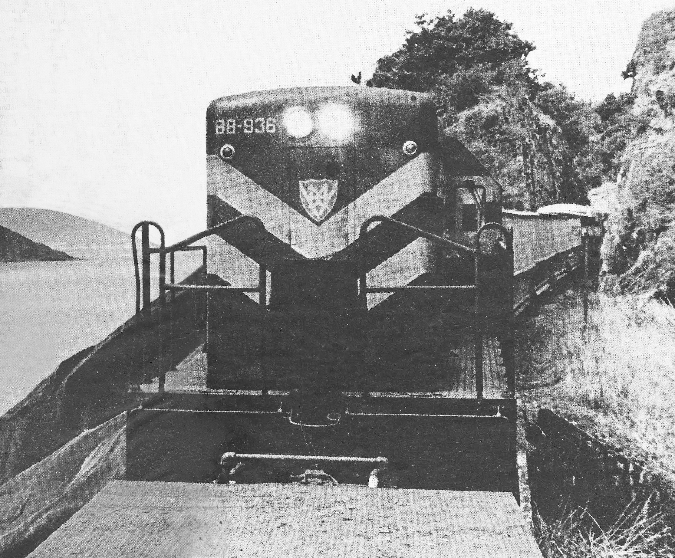
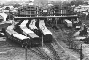
GE U8 BB-936 at Cape Varella (photo by Paul S Stephanus)

Every Việt Cộng attack on it is an indirect compliment to the line.

For four years after the end of the French war in 1954, the transportation system of Việt Nam below the 17th Parallel lay in ruins under the rubble of the two wars which had swept over it. Both the railway and the road system were fragmented by blown bridges and torn-up track and pavement. In the comparable period in Europe (1946-1950), transportation and the local economies recovered almost entirely from even more complete destruction, with proportionately less American aid than Việt Nam had available; but Việt Nam marked time. The reasons for this go deep into the roots of the present conflict, and several more years must pass before the emotional and political dynamite surrounding Việt and American policy in that era is disarmed so that a cool appraisal is possible.

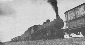
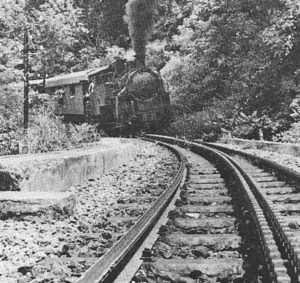
Makeshift operations have characterised many section of the railroad through recent wars. South of Quảng Ngãi, a gas-powered section speeder passes over a fragile trestle alongside the cribs of a bridge that was bombed out in World War II. (Việt Nam Hỏa Xa)

While a political climate as complex as 16th century Italy raged overhead, the railway, like a French bureau which grinds on through the rise and fall of parties and governments, held itself together. In Việt Nam, it is the policy to maintain a fixed workforce regardless of traffic, and since 1954 this has more than once kept the railway organisation from falling apart. [This policy has been slightly modified recently. The work force has been allowed to decline, mainly by attrition, from 6,000 in 1960 to 3,400 at present. Five hundred and thirty of these railroaders were drafted, including a hard-to-replace engineering staff.] Furthermore, in Việt Nam, technicians such as the railway officialdom are basically nonpolitical, and the railway board is not a power base as it might be in Europe. This, too, has spared the railway some problems.

In April 1958, American aid finally reached the transportation system (in contrast to the situation in Europe after World War II, when rail and highway rebuilding was in the first-months priorities of United Nations Relief & Rehabilitation Administration aid), and in 18 months it restored virtually all the damage.

In April 1958, when the reconstruction program began, the system was more or less normal south of Ninh Hòa, but from there north, only fragments were “operational,” and then only in the sense that light local passenger service was furnished by gasoline speeder trains, Việt Minh style, over flimsy wooden trestles and shooflies. Repairs began with house-to-house inquiries by the police or railway personnel to find out where the Việt Minh had buried rails and ties. Since the Việt Cộng insurrection was already overt (the first acts of terrorism and destruction took place in 1957), and was especially strong in the northern provinces of South Việt Nam, it was sometimes worth a man’s life to reveal a cache of buried railroad equipment. However, one by one, the hiding places came to light and the track restoration began. Ninety-eight bridges were repaired or replaced. In many cases, it was possible to lift the bridges intact from the water where the Việt Minh had flung them. Many of the bridges were a standard 50-meter truss originally built by the Germans in their post-World War I reparations to the French, and this meant that replacement trusses could be built up from the pieces salvaged from two or more usable spans.

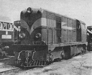
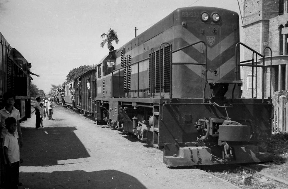
BB-902 is one of the six Alsthom 850 hp B-B diesels supplied to VNHX under the French assistance program (Paul S Stephanus)

The total cost of the rebuilding was 7.3 million dollars, a modest amount for restoring over 200 miles of demolished railroad. The cost of track materials was covered by a repayable 4.363-million-dollar US loan. On August 7, 1959, a train ran from Saigon to Huế for the first time in 15 years. Because of slow orders on track still being repaired, running time was 34 hours 25 minutes for the 600-mile trip. Before World War II it had been 26 hours.

The only retrenchment in the railroad at this time was the abandonment of the Saigon-Mỹ Tho line, Việt Nam’s first railroad. This line had been beset by water competition ever since it opened in 1885, and in 1958, its right of way and bridges were turned over to a highway project. “Water competition” in this case means sampans on the network of canals and sloughs in the delta. Of course, watercraft are an alternative all along the coast, but north of Saigon, this mode involves travel on the open sea and longer hauls, so it is not a serious factor.

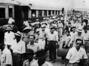
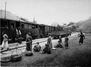
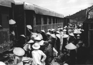
The opening of the railway north of Ninh Hòa was a direct benefit to the rural people who inhabit the coastal valleys, and who have been alternatively wooed and terrorized in the course of this war. Periodically, these people must travel from their rice plots to town to buy clothes and the small luxuries of their frugal lives, and the railway fare is half that of the buses on the parallel Highway I. It also produces some benefits in freight transportation, although the economy is so disorganized by war and inflation that only the government and the military have much freight to move over and above the personal barter level of trade represented by a passenger with two rice baskets on a carrying pole.

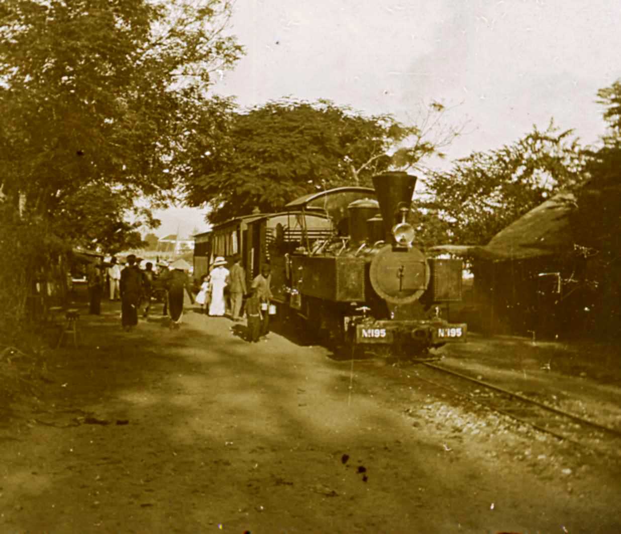
Polished 4-6-0 was decorated to participate in 1961 opening of the branch line to An Hòa Industrial Complex. This locomotive was built in 1927, and today is stored serviceable at Tháp Chàm (Paul S Stephanus)

In 1961, the railway played an important part in one effort to move the economy out of this stage – the Nông Sơn development at An Hòa, southwest of Đà Nẵng. Here at the anthrcitious Nông Sơn coal mines, opened after partition shut off the former supply of coal from the north, the government of South Việt Nam hoped to develop a complex of medium industry, including chemical production, using the coal and coal-generated electric power as a base. A 12-mile branch of the railway was opened in 1961 from Bà Rén to An Hòa. The development was completely surrounded by Việt Cộng units, however, and after 1963 the coal it mined could not be transported out. In 1965, the whole Nông Sơn development was given up until such time as security improves, which in that region could be a long time.

Although the South Vietnamese enjoyed the services of a nearly complete rail network from 1959 to 1964, those years nonetheless were far from ideal. The guerrilla war increased in pitch each year, and the railroad, as an instrument of the government, became a target in the same way as do the lives of schoolteachers, policemen and local government officials. The object of the Việt Cộng was to destroy all connections between the government and the people, substituting the VC’s own shadow government in the rural areas. The availability of trains on the government’s railroad clashed with that goal, as it does today. Accordingly, trains were fired upon and derailed by mines, bridges were blown up, and stations were bombed. Although there were interruptions of service for days at a time in some sectors, the railroad managed to retain its integrity as a system. The only exception was the 84-mile Lộc Ninh branch, which operated through rubber-plantation country near the infamous Zones C and D – a territory the South Vietnamese Army had virtually ceded to the Việt Cộng. Operation on this route was discontinued as unsafe in 1961.

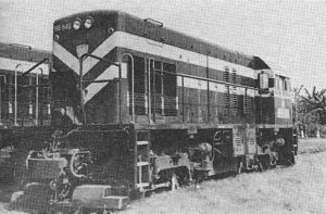
Rated at 900 hp and equipped for multiple-unit operation, 48 GE U8s are the mainstays of the railway (Paul S Stephanus)

The major improvement of the railroad during this period was the delivery in 1963 of 23 US-built diesels, along with diesel, car and wheel shop machinery, and 221 box cars, all of which were provided for by two US Development Fund loans. The new freight cars equalled about 25 per cent of the previous car capacity, and the diesels were able to handle most operation as traffic fell under war conditions. Ten new third-class passenger cars came from Australia under the Colombo Plan – an Asian self-help treaty for economic development.

During this period, the military situation for the South Vietnamese government grew steadily worse. The Việt Cộng began to roam the countryside in battalion or regimental strength, and the government’s soldiers were virtually driven from the field, leaving the railroad more and more exposed to the depredations of the guerrillas. The coup d’etat which resulted in the removal and assassination of Premier Ngô Đình Diệm in 1963 and led to a succession of ineffective military governments did not improve these conditions, and in fact the military position of the South Việts continued to decline until the arrival of US combat troops in 1965.

The coup de grace for the railroad came earlier than that, when a series of typhoons struck South Việt Nam in November 1964, and the resulting floods washed out large sections of the line. The railway had been able to keep up with the series of harassing derailments imposed by the Việt Cộng, but the combination of sabotage and nature proved too much. The guerrillas took advantage of the disruption of service to move in on abandoned areas and to do still more damage. By the end of 1964, more damage had been inflicted on the South Vietnamese railway system in a two-month period that in 15 years of World War II and the French War combined.

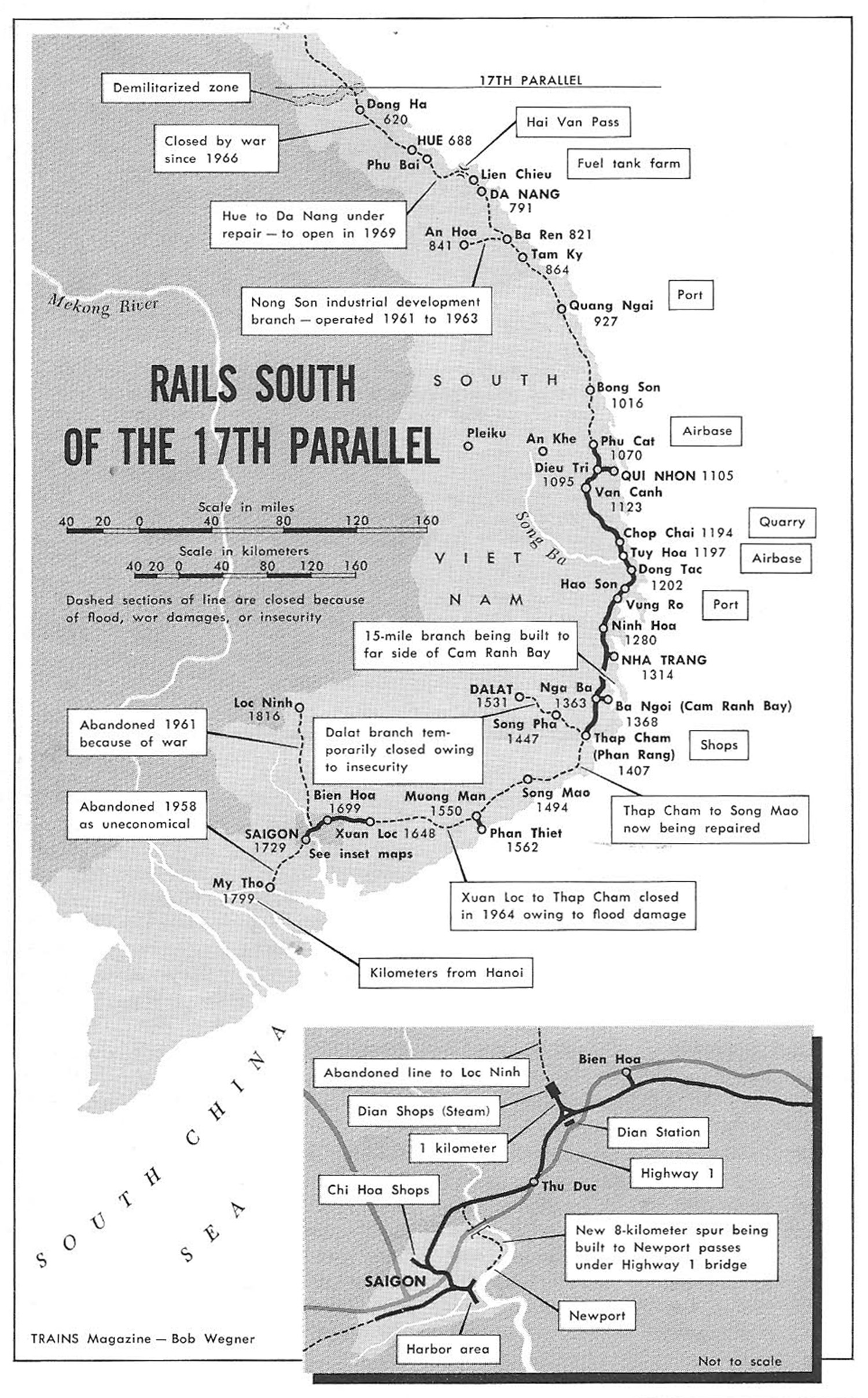
Since 1964, the operations of Việt Nam Hỏa Xa have been broken into segments. The details of these segmented operations can best be described by surveying them from north to south.

1. Đà Nẵng to Đông Hà

Symbolising a railroad slowly returning to life, an austere 1927 Cail 4-6-0 – dirty and bullet-ridden after a year and a half in storage in Huế – backs down the main line at Phú Bài in September 1968 with a work train to help open the road to Đà Nẵng. (photo by Paul S Stephanus)

After the 1964 typhoons, VNHX still considered this sector operational. During 1965 and 1966, a daily mixed was scheduled between Đà Nẵng and Huế, but the level of sabotage on this line was high, and the service was off more than it was on. Trains occasionally ran between Huế and Đông Hà in 1965 and 1966, but that sector has since been declared insecure and does not operate, although there are locomotives and cars in Huế which could handle this now isolated section, if necessary. Đà Nẵng is the principal US Marine port of supply, and the VNHX handles some local switching there. In connection with this supply base, the US has a fuel tank farm about 9 miles north at Liên Chiểu, and in 1966 and early 1967, a daily tank car train ran between Liên Chiểu and Đà Nẵng.

The Đà Nẵng to Huế section was closed from February 1967 until the end of 1968. The last through trains ran north from Đà Nẵng to Huế on February 1, 1967, and returned the next day. These trains were the regular civilian mixed, powered by a 4-6-0, and three diesel-powered military supply trains. They were the first trains since January 10, 1967 and the last for almost two years. On February 3 and 4, four bridges were blown between Đà Nẵng and Huế, causing enough damage to close the line for at least two months owing to a shortage of materials. Then in April 1967, swimmers floated a massive TNT charge down the Nam Ô river by night and obliterated one piling of the rail-highway bridge just north of Đà Nẵng, dropping two 80-meter spans into the water. At least two swimmers were blown up with the bridge, which was protected by 45 US Marine guards. This stopped all trains north of Đà Nẵng, including the Liên Chiểu tank trains.

Nam Ô Bridge, Đà Nẵng

The Nam Ô bridge was restored by November 1967 (in the meantime, a pontoon bridge carried highway traffic, including tank trucks, to Liên Chiểu), but not until July 1968 did work begin on restoring railroad service. At that time, a work train powered by a 4-6-0 began pushing south from Huế to meet two diesel-powered work trains coming north from Đà Nẵng, while US Army engineers assisted in the restoration of smaller bridges in this section. By December 1968, the northbound and southbound work trains were less than 20 miles apart, and only two small bridges remained to be repaired, with the through service from Đà Nẵng to Huế expected to resume in February 1969 or sooner, barring some calamity. Already, some military supply trains were operating north over the Hải Vân Pass to Lăng Cô, relieving the dangerous highway in this sector, and a 4-6-0 powered mixed train had begun making turns from Huế to the big US supply base at Phú Bài on the northern segment. With the work train and mixed operating from Huế, two 4-6-0s and a 4-4-0 on standby and for switching have been in steam regularly since October. Once the lines have been joined between Đà Nẵng and Huế, however, diesels will run through, and Huế’s steam power will revert to standby duties.

The problem in restoring a section such as the Đà Nẵng-Huế line is not an engineering one. The Việt Cộng are only rarely able to hit a big multi-span bridge such as the one over the Nam, and the smaller bridges they do attack can usually be repaired in less than 48 hours. The present work trains are more concerned with clearing brush from the track after more than 18 months of disuse than in repairing sabotage damage. The holdup instead is security and priorities. The VNHX is not an armed force. Its men are employed to run trains, not to fight. In spite of this, they have never refused to take out a train when ordered to do so, and they regularly operate under conditions which make them a prime target – such as handling military supply trains. From 1961 to mid 1968, 65 VNHX men have been killed and 1,341 wounded or injured in attacks on the railroad. VNHX officials take the view that if they are going to run trains under these conditions, the military they are serving should indicate the need for continued operation by supplying enough troops to protect at least some major bridges and military supply trains. If such troops are not available, or if the state of war in the countryside is so intense as to make regular operation unlikely, there is no point in rushing to restore service. However, the military, especially the US military, which has the resources to do things quickly when it wants to, now realizes the value of the railroad – or at least is more aware of its potential than in 1966-1967, when the first rush of the US buildup was largely truck-borne.

Huế-Đà Nẵng – Route of Risk, March 1969: It takes courage to commute from Huế to Đà Nẵng in South Việt Nam. The line is subject to attack and constant precaution is the order of the day. The track is lined on both sides with outposts, protected by barbed wire, bunkers and pillboxes. But at least the trains now run daily. They were blasted out of action by the Việt Cộng for over two and a half years, and only resumed service in mid-January of this year. (AP Newsfeatures Photo)

For six weeks after the February 1968 Tết Offensive, the highway pass between Đà Nẵng and Huế (the Hải Vân Pass) was closed; and only a few days after Tết, the US military was talking to VNHX about reopening the railroad. Army Engineer aid which had been stalled for months has since come forward. In September 1968, the military was given another demonstration by nature – Typhoon Bess hit Việt Nam, washing out the highway in several places. A few truckloads of dirt over the line at a tunnel mouth was the only consequence to the railroad. The lesson for the military is a short one and an old one: the railroad is no more vulnerable than the highway for regular mass supply movements (as opposed to the expensive tactical logistics resorted to only when bridges are out or roads and rails are otherwise impassable). In many cases, the railroad can be restored more quickly. It is much better engineered than the highway through the mountain passes, and has capacity that can replace dozens of trucks and drivers with a single train.

All of these factors, plus the good marks the Việt Nam government gets from the people when the train service is restored and military convoy traffic is kept off the highways, are working towards a higher priority for the railroad in military planning. This applies to all sections of the line, as we shall see. With this higher priority has come the “push” and the resources to restore the railroad.

2. Đà Nẵng-Phù Cát

This sector, which includes the new-in-1961 An Hòa branch and the important provincial capital of Quảng Ngãi, has been totally non-operational since the November 1964 typhoons, and is likely to be the last segment of the coastal main line restored to service. In 1966, many miles of line were cleared of track by US marine bulldozers, so that Marine tanks could freely operate down the right of way. The track material was to be stockpiled, but this was never done, and the rebuilding now will be a major job, probably not completed before 1970 under present conditions. Furthermore, during 1968, units of the ARVN, the regular South Vietnamese army, stole miles of track materials to make bunkers, and much of this found its way onto the local black market. VNHX local officials tried to stop the damage, but were powerless against the truckloads of men who swooped down on the idle line. Poor communications prevented them from reaching Saigon for help, and when VNHX sought the assistance of the provincial chief, he was “unavailably sick.” Province chiefs are ARVN officers. Between them, the Marines and the ARVN have done damage to this sector that will take longer to repair than most of the pillaging of the Việt Cộng.

In this sector is a work train stranded in the 1964 typhoon at Bông Sơn, while the train was on its way from Quy Nhơn to Đà Nẵng. In 1968, the US Army sent trucks to Bông Sơn and carried the railroad cars back to Quy Nhơn, where they were restored to service. The diesel is still there, and could be used to move a work train south towards the present end of operational track at Phù Cát if a decision is made to proceed with this reopening. Bông Sơn’s coastal valley is one of the most important rice-producing areas in central Việt Nam.

3. Phù Cát-Quy Nhơn-Tuy Hòa

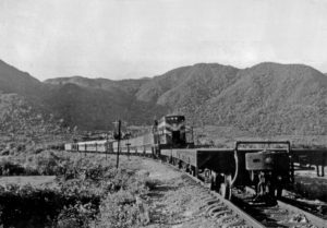
A 900-year-old temple, built by Hindu Champas, looks down on a 1959 Alsthom diesel moving off a standard German 50-meter truss bridge along the old Trans-Indochina line near Quy Nhơn in 1967. (Paul S Stephanus)

After the 1964 typhoons, the entire line from Đà Nẵng to Nha Trang was closed at first, but Quy Nhơn soon revived as a switching operation because of its status as a port. Quy Nhơn is the seaward anchor of Highway 19, the vital route to the interior which supplies the big US Army installations at An Khê and Pleiku, and the port handles heavy traffic. In addition, a major new jet fighter base was built 21 miles northwest at Phù Cát, to which VNHX runs a daily supply turn from Quy Nhơn. During the construction of this base, a quarry train was also operated. This train brought rock fill from a point 8 miles south of Phù Cát for dumping at the base site. This activity alone saved the US a large number of dump trucks and drivers which would have clogged Highway 1 in that sector. The supply train handles, among other things, ammunition and fuel, and would be a prime target on its daily 42-mile round trip, but the Quy Nhơn area is relatively secure, since it is patrolled by both US and Korean troops.

During the 1968 Tết Offensive, a bridge was damaged by a fire in the US Army pipeline that used the bridge, but the structure was soon restored. The lack of a serious attack on the supply train is an indication of the excellent local security conditions.

The Quy Nhơn operation of VNHX also included a mixed train to Vân Canh, about 22 miles by rail southwest of Quy Nhơn. This train served mainly the civilian “strip” development which has grown up along Highway 1, where it parallels the main line west of Quy Nhơn. During 1968, work trains operating south from Quy Nhơn and north from Tuy Hòa restored service all the way to Tuy Hòa. By November, military freight was being carried over this newly-reopened section by a down-one-day, back-the-next turn from Quy Nhơn. Travelling slowly to reduce damage in case of mining, the train leaves Quy Nhơn every other day at about 8am and arrives at Tuy Hòa, 66 miles, in 9 hours – an average of about 7mph. On September 24, shortly before the line was reopened, the diesel locomotive of a work train was derailed by a pressure mine. This kind of activity must be expected from time to time as long as the guerrilla war continues. It does not prevent operation.

4. Tuy Hòa area

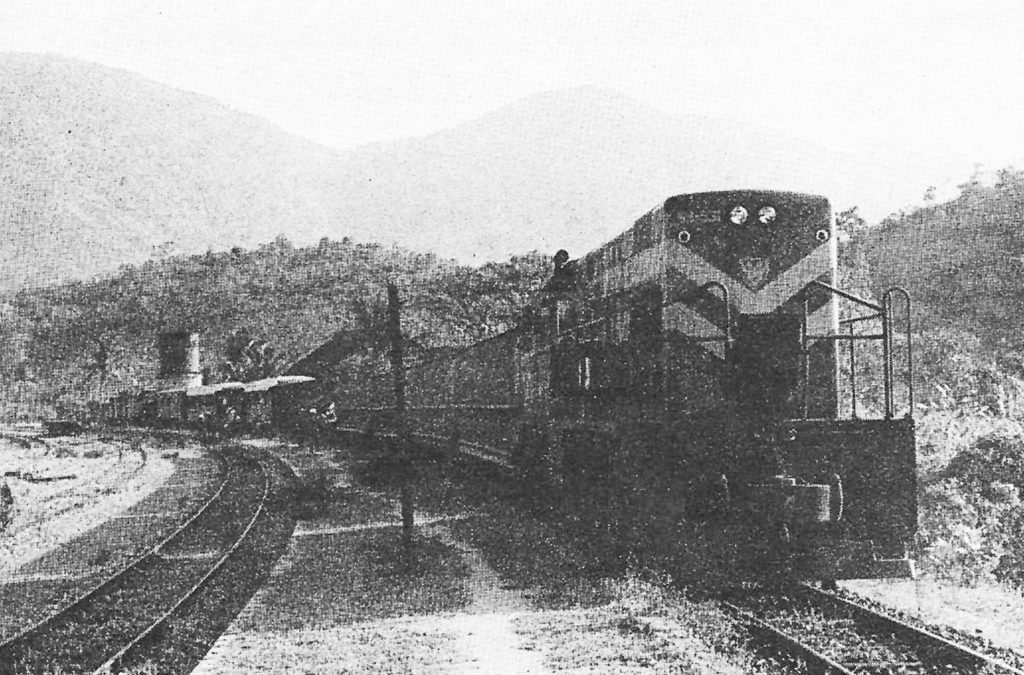
Việt Nam’s longest bridge – containing 21 50-metre spans erected in 1936 – carries the Trans-Indochina main line and Highway 1 across the River Ba. A GE U8 moves quarry stone to Tuy Hòa airbase. (Paul S Stephanus)

Tuy Hòa’s rail terminal, like that of Quy Nhơn, was isolated by the 1964 disasters, but was soon revived because of the construction of a big new US airbase at Tuy Hòa South. The new town of Tuy Hòa sits on the north bank of the River Ba, which the railroad and Highway 1 cross on a bridge consisting of 21 50-meter spans, the longest bridge in Việt Nam. Several miles south of the river is the airbase, and a little more than a mile north of Tuy Hòa station is the Chóp Chài quarry, source of the grading material used to construct the base. The distance from the quarry to the base is a little over 5 miles, and since 1966, a quarry train has been running between these points – first to build the base, then to build a railroad bypass around the base and to provide rock for work on Highway 1 south of Tuy Hòa. A daily commuter train runs from Tuy Hòa to the airbase, carrying Vietnamese civilians to and from their jobs at the installation. At the height of the airbase construction, quarry trains ran up to four or five times a day, handling 14,000 metric tomes of rock in one week, and a diesel unit was assigned solely to this duty. Now, the train runs about eight times a week, and the same diesel handles both the quarry and commuter trains, releasing the other unit normally stationed at Tuy Hòa for the rapidly-expanding motive-power demands caused by the present line reopenings.

5. Tuy Hòa-Nha Trang

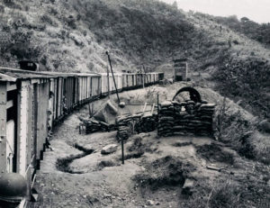
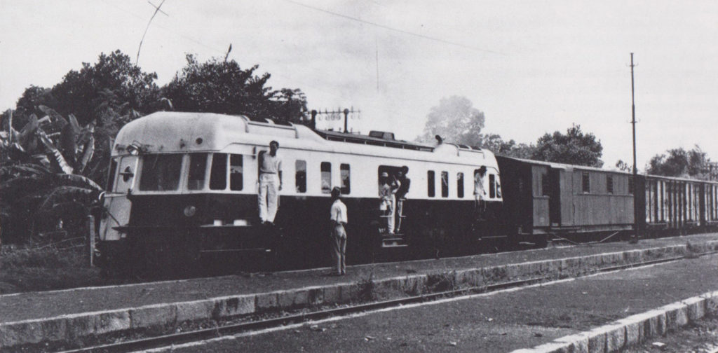
Since 1964, service north from Nha Trang had been knocked out by a blown concrete bridge north of Nha Trang, as well as by track damage, but in July 1967, service was restored. A daily mixed turn from Nha Trang to Hảo Sơn began carrying an average of 250 persons per day, an indication of the demand for railroad service where lines can be reopened even in this sparsely settled stretch, with the service ending “nowhere” at Hảo Sơn, a gutted railroad station without a town on the north side of the pass at Cape Varella.

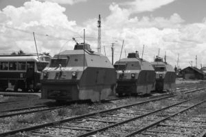
An armored car (Việt Nam Hỏa Xa)

The success of this reopening in 1967 undoubtedly pointed the way for the more ambitious reopenings undertaken in 1968. The 5-mile gap between Hảo Sơn and the operating segment from Tuy Hòa to the airbase, however, presented two serious obstacles. First, the runway of the airbase cut across the VNHX main line. This was bypassed by a line relocation during 1968. Second, the through truss bridge at Sắc Đéc was made in the United States in 1967 and test-assembled at Dĩ An shops early in 1968. It was knocked down and shipped over water to Nha Trang, then moved by rail to Sắc Đéc, assembled at the scene and completely installed on December 4, 1968. Continuous rail service was still available in December 1968 from Quy Nhơn to Tháp Chàm, a distance of about 174 miles along the central coast. This segment of the line passes through the US Army’s new port development at Vũng Rô, just south of Hảo Sơn. Here, two De Long piers have converted a former wilderness beachhead on the shore of Cape Varella into a “little Cam Ranh,” which is now one of the five greatest ports of Việt Nam for military supplies. Up to now, the only role the segmented railroad could play for Vũng Rô was to lend its right of way for the pipeline which runs from Vũng Rô to the Tuy Hòa airbase, but with the line reopening, it should be possible for the railroad to take over some of the massive truck-hauling job now going on between Tuy Hòa and Vũng Rô.

6. Nha Trang-Tháp Chàm (Phan Rang)

Until 1968, the daily mixed Nha Trang-Tháp Chàm, and its connecting daily mixed over the Đà Lạt branch, had provided the safest and most continuous and stable service on the VNHX since the 1964 disaster. Tháp Chàm means simply “Cham Temple,” and refers to the spectacular Champa ruins on the hill above the shops. These relics of the old Hindu Champa civilization are also found at Quy Nhơn, Tuy Hòa, Nha Trang and other places on the coast, and all predate William the Conqueror’s reign in England. The ruin at Tháp Chàm, however, is the most flamboyant in architecture. The last remaining Cham people are now concentrated in a few fishing villages near Phan Rang and Phan Thiết, and the Tháp Chàm railroad station is actually there to serve the major town of Phan Rang. It is also the location of a locomotive and car shop.

Nha Trang Station (Việt Nam Hỏa Xa)

Nha Trang is a seaside resort where French villas line the curving beach road, overlooking a bay surrounded by green mountains and dotted with islands. Today it is also a military port, and the regal old Grand Hotel is headquarters of Field Force One, the US Army’s Corps Command for central South Việt Nam. The railroad takes a circuitous route west and then south from Nha Trang, bypassing a cluster of mountains that separate Nha Trang from Cam Ranh Bay. At Ngã Ba, a 3-mile branch line takes off for the shore of the bay. This freight-only branch is operated by the last remaining “Camion rail” in service – a 1940 GMC truck engine converted to haul light loads over the railroad over sections of track wrecked by previous wars.

However, the branch reaches the wrong side of the bay to serve the massive US port development, although it is now handling a supply train from Ba Ngòi’s barge dock to the Korean Army base camp at Ninh Hòa. A quarry train for a Highway 1 project near Nha Trang also originates on this branch. Both of these trains are in addition to the Camion rail on the Ba Ngòi branch, and are products of the last months of 1968 and the increased military awareness of the railroad. Even more to the point, though, is the new 15-mile branch line now being built to the opposite side of Cam Ranh Bay, on the peninsula where the main US port development is located. This line was made possible when a permanent bridge with a rail section was installed by the United States to replace the pontoon bridge to the peninsula, and will afford direct rail distribution to the entire coastal tributary area of this massive port, whose docks and depots supply units as far north along the coast as Quy Nhơn.

From Ngã Ba, the line goes over flat, dry territory to Tháp Chàm. The mixed is almost always diesel-powered, but on rare occasions, one of the stored-serviceable 4-6-2s at Nha Trang or Tháp Chàm has substituted (These engines occasionally have been used on work trains). With the extensive line reopenings, steam power may see a more extensive pinch-hitting role as diesels are spread thinner. Beginning in mid-1968, the Nha Trang-Tháp Chàm mixed was the subject of stepped-up Việt Cộng harrassment, with minings and occasional interruptions of service lasting two or three days. Because of this harassment, trains have been running slower, and a power shortage caused by the minings and the new services has made it necessary temporarily to cut back both the Nha Trang-Tháp Chàm mixed and the Nha Trang-Hảo Sơn scheduled to an every-other-day basis. Six mine-damaged diesels were under repair at Tháp Chàm as late as early December 1968, helping to explain this service cutback, which should be alleviated as you read this.

7. Đà Lạt branch

Cog Railway to Dalat (photo by Paul S Stephanus)

Until the fall of 1968, the Đà Lạt branch was operated as a connecting service of the Nha Trang-Tháp Chàm mixed. The train from Nha Trang would arrive in the morning in time to connect with the diesel-powered Sông Pha turn, and would wait for the Sông Pha train to return before going back to Nha Trang. In fact, sometimes, both turns were handled by the same equipment. Now, owing to the stepped-up Việt Cộng molestation between Sông Pha and Đà Lạt, the whole Đà Lạt branch has been temporarily shut down.

When the Đà Lạt branch is operating, it is worked in two sections. The Tháp Chàm to Sông Pha turn takes traffic to and from the heavily graded rack section. West of Sông Pha to Đà Lạt, steam rack-and-adhesion locomotives hoist traffic up grades of as steep as 12 per cent to Đà Lạt. Despite the temporary line closing, VNHX is going ahead with an order for GE rack diesels for this line, but they are not expected to arrive until late 1969 or early 1970.

Đà Lạt is an extremely important traffic point, because of the large vegetable crop grown in the pleasant climate of its 4,500-foot elevations. The US Army has become one of the largest customers for Đà Lạt vegetables for its mess halls, and there is substantial civilian consumption which the extension of service on the main line should increase. For braking reasons, cars of vegetables can be handled only four at a time down the rack, and the cars must be equipped with the rack braking gear. Consequently, the steam rack locomotives run something of a shuttle service down the rack to Sông Pha, as traffic demands.

Cog Railway to Dalat (photo by Paul S Stephanus)

The adhesion-only section of the Tháp Chàm to Sông Pha branch is 24 miles long, and rises in elevation from near sea level to about 500 feet, with a few 1.5 per cent grades. The next 30 miles include three rack sections on 12 per cent grades, which are tackled at walking speed. The average speed over the whole rack-and-adhesion section from Sông Pha to Đà Lạt is 10 mph. The scenery is breathtaking as the train climbs 4,500 feet into the sky, surrounded by deep forests and rushing mountain streams. The Việt Cộng are in those forests, but until 1968 they did not usually touch the rack trains. A public relations problem may have been what caused the Việt Cộng to stay away, because the trains carry no military freight except vegetables, and are the only practical access to and from Đà Lạt for civilians wishing to trade in the lowland.

Whatever the reason for the tacit truce, however, it collapsed after the Tết Offensive. About 30 times in 1968, small (6-to-12-meter) I-beam bridges were damaged by saboteurs and repaired, usually in 4 to 48 hours. Most of the trouble was in a 6-mile section of inaccessible jungle along the 12 per cent grade north of Sông Pha. Here, one small bridge has been damaged eight times. In addition, before the line was closed, trains were attacked several times. Swiss-built Abt-rack engine 40-302 was hit twice. In May 1967, before attacks became commonplace, a train powered by 40-302 was stopped, crew and passengers were driven away, and a charge was placed in the 302’s cab. The damage was quickly repaired at Đà Lạt, and one wonders whether the sapper who did the job was just a little too afraid of the hissing “Hỏa Xa” to place his charge where it would have done real damage – among the bewildering valve motion and rack gears of the four-cylinder Abt drive system. In any case, 302’s next encounter was much grimmer. On September 24, 1968, the Communists attacked an up train powered by 40-302 with RPG rocket launchers (a Soviet bazooka). Three crewmen died and 302 was seriously hit. She is now at Đà Lạt for repairs.

8. Tháp Chàm-Mường Mán-Phan Thiết

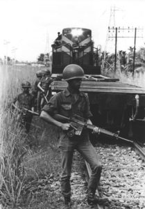
Railway Security – ARVN security detail jumps from a train to check security on a run north of Saigon (Việt Nam Hỏa Xa)

The line between Tháp Chàm and Mường Mán suffered heavily in the 1964 floods, but now a work train is pushing forward to link up with the isolated locomotives and cars at Mường Mán. In December 1968, the work was proceeding south from Tháp Chàm as far as Sông Mao, and the plan was to start a meeting work train north from Mường Mán. This section by itself will not be too significant from a traffc standpoint until the gap between Mường Mán and Xuân Lộc is closed, permitting through service to Saigon. But it will give access to the pool of rolling stock at Mường Mán. The 7-mile branch to Phan Thiết is in operable condition and has seen occasional movements; and Phan Thiết, a town of 100,000 population, should generate civilian travel.

9. Mường Mán-Xuân Lộc

This segment can be opened, providing through service to Saigon, whenever sufficient security forces are made available. The ARVN has allocated enough forces to protect the work train, but the province chief in the area wants assurance from the assurance from the US that a reaction force will be provided in case of a major attack on it. With all the military commitments and contingencies currently possible in the Saigon area, the US Command has not been willing to give such an ironclad promise.
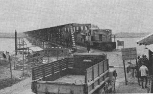
10. Saigon area

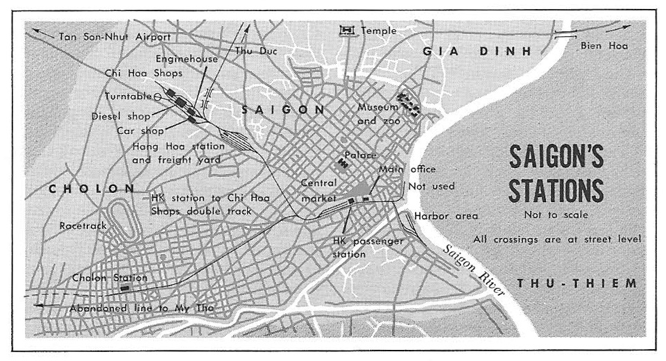
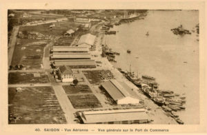
Although the Saigon sector has involved only short runs to date, it is the busiest part of the system and is becoming still busier. In 1968, 2,500 tons a week were moving from the Saigon River docks (not including those at Newport, which will be seved by a branch now under construction), mainly to Dĩ An, base camp of the US Infantry Division; the big airbase at Biên Hòa; and the new Hố Nai yard serving the huge Long Bình supply complex stretched out along Highway 1 near Biên Hòa. Two trains a day were handling this traffic by October 1968, with some trains going on to Xuân Lộc, the 11th Armored Cavalry base camp at the current end of operable track north from Saigon. Plans were progressing to construct about 12 miles of spur lines through the Long Bình complex, and a gravel train was inaugurated from Thủ Đức to Xuân Lộc for improvements on Highway 1. The 2,500 tons per week figure is double that for a year earlier, and does not include the gravel trains.

Further increases in business are expected, now that VNHX has assumed the job of port clearance for Saigon, which includes decisions as to how freight will be moved off the docks. The US Command had taken this job from the railroad and immediately suffered a massive cargo pilferage problem, which has caused an aid program scandal in Congress. The railroad’s experienced personnel never had such a problem, and it is hoped that by returning port clearance responsibility to VNHX, the pilferage will be stopped. Incidentally, by any standard, and not just by comparison with the usual situation in Việt Nam, the railway has been free of corruption.

Saigon’s Chí Hòa Depot (Việt Nam Hỏa Xa)

Until the Tết Offensive disrupted the life of Saigon, passenger trains also ran to suburban Chợ Lớn and Thủ Đức. The main patrons of the Chợ Lớn train were schoolchildren, but the temporary closing of Saigon’s schools, which are being used to house refugees, has ended this service for now, and the Thủ Đức trains are not run because of the danger to passengers in this beseiged city.

Saigon has the two heaviest shops on the system – the diesel shop in the central city at Chí Hòa, and the steam shop 13 miles out at Dĩ An.

Because of these shops, nearly half of the diesel locomotives on the system are kept at Saigon and are barged up-country as needed. If the link from Xuân Lôc to Mường Mán is completed, this slow barging process can be ended, and availability of locomotives up-country will automatically increase. In April 1967, a team of Việt Cộng sappers broke into the Chí Hòa compound and damaged 10 locomotives and a heavy wrecking crane with satchel charges. The shops repaired the damage, and the engines were excess to the system’s needs at that time, so no operating difficulties resulted from this damage. With the time coming for the line to open – perhaps all the way to Huế – the day should be passing when lines of diesels at Chí Hòa sit idle waiting for work and inviting attack. [NB – To preclude a repeat of this calamity, Saigon’s large stockpile of locomotives has now been scattered to several points, instead of being lined up at Chí Hòa shops. Demands for more power up-country should soon end the surplus].

Dĩ An has little work to do now, but an overhaul of Esslingen-built rack engine 40-306, which included stripping her to the frame and removing her boiler, was completed. Reassembled, she was barged up the coast to Ba Ngòi and forwarded by rail to Sông Phà, in time to replace the rocket-blasted 302.

An early goal of the massive revival under way is normal operation over a large part of the system.

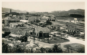
Train arrival at Saigon Station (Việt Nam Hỏa Xa)

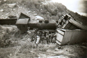
“Normal operation” in Việt Nam is still not normal by the standards of any nation not enmeshed in a guerrilla war. There simply are not enough troops to guard every bridge, let alone every mile of track. One man with a few pounds of TNT can slip it along the rails, and with a simple electronic detonator (a flashlight battery and some of the Army field wire scattered so freely around Việt Nam by the Signal Corps) can derail a train while he watches from a concealed position in the bushes. Such incidents will continue to occur, but probably not often enough to disrupt service seriously. The usual result is a 12-to-24 hour pickup job and some time in the shop for the equipment. To date, repairing equipment to stay ahead of this damage has not been difficult, although conditions will get tighter as traffic picks up with the reopening of the line. However, shop procedures can be speeded, and as more rail lines open, it will become easier to get equipment to and from repair points.

Civilian trains are equipped with a radio to call for help, but they do not carry armed guards unless there is military freight on board. Actually, soldiers are more of a curse than a blessing on a civilian train, because they draw fire. The civilian trains do have passive defenses, though. The locomotive pushes ahead of it a flat car intended to detonate pressure mines in sensitive regions, although a clever sapper can circumvent this by placing the trip a car-length beyond the charge. Passenger trains usually have a few hopper cars [Recently box cars have been substituted for hoppers in this duty owing to the demand for hoppers in gravel and rock trains] behind the locomotive to take the brunt of a derailment in which the charge goes off ahead of the train or under the engine.

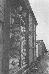
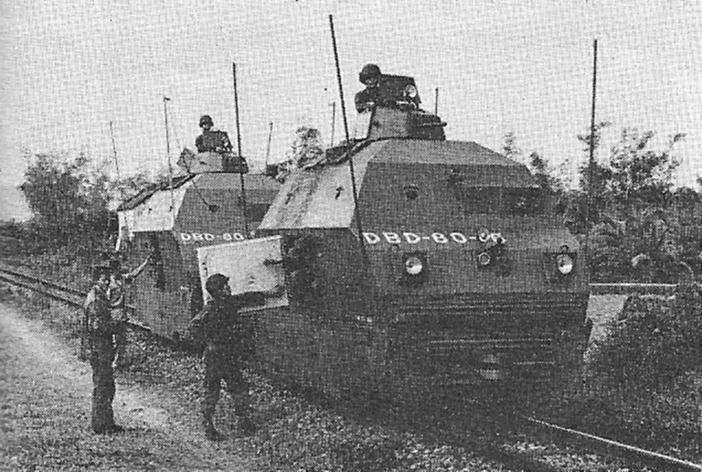
A military train is usually interspersed with armored cars armed with .30-caliber machine guns, mortars, grenade launchers, automatic rifles, and riflemen. The object is to have enough force on hand to hold off an infantry attack until planes and/or helicopters can arrive with assistance.

“Wickhams” came from Malaya in 1962 and are used from time to time for train-escort and mine patrol duty (Việt Nam Hỏa Xa)

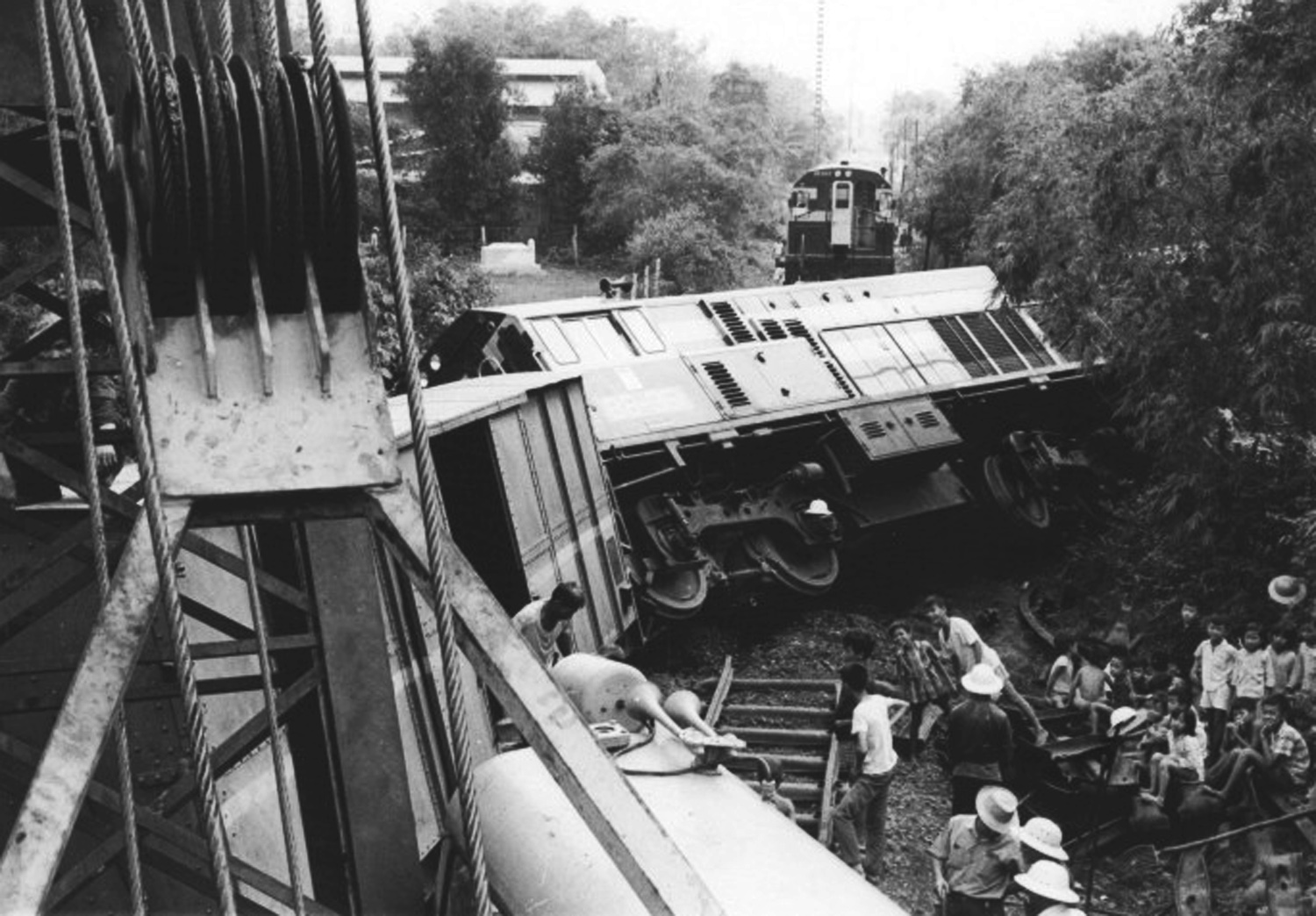
No military trains have been overpowered in the present conflict, but during the French war, some grisly instances occurred. One train was trapped by mines in a deep rock cut near Mường Mán. Gasoline was thrown over the edge of the cut into the armored cars and ignited, burning the guards to death. The Việt Minh then went through the rest of the train, shooting every French Union soldier in sight and lecturing the civilians on board about the dangers of adhering to the regime. The better communications and helicopter mobility of today, coupled with the relative weakness of VC units in the central region, should avert such attacks; but nevertheless, the guerrillas can pick the time and place where they will strike, and anywhere they appear in force, they are able to hold temporary sway. The only question is whether they are willing to sacrifice the lives and weapons involved in attacking a particular target. That the railroad draws its share of attacks indicates that the Việt Cộng continue to regard it as important.

The importance of the railroad to the civilian population is indicated by the patronage of the trains. The train is not only cheaper, but safer than the buses on the parallel Highway 1. The Việt Cộng sporadically mine the highway, apparently trying to blow up military vehicles, but disregarding the fact that, just as often, it is a crowded Lambretta or Renault microbus that sets off the charge, with hideous results. The attacks on the railroad have been less lethal to civilians, although the last car of the Đà Nẵng-Huế train was blown up in 1966, killing nine civilians. The Đắk Sơn Massacre brought home to many Americans the lesson that one trick in the Communist book is to kill civilians indiscriminately on calculated occasions, to destroy faith in the government, or to increase pressure for surrender at any price.

A General Electric BB diesel-electric locomotive passes Phù Cát in October 1971 (Việt Nam Hỏa Xa)

The military importance of the railroad is increasing dramatically as more of the line is opened. Highway 1 is now carrying most of the burden of supplying the chain of coastal military installations from the string of military ports. The heavy traffic has beaten the pavement to pieces, making speeds over 20mph impossible over long stretches. Where the pavement is gone altogether, slippery laterite clay sends trucks skidding into ditches after a rain. The dust clogs air filters in dry weather. In short, the truck lift is a costly operation. It did a good job in the initial tactical situation that accompanied the massive buildup of US and allied troops since 1965, but now that the railroad is being restored, the load can be taken off the hot rubber and the highway can be returned to the Vietnamese, who must now duck aside every few minutes for another rampaging convoy.

Whatever the rest of the world thinks, VNHX officials are clearly anticipating postwar operations in the foreseeable future. Equipment is being shopped and set aside for the day when through trains again run from Saigon to Huế carrying diners and sleepers. In fact, some first-class cars and a diner were rolled out for the dedication of the Hố Nai freight station in 1968, and VNHX officials turned down an offer of US Army helicopter transportation in order to ride again in VNHX’s former luxury. It is anticipated that new railcars will be purchased to cover local services after the war. New freight tariffs and fare structures have been designed to meet the expected competition of a rebuilt Highway 1. Thus, we can all look forward to the time when the “conveyance which runs by fire” will be an instrument of peace.

SOUTH VIỆT NAM’S DIESELS AND MOTOR CARS

Class BB901

Alsthom (France) 1959, 850hp B-B diesel-electric locomotives

Alsthom diesel-electric locomotive No BB902 at Chí Hòa Depot (Việt Nam Hỏa Xa)


BB901 Central

BB902 Saigon

BB903 Saigon


BB904 Central

BB905 Saigon

BB906 Central


Class BB907

General Electric (US) 1963, 900hp, B-B model diesel-electric locomotives, 114,000 pounds

General Electric B-B diesel-electric locomotive No BB921 on the Nha Trang-Tháp Chàm mixed (Paul S Stephanus)


BB907 Saigon

BB908 Saigon

BB909 Stranded at Bông Sơn

BB910 Đà Nẵng

BB911 Đà Nẵng

BB912 Central

BB913 Đà Nẵng

BB914 Central

BB915 Mương Mán

BB916 Central

BB917 Đà Nẵng


BB918 Central

BB919 Đà Nẵng

BB920 Central

BB921 Stranded at Bà Rén

BB922 Central

BB923 Mương Mán

BB924 Central

BB925 Mương Mán

BB926 Mương Mán

BB927 Đà Nẵng

BB928 Saigon

BB929 Central


Class BB930

Identical to Class BB907 but built in 1965

General Electric B-B diesel-electric locomotive No BB937 (Việt Nam Hỏa Xa)


BB930 Central

BB931 Central

BB932 Stranded at km 1616

BB933 Saigon

BB934 Mương Mán

BB935 Mương Mán

BB936 Central

BB937 Central

BB938 Saigon

BB939 Central

BB940 Central

BB941 Saigon


BB942 Central

BB943 Saigon

BB944 Saigon

BB945 Saigon

BB946 Saigon

BB947 Saigon

BB948 Saigon

BB949 Saigon

BB950 Saigon

BB951 Saigon

BB952 Saigon

BB953 Saigon

BB954 Saigon


Class 1988

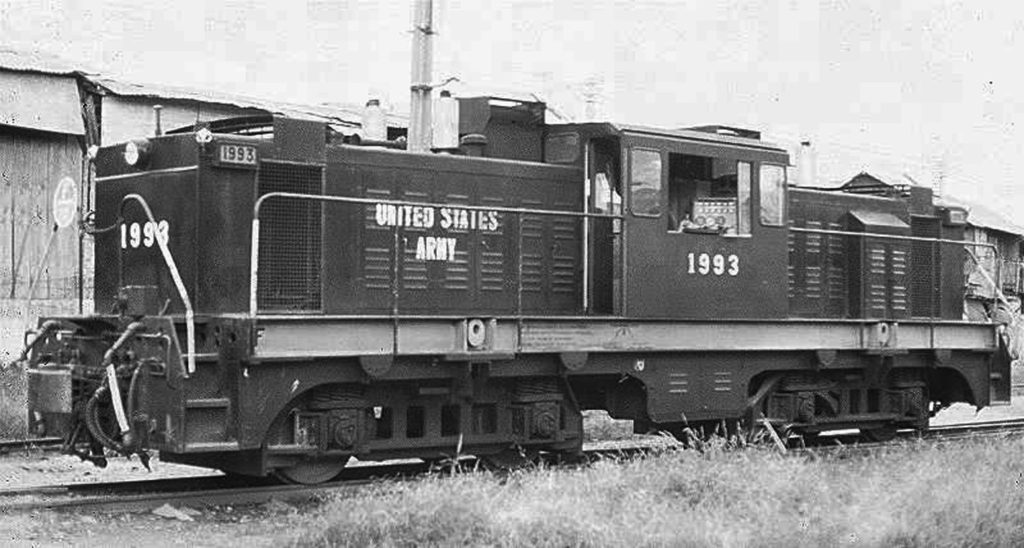
Plymouth BB diesel-hydraulic locomotive No 1993 (photographer unknown)


US Army-owned Plymouth (US) model CR-8 1,000hp dual-engined diesel-hydraulic locomotives built in 1964; 114,400 pounds; until 1968 used and lettered for Royal State Railways of Thailand; to enter switching service in Saigon, relieving road units for use elsewhere; now lettered US Army; road numbers 1988-1997, at Saigon.

Class C301Y

Bandet, Donon & Rousell (France) 1955; 300hp 0-6-0 diesel-mechanical locomotives supplied to VNHX by US Army in 1957; road Nos C301Y-C302Y, at Saigon

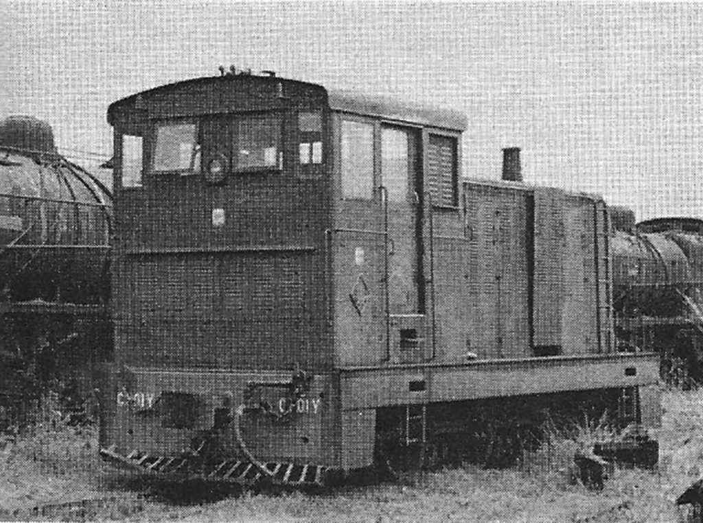
Two French direct-drive diesel units, which switch at Dĩ An and Chí Hòa, were brought to Việt Nam in 1957 (Paul S Stephanus)


Class B2-301Z

Renault (France) 300hp “Autorail” diesel-mechanical railcars, 1940

A Renault “Autorail” diesel-mechanical railcar (Việt Nam Hỏa Xa)


B2-301Z Huế, stored unserviceable

B2-302Z Huế, stored unserviceable

B2-303Z Saigon, junk


B2-304Z Saigon, stored unserviceable

B2-305Z Saigon, stored unserviceable

B2-306Z Đà Nẵng, junk


Rail trucks

Camions rail, or rail trucks built from 1940 GMC trucks, were used over sections of the line damaged during World War II and the French war. One still serves on the Ba Ngòi branch. (Việt Nam Hỏa Xa)


VNHX still has 10 “Camions rail” (rail trucks), which it built in 1940 using 60 hp GMC truck engines. These units operated over war-damaged sections of the line demanding light axle loadings. Only one is now working pulling one or two freight cars over the Ngã Ba-Ba Ngòi branch, meeting the Nha Trang to Tháp Chàm mixed. Surviving are four similar “Drasire” cars which no longer operate. These were built in 1940 and also have 60 hp GMC engines, but they have space on board for passengers or sectionmen.

Wickhams


These armored rail motor cars came to VNHX from the Malayan railway system in 1962. They were built originally by the Wickham company in England and are used to patrol track for mines and ambushes and to accompany trains in dangerous sections. Formerly they ran ahead of trains, but now three or four usually follow an escorted train to rush up with reinforcements in case of an attack. Twelve units, 6001-6012, have 60 hp engines; 18 units, 8001-8012, 8012A, 8014-8018 (there’s no No 13) are 80 hp. Each has gunports in the sides and a turret in which a .30-caliber Browning air-cooled machine gun may be mounted.

NOTES

Five sector designations are used in this roster. The Huế, Đà Nẵng and Mương Mán isolated local areas are self-explanatory, although the Huế and Đà Nẵng sectors may be joined as you read this, and work has been under way to bring out the isolated Mương Mán engines to Tháp Chàm in the Central sector. The Saigon sector includes the branches in the Saigon area and the operation out to Biên Hòa and Xuân Lộc. The Central sector includes the continuous line now open from Tháp Chàm to Quy Nhơn and branches.

At present, power can be moved between these isolated sections only by coastwise barge. Nine units were barged from Saigon to the Central sector in 1968, and one was barged from the Central to the Saigon sector for repair. As of early December 1968, 22 of VNHX’s 54 road diesels (the Alsthoms and the GEs) were out of service with different degrees of Việt Cộng damage. Only by continual repair effort against this harassing damage (most of it minor) does the road keep operating.

All horsepower ratings are European gross ratings. The 900 hp GEs, for example, would be 810 hp by US net horsepower for traction standards.

This is the second of two articles on the railways of South Việt Nam written in 1969 for Trains magazine by Jerry A Pinkepank – to read the first article, click here

Tim Doling is the author of The Railways and Tramways of Việt Nam (White Lotus Press, Bangkok, 2012) and also gives talks on the history of the Vietnamese railways to visiting groups.

A full index of all Tim’s blog articles since November 2013 is now available here.

Join the Facebook group Rail Thing – Railways and Tramways of Việt Nam for more information about Việt Nam’s railway and tramway history and all the latest news from Vietnam Railways.

Rails Through Viet Nam 1 – “The Conveyance which Runs by Fire” by Jerry A Pinkepank, Trains magazine, March 1969

Rails have been target and weapon since 1939

The superimposed initials on the shield-shaped Việt Nam Railways emblem are VHX. They stand for Việt Nam Hỏa Xa which, literally translated, means the “conveyance which runs by fire.” What a grand piece of oriental poetry that is, especially when applied to a rakish 4-6-2 pulling a meter-gauge express of yellow-trimmed green cars along the rugged cliffs at Cape Varella, with the South China Sea breaking on the rocks just below the wheels.

For nearly the past 30 years, however, “conveyance which runs under fire” would have been a better name, for since 1939, the Việt Nam railways have operated under the guns of war, knowing intervals of peace no longer than three years. Even now, Vietnamese trains continue to run in the vortex of the third-costliest war of this century. Instead of a pretty little express swinging along the sea, today’s train is a creeping mixed – perhaps in South Việt Nam, an American diesel hood unit pushing a flat car ahead of it to detonate pressure mines, and trailing a consist interspersed with armored cars full of troops; or in North Việt Nam, a Soviet bloc diesel feeling its way through recently repaired bomb damage. As always where rails and war mix, the railroad is both a target and a weapon, and often is the last cohesive long-distance transportation for the common people, the slender economic thread which prevents villages from reverting to medieval isolation with only a slow and unsafe highway between them.

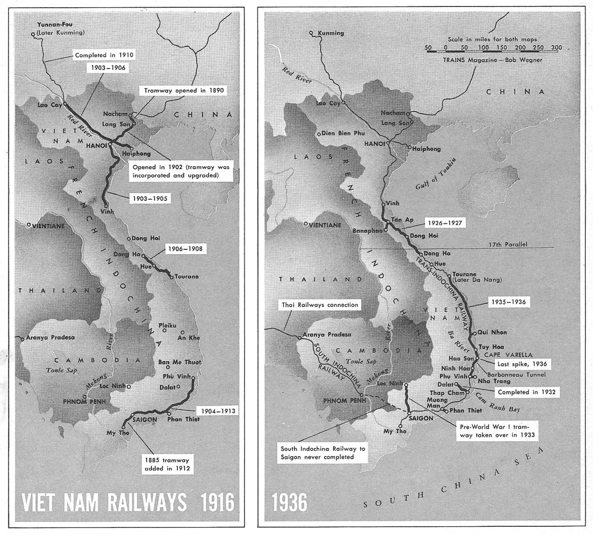
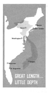
An examination of the Việt Nam railway system logically divides into two parts: the history under French rule, when all of Indochina, including what is now North and South Việt Nam, Laos and Cambodia, were under a single political sway, and a Frenchman dreamed of linking all with a single meter-gauge rail network that would reach by interchange all the way to Singapore and maybe Burma and India; and the history of South Việt Nam’s railway in the present conflict. A fundamental political event in Southeast Asia occurred in 1954, when the Geneva agreement ended French rule of Indochina and partitioned Việt Nam at the 17th Parallel, cutting the Trans-Indochina Railway near its center and setting up South Việt Nam and its railway, the VNHX, as separate entities.

To understand Việt Nam’s railway it is necessary to know some Vietnamese geography, demography and history.

The coast of Việt Nam extends for 1,200 miles along the South China Sea, from the Gulf of Tonkin to the Gulf of Siam – a shoreline comparable in length to the East Coast of the United States, although journalists tell us that this war is being fought in a “small country.” For comparison, if Boston were on Việt Nam’s China border, Hà Nội would be about at New London, Connecticut; the partition line between North and South would be at Washington, DC; Saigon would be around Waycross, Georgia; and the tip of the Cà Mau peninsula would be south of St Augustine, Florida.

Although the country has great length, it has little depth. Even its narrow shape on the map is misleading, for only the Mekong Delta in the South, the Red River Delta in the North, and the land around a series of small river mouths up in the central coast are densely settled. Here as many as 1,300 persons per square mile crowd onto 20 per cent of the land area. The 80 per cent of the country which is mountainous upland is populated at a density of as little as 5 persons per square mile, with only a few “western frontier” towns such as Đà Lạt, Buôn Ma Thuột, An Khê and Pleiku dotting the high elevations of the interior. Furthermore, the people who live in the interior are primarily primitive tribes, alien and for the most part hostile to the coastal Việts. This makes the country well adapted to the guerrillas – every populated area is immediately abutted by hundreds of square miles of wilderness, usually protected by the thick canopy of tropical rain forest where an army willing to abandon the roads can move undetected, virtually at will.

Cochinchine – A bamboo bridge

Nor is the coastal settlement a uniform strip. The population has settled at the river mouths, and between these river mouths, mountain spines projecting from the highlands down to the sea separate the settlements. There are many places on the central coast between these mountain spines which resemble the American desert, because without a river, these coastal valleys are often blocked from the rain and grow only cactus and desert brush. The railway, running the length of the coast, pierces these mountain spines and desert valleys to link the river-mouth settlements. Where through service on the railway is interrupted, the old geographical separation quickly reasserts itself, for the highway in its present condition is only a meager, primarily local substitute in civilian travel.

South Việt Nam as a separate entity is not just a political fiat of 1954, but has many historical precedents for its division, starting with the southward push of the Việts in the 10th century. Originally, the Việt people occupied only the Red River Delta around Hà Nội and Hải Phòng. Between 938 and 1400, they pushed south along the coast, driving scattered fishing tribes of apparently Polynesian origin back into the hills to become the mountain tribes of today. By 1400, the Việts had reached to where Đà Nẵng lies today, and had run up against the Kingdom of Champa, a Hindu, racially Indian culture, which they proceed to exterminate over the next 100 years. Thus, the dividing line between North and South Việt Nam now lies just about at the point where the Chinese-influenced culture of the Việts spreading South met and turned back the Indian-influenced cultures of Champa and Khmer coming east and north.

Between 1400 and 1698, the Việts drove onwards to Saigon. Not until the 18th century were the Mekong Delta and the Cà Mau peninsula settled by the Việts. The striking fact is that most of the settled land in South Việt Nam has been populated by Vietnamese for less time than the East Coast of the US has been settled by Europeans. In fact, the Vietnamese still call the territory beyond the Mekong the “New West.” In the process of southward colonization and conquest (which between 1818 and 1863 even extended the Vietnamese empire into Cambodia as far as Phnom Penh and Tonle Sap, the “Great Lake”), the southerners acquired a different dialect and a local political fealty.

Saigon – Arroyo Chinois

In a civil war that lasted from 1545 to 1777, with intermittent truces, the South under Nguyễn princes rebelled against the Lê and Trịnh princes of the North, and during this entire period the South was separately governed. In the 1630s, the Nguyễn erected two great walls across the country at Đồng Hới, a few miles from the present 17th parallel line. Not until 1802 was the nation reunited under a single ruler, and by then the concept of North and South Việt Nam as separable political entities was well established. The separation was underlined by the history of the railway, which was built in separate northern and southern sections, and not linked into one until 1936 – only to be sundered again in 1954.

The French ruled Việt Nam, Laos and Cambodia and French Indochina from 1884 until 1954. The nations within Indochina retained their separate political identity and their royal families, and the relationship of the French to the local rulers was formally different in each place. The Governor General of Indochina was appointed by Paris and he governed from Hà Nội, but Paris supplied little direction to its appointee and he ruled as he saw fit, obtaining appropriations from the French National Assembly by a series of more or less desperate appeals. Despite vitriolic propaganda to the contrary in America, this led to a benign colonialism, in which Việt Nam acquired a school system that generated one of the highest literacy rates in Asia, a strong civil-servant class which years of systematic assassination by the Communists has not wiped out, and a more diversified economy than the pre-French rice culture.

The railway and the highway system are among the best examples of the nature of colonial rule. In many colonies outside Indochina, railways were built primarily to haul a single raw material out of the interior to the coast, leading with some justification to the charge of colonial exploitation. In Việt Nam, the railway was built to serve Việt Nam, and not an external consumer of its product. Everything Việt nam exports – its peacetime rice surplus in the Mekong and Red River Deltas and its rubber, for example – moves in patterns that have little to do with the great coastal railway. That line instead distributes the country’s products internally, and carries its people between their own cities. The Việt phrase Độc lập – which means independence – is an old rallying cry under which the Việts threw off Chinese masters of the past; and it was heard again when Northerner and Southerner alike threw off the French. But this desire for national self-rule was not the result of an abusive colonial policy. It was simply the rejection of any outside domination, no matter how benign.

Cochinchine, Mỹ Tho, 1904 – Le train en gare (Fonds Breton)

The two earliest railways in Việt Nam were tramways – a metre-gauge line from Saigon to Mỹ Tho, opened in 1885, the year after French suzerainty over Việt Nam became official; and a 60-centimetre tramway from Lạng Sơn to Na Cham along the Chinese border, opened in 1890. These lines were modest local ventures, and it wasn’t until 1902, with the start of Governor General Paul Doumer’s grand design for an Indochina railway system, that a meaningful start was made on a railway system for the country.

Doumer was the great man of France’s administration in Indochina. He presided over the colony for most of the first three decades of this century, and in that time his administration advanced most of the road, railway, school and civil-government system Việt Nam has inherited. The Doumer Bridge in Hà Nội, whose bombing made news in 1967, is named for him. His vision for an Indochina railway system involved a great coastal line from the China border through Hà Nội to Saigon, and a continuation line from Saigon to Phnom Penh, Cambodia, and on to a connection with the Thai railway system at Aranyaprathet. The Thai system – meter-gauge like Doumer’s – connected with the Malayan system, which reached all the way to Singapore and was of the same gauge as systems in Burma and India that could be reached by relatively short connecting links. The cross line from the port of Hải Phòng to Kunming (formerly Yunnan-fu), China, the capital of Yunnan province, was a contemporary but separate project, conceived in Paris as part of the establishment of French influence in Yunnan.

Two separate government corporations were set up to execute Doumer’s vision: the South Indochina Railway to build and operate the line from Saigon to the Thai border; and the Trans-Indochina Railway to take charge of the coastal line. Both companies were financed through the sale of securities in France. Frenchmen and French institutions bought colonial railway bonds as a patriotic duty – the philosophy was that the colony did not seem likely to return more than was invested in it, but was a kind of national status symbol and an obligation of la mission civilatrice, the French version of the “white man’s burden.” The Việt Nam Hỏa Xa, as successor to the Trans-Indochina company, still regards itself obligated by some of these securities, since the South’s independence from France was accomplished in the end by treaty, and not accompanied by a repudiation of debt. Although the coolness between Saigon and Charles de Gaulle’s government masks the fact, Việt Nam’s government retains strong cultural and – by its own choice – economic ties with France. However, the corporate form of the VNHX does not alter the fact that it is an arm of the South Vietnamese government, just as SNCF is an arm of the Government of France. Management responsibility, both before and since partition, is vested in a board of directors appointed by the government in power at the time.

Tonkin – Passengers board a train at Đồng Đăng

Construction began with the 1902 opening of the line from Hà Nội to Na Cham, 100.2 miles. The northern end of this road included the 1890 tramway right of way, which was upgraded and converted to meter gauge. From 1903 to 1905, the line was built south from Hà Nội to Vinh, where end of track remained until after World War I. In the South, the line was built from Saigon to Phú Vinh (a village near Nha Trang) between 1904 and 1913, and the tramway line to Mỹ Tho was purchased and added to the Trans-Indochina system in 1912. A central segment connecting Tourane (now Đà Nẵng), Huế and Đông Hà was constructed in 1906-1908. This 10 years of feverish construction gave Việt Nam about 500 miles of coastal railway by 1912. Coupled with the separate Hải Phòng-Yunnan project – the Vietnamese portion of which was completed from 1903 to 1906 – and branches, the 1916 Việt Nam railway system was 1,200 miles.

The First World War, of course, consumed the energies and talents of France from 1914 to 1919, and for a recovery period thereafter, so that major construction did not begin again until 1926-1927, when the northern and central sections were joined by construction between Đông Hà and Vinh. German reparations, in the form of both locomotives and truss bridge spans, helped in this venture. German reparations materials continued to arrive until 1933, when the Nazis came to power.

The French did not undertake to close the gap between Tourane and Phú Vinh/Nha Trang until 1935-1936. This section presented the greatest engineering obstacles, and offered the least traffic. The obstacles were all concentrated between Nha Trang and Tuy Hòa, where the mountain backbone of Việt Nam projects into the sea at Cape Varella. The peaks in this range attain heights of 6,000 to 7,000 feet – modest by the standards of the Himalaya chain with which these mountain spines eventually connect, but equal to the mountains of Montana contested by the Great Northern, Northern Pacific, and the Milwaukee, and virtually devoid of suitable railroad passes. Also, at Tuy Hòa, it is necessary to cross the broad flood plain of the Sông Ba. This difficult 70 miles was closed by means of 10 tunnels (including the 3,600-foot Barbonneau tunnel, the longest in Việt Nam), some sheer rock cuts, and a cliff-hugging shelf blasted out along the shores of Vũng Rô (Phú Yên). The Sông Ba was spanned by the longest bridge in Việt Nam, consisting of 21 197-foot spans. The official joining of the rails took place near Hảo Sơn station, just north of the Barbonneau tunnel, in 1936. The Việt Nam system thus attained a peak mileage of 2,080.

The Trans-Indochina company added to its main line and branches in 1933 by absorbing a pre-World War I tramway line running to Lộc Ninh, famous in later years as the site of a special forces camp that in January 1968 repelled Korea-style human wave attacks with point-blank artillery fire. The government wanted this line as part of an interior route through Laos, whose other end was to be the branch from Tân Ấp to the Laotian border at Banaphao. The line would have run from Banaphao across Laos to the Mekong River, then south through Laos and Cambodia to join the old tramway line at Lộc Ninh. The tramway company was the same one that ran Saigon’s now long-discontinued meter-gauge streetcars, but whether or not this line was electrified is not known. The Laos line never got any farther than its 1933 beginnings.

By far the most spectacular branch was the Đà Lạt line, which climbed 12 per cent grades with the help of three Abt rack sections to reach the resort city of Đà Lạt. The branch was begun in 1914, but the rack portion was not built until 1927-1932. This line is still operating with Swiss-built steam rack locomotives [Operation of the Đà Lạt branch was temporarily suspended in November 1968 owing to intense Việt Cộng attacks] and will be examined in detail in part 2.

Handsome 4-4-0s, built in 1902, were Trans-Indochina’s first passenger power. With a brass-bound boiler, armor-plated cab, and 54-inch drivers, this engine performed switching in 1963. (Việt Nam Hỏa Xa)

The rail alignment passed some large towns a few miles inland in order to get a narrower crossing of rivers, resulting in short spurs to Phan Thiết, Nha Trang and Quy Nhơn.

The South Indochina Railway, the other line projected by Doumer, was constructed from Phnom Penh to the Thai border, but the Saigon-Phnom Penh link was never completed. The native hostility of the Cambodians for the Việts, who subjugated them well into the 19th century, plus the fact that the swamp-and-jungle route and a bridge over the Mekong would be expensive, probably contributed to a lack of enthusiasm for the line.

It has already been stated that the Hải Phong-Yunnan line was a separate enterprise. France had a long history of interest in Yunnan province, a remote and underdeveloped mountain region adjacent to Indochina’s north-west frontier. In 1897, France signed an agreement with China permitting France or a French company to build a railroad from the Indochina border to Kunming (Yunnan-fu). In 1903, this was refined into an agreement for the French Railroad Company of Indochina and Yunnan to build a line and operate it for 80 years, at which time China would have the option of purchasing the road for its original construction cost. The portion from Hải Phòng to the border at Lào Cai was built in 1903-1906, and the balance of the line to Yunnan-fu was finished in 1910. For many years (until the north and south sections of the coastal line were linked), this line carried a heavier traffic than the Trans-Indochina, but within China it operated only in daytime because of the depredations of a virulent form of Chinese banditry.

Standards of construction were high on the Việt Nam railways. Steel ties and deep rock ballast are the rule. The rail is 60 to 65 pounds per yard, and the axle loading over most of the system is 16 tons (US). Both of these figures are adequate for a railway of light European standards. The loading gauge, 3.9 meters high by 3.1 meters wide, is the widest of all of Asia’s meter-gauge systems. Tie spacing is 73 centimeters (about 28 inches) – close for steel ties. The coastal main line is without serious grades – climbs of 1 per cent are rare – although this was at the cost of some expensive cuts in a few places where mountain spines reach down to the coast. The Hải Phòng-Yunnan line, however, is another matter. It climbs from sea level to 6,000 feet, using several miles of sustained 2.5 per cent grades compensated by a 0.5 per cent reduction around the curves, which are as tight as 14.5 degrees. There are 115 tunnels on this line, totaling over 10.6 miles in length.

Pacifics took over as Trans-Indochina’s prime passenger power in 1930, when woodburners arrived from Germany as WW I reparations to France. Hanomag 4-6-2 “Pacific” No 231-402 (ex Cambodian Railways No 2) is shown here at Tháp Chàm in 1967, photo by Paul S Stephanus

During the brief halcyon period of the Trans-Indochina, from 1936 to 1940, it was possible to travel from Saigon to Hà Nội in meter-gauge sleeping cars. The distance was 976 miles (about the same as New York-Chicago on New York Central) and took some 48 hours (vs 16 hours between the US points at that time). Local service was provided by self-propelled gasoline railcars called automotrices, which were also popular for local services in France. The freight service on the line was light, but included movement of rice from the surplus regions at the ends of the country to the deficit regions in the center. By travelling on to the Chinese border at Na Cham, one could theoretically make a series of rail connections across China and the Trans-Siberian Railway all the way to Paris, although a ship from Hải Phòng or Saigon would probably have been faster and certainly less complicated, considering the constant upheavals in China and the stern view of foreign travel in purge-era Russia. The China connection to Kunming was a dead-end, since it did not join with the rest of China’s rails.

The year 1939 saw the start of World War II in Europe (it had begun in China in 1937), and 1940 witnessed the start of war troubles for the Việt Nam railways which have never ended. The Hải Phòng-Yunnan line was the first to feel the impact. The Chinese government undertook a program to upgrade the Chinese end of the line for both day-and night operations, envisioning supply through Hải Phòng, then a neutral port. Thus supplied, the Chinese could hold out in the Yunnan mountains against the advancing Japanese. This activity drew Japanese bombers, and in 1940 they destroyed two important bridges inside China. The damage was repaired, but the harassment by the Japanese and the unwillingness of the French company to spend money to upgrade the line prevented the Chinese from reaching their goal of 15,000 tons per month over this route. In May 1940, France was overrun by the Nazis, and in September 1940, the Vichy government accorded Japan the right to land troops in Indochina. The former route of supply became a route of menace, and the Chinese tore up a section of track near the border and blew up a bridge they had just repaired to block the Japanese advance along this route.

Vietnamese carry goods and produce aboard the mixed train two hours before departure time at the bombed-out station of Hảo Sơn. Trains on the run between Hảo Sơn, Nha Trang and Tháp Chàm were the most dependable in the country until Việt Cộng activity in 1968 slowed operations. Metal ties in gons will help repair the line to Tủy Hòa. (photo by Paul S Stephanus)

The Japanese occupation of Indochina was followed in 1942 by their sweep of the entire Malay peninsula down to Singapore. (Thailand, which allied itself with Japan, gave passage to the Japanese invaders of Malaya from Indochina). Thus, in 1942, the Trans-Indochina coastal main line found itself carrying freight for the conquering Japanese invaders of Malaya, and a record 240,000 metric tons of freight was moved vs 60,000 to 100,000 metric tons from 1923 to 1935 (before the two halves of the system were linked together). This attracted Allied air attacks, and the Trans-Indochina was cut in several places by bombing, usually at key bridges. Ironically, some of the some of the damage in 1945 was inflicted by the battleship New Jersey, which recently returned to shell the Việt Nam coast.

In 1945, the French garrisons in occupied Việt Nam revolted from Vichy and declared for the Free French. A majority of these troops were Vietnamese regulars in the French Army, and more than half were killed in a fighting retreat to Yunnan or in Japanese prison camps. Little French power or presence remained in Việt Nam or Indochina when peace came in August of that year. Vietnamese nationalists led by Hồ Chí Minh demanded that Paris grant them independence. It is probable that France would have done so, had not the French government been in such disarray at the time; as it was, the initiative was left to generals on the local scene. A series of incidents culminated on December 1946 in a coordinated terrorist attack throughout Việt Nam by Hồ Chí Minh’s guerrillas, the Việt Minh, and France was plunged into the tragic Indochina War.

The French forces on hand were so meager that they quickly lost control of the countryside and were confined to a few enclaves around cities, from which they made sporadic thrusts that ended either in “no contact” or in bloody ambushes. The railway between towns was left exposed, and it suffered many times the damage it had taken in World War II. The Việt Minh apparently assumed that their advantage in the countryside was temporary, and that France would soon be throwing against them divisions of European troops which would move along the railway. Actually, France never greatly increased the level of its military operations in Việt Nam, and even the troops and equipment she could afford to send were bitterly resented by the French population at home, who sought an end to the colonial involvement. In any case, the destruction on the railroad was nearly complete.

Annam, 31 March 1949, attack on a train at Sa Hùynh

Locomotives and cars were rolled out onto bridges, and since explosives were lacking, bridge truss, rolling stock and all were pried off the pilings and into the water with jacks. Bridge pilings were reduced with sledge hammers and hack saws, and miles of track material were torn up, carried away and buried. One hundred and ninety four railroad employees were killed and 972 were injured in war incidents from 1947 to 1954.

By the early 1950s, it was evident that the waves of French divisions were not coming. The Việt Minh were in such complete control of some areas, such as the famous “Street without joy” north of Huế, that they repented their destruction and restored service, using flimsy wooden trestles, hand pushcars, or tiny gasoline speeders, pulling handcars with temporary thatched roofs and sides. These Việt Minh trains ran on fragments of line north of Đà Nẵng until May 1955, when the Việt Minh withdrew under the Geneva Agreement.

The slaughter of the garrison at Điện Biên Phủ in 1954, and the French surrender at Geneva shortly thereafter, partitioned the country and the railway at the 17th parallel, and created South Việt Nam as a separate political entity. Đông Hà became the northernmost operating point, just as it had been “end of track” for the central section from 1908 to 1927. A total trackage of 872 miles of the old system was inherited by the South’s VNHX, of which virtually everything north of Ninh Hòa was either inoperable or could support only the section-speeder-type trains used by the Việt Minh. But peace was at hand at last, and the government in the South faced the rebuilding task ahead.

SOUTH VIỆT NAM’S STEAM POWER

This roster lists the 87 surviving steam locomotives in South Việt Nam, and gives a sample of the pre-partition Việt Nam roster. The absent numbers often belong to locomotives in North Việt Nam.

This is the first of two articles on the railways of South Việt Nam written in 1969 for Trains magazine by Jerry A Pinkepank – to read the second article, click here

Tim Doling is the author of The Railways and Tramways of Việt Nam (White Lotus Press, Bangkok, 2012) and also gives talks on the history of the Vietnamese railways to visiting groups.

A full index of all Tim’s blog articles since November 2013 is now available here.

Join the Facebook group Rail Thing – Railways and Tramways of Việt Nam for more information about Việt Nam’s railway and tramway history and all the latest news from Vietnam Railways.

Date with the Wrecking Ball – Former Secretariat du Gouvernement Building, 59-61 Ly Tu Trong, c1875

10589773786_0e1e07d153_o

The project to build a new City Administration Centre behind the Hồ Chí Minh City People’s Committee involves the destruction of several heritage buildings. The art deco office and apartment block at 213 Đồng Khởi was demolished in mid 2014 to make way for a “faux colonial” extension to the 1909 City Hall, and now, after several changes of plan, the old French government building at 59-61 Lý Tự Trọng has also been condemned to destruction.

Direction de l'Intérieur 1881

The earlier Direction de l’Intérieur as depicted in the 1881 engraving, Saïgon d’après nature

Many of us pass it every day and scarcely give it a second look. Yet the building which houses the Hồ Chí Minh City Department of Information was once a focus of French colonial power second only to the Governor’s palace.

The earliest French government building on this site was the Hôtel de la direction de l’intérieur (Office of the Direction of the Interior), constructed by the Cochinchina authorities in the early 1860s. Although no photographs of the building have survived, it was depicted clearly in the remarkable 1881 engraving, Saïgon d’après nature.

However, a larger headquarters was soon required, so in 1875, at a total cost of 108,000 francs, the current structure was built to a design by then Director of Civic Buildings, Marie-Alfred Foulhoux (1840-1892) – the same Foulhoux who later designed the Palais de justice, the Customs Directorate, the Lieutenant Governor’s Palace and the Saigon Post Office.  For more details of Foulhoux’s work, see the article Foulhoux’s Saigon.

Saigon 1890

The Hôtel de la direction de l’intérieur compound as it appears on an 1890 map of Saigon

The work was extensively refurbished in 1881, and in the following year, the Dictionnaire Véron, ou mémorial de l’art et des artistes de mon temps, by Théodore Véron (Poitiers, 1882), described it as follows:
FOULHOUX (Alfr.). – “Office of the Direction of the Interior in Saigon (French Cochinchina)”. In front, three building components with triangular pediments supported by small columns. At the façade of the monument, two entrance gates with curved iron gates, lit at night, by two gas lamps on pilasters. The main entrance gate at the centre has nothing more salient than those of the two pavilions on the right and left, other than two statues at their bases, one on each side. In short, this facade, with its simple and pure lines, has a monumental look.

The Hôtel de la direction de l’intérieur was second in importance only to the Governor’s palace in colonial Saigon. According to Louis de Coincy’s book Quelques mots sur la Cochinchine en 1866 (A few words about the colony in 1866), the Department of the Interior, then at 27 rue de Lagrandière, was “responsible for the entire civil, judicial and financial administration of the colony,” and was represented throughout Cochinchina by provincial Inspectors of Indigenous Affairs.

In 1888, it was renamed the Secrétariat général du gouvernement de la Cochinchine. By the early 20th century, it was often known by the alternative names of Bureaux du gouvernment or Bureaux des Services civiles.

Following the Second World War, the French briefly set up a Ministère de l’Intérieur (Interior Ministry) in the compound for the short-lived State of Việt Nam.

7343405234_61f490dfa3_b (1)

The renamed Secrétariat général du gouvernement de la Cochinchine compound in the early 20th century

However, after 1955 a new Bộ Nội vụ (Interior Ministry) was opened in the former Direction de la Police et de la Sûreté compound at 164 Tự Do and 59-61 Gia Long (as it then became known) was transformed into the South Vietnamese Ministry of the Economy (Bộ Kinh tế).

In 1958 the compound made a fleeting appearance in Joseph L Mankiewicz’s film version of Graham Greene’s novel The Quiet American.

The compound currently serves as the headquarters of the Department of Information and Communications (Sở Thông tin và Truyền thông) and the Department of Trade and Industry (Sở Công thương).

In December 2014, the Hồ Chí Minh City People’s Committee announced that it had launched a competition to select a design for the new building “which will achieve the highest requirements, the optimal location in the most solemn part of the city, with architectural harmony between works to be preserved and embellished and those to be built new, in harmony with the architecture of the surrounding area.” Eleven designs were eventually shortlisted and placed on public view in the Hồ Chí Minh City Exhibition Centre, with the intention of canvassing public opinion on which one was best.

In the late 1940s the compound briefly served as the Interior Ministry of the State of Việt Nam

In the wake of this exhibition, no first prize was awarded, but by October 2015 it was implied that the judges’ “second choice” design by the Nikken Sekkei company would be selected for implementation. This scheme involved preserving the old French government building at 59-61 Lý Tự Trọng by cutting it into three pieces and physically moving it 100m southwest of its present location, so that it was in line with the central axis of the City Hall.

Nothing was then heard of the project until April 2018, when it was announced that an entirely different scheme by American design and architecture firm Arthur Gensler Jr. & Associates, Inc would be placed on public view for consultation. Unlike the Nikken Sekkei scheme, the Gensler design dispensed with the 130-year-old Secrétariat général building altogether.

This will be the third major Saigon heritage building destroyed to make way for a Gensler project. It follows the destruction in 2010 of the old Contrôle financier building (12 Lê Duẩn) to make way for the stalled Lavenue Crowne project and the demolition in 2015 of the old Grands Magasins Charner (Tax Trade Centre) to make way for a new 46-storey commercial complex and metro station.

UPDATE: In early August 2018, following an online petition which attracted over 6,500 signatures, the HCMC Department of Planning and Architecture recommended to the HCMC People’s Committee that this building should after all be preserved and recognised as a historic monument.

IMAGE 1

The Secrétariat général du gouvernement de la Cochinchine building in the early 1900s

SAIGON 1970-71 - Tu Do Street by Steve MACV Advisory Team 280 i

The building serving as the South Vietnamese Ministry of the Economy (Bộ Kinh tế) in the 1960s

IMAGE 8

Today the building houses the Department of Information and Communications (Sở Thông tin và Truyền thông) and the Department of Trade and Industry (Sở Công thương).

Tim Doling is the author of the guidebook Exploring Saigon-Chợ Lớn – Vanishing heritage of Hồ Chí Minh City (Nhà Xuất Bản Thế Giới, Hà Nội, 2019)

A full index of all Tim’s blog articles since November 2013 is now available here.

Join the Facebook group pages Saigon-Chợ Lớn Then & Now to see historic photographs juxtaposed with new ones taken in the same locations, and Đài Quan sát Di sản Sài Gòn – Saigon Heritage Observatory for up-to-date information on conservation issues in Saigon and Chợ Lớn.

Exploring Hue guidebook launched


Thế Giới Publishers is pleased to announce the launch of Tim Doling’s latest English-language guidebook, Exploring Huế (2018).

Over 520 pages long and packed with useful maps and images, Exploring Huế takes visitors on a journey of discovery through the ancient Nguyễn dynasty heartland of Thừa Thiên Huế province.

The first detailed English language heritage tourism guidebook to this area, Exploring Huế takes in over 500 years of Nguyễn dynasty history, affording an opportunity to view and learn about the rich surviving built heritage associated with the nine Nguyễn lords and 13 Nguyễn emperors, their queens, princes, princesses and mandarins. It also introduces the Chinese heritage of Bao Vinh-Địa Linh and Gia Hội, the architecture of the French town south of the river, relics of the American War era, and the cultural traditions of the region’s ethnic minority groups. Visitors can choose from 23 different tours, covering Huế city and the province’s six districts and two district-level subdivisions.

The book is launched in the wake of Vietnamese Prime Minister Nguyễn Xuân Phúc’s January 2018 visit to Huế, in which he urged that more should be done to develop the tourism potential of the city he dubbed the “Kyoto of Viet Nam.” It is hoped that Exploring Huế will help to boost the Huế tourism sector by providing greater depth to the visitor experience and encouraging longer stays, more repeat visits and more sustainable tourism practices.

Tim Doling is the author of the walking tour guidebooks Exploring Hồ Chí Minh City (Nhà Xuất Bản Thế Giới, Hà Nội, 2014) and Exploring Huế (Nhà Xuất Bản Thế Giới, Hà Nội, 2018).

A full index of all Tim’s blog articles since November 2013 is now available here.

Join the Facebook group pages Saigon-Chợ Lớn Then & Now and Huế Then & Now to see historic photographs juxtaposed with new ones taken in the same locations, and Đài Quan sát Di sản Sài Gòn – Saigon Heritage Observatory for up-to-date information on conservation issues in Saigon and Chợ Lớn.

A Short History of Saigon Port

Saigon – Les Messageries maritimes – Le Courrier de France

Saigon’s port has played a crucial role in the city’s development as an economic powerhouse. This overview traces its history, from the late 17th century to the present day.

The earliest port facilities in Saigon were established before the arrival of the Việts, at a time when the city was still an outpost of the Cambodian mandala known as Prey Nokor.

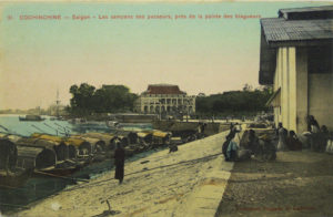
A marriage alliance in the early 1620s between a daughter of the second Lord Nguyễn Phúc Nguyên of Đàng Trong and King Chey Chetta II of Cambodia was followed by the first Việt settlement and the establishment of a Nguyễn customs house in this port, which suggests that at the time Prey Nokor was already attracting a regular throughput of merchant traders.

However, it’s probable that the Mercantile port did not develop significantly until the late 17th century, when supporters of the overthrown Ming dynasty settled in Gia Định prefecture and took control of the shipping and processing of rice from the Mekong Delta. This early mercantile port was located on both sides of the Bến Nghé creek, at its junction with the Saigon River.

Just to the north of the mercantile port, in the area in front of today’s Majestic Hotel, was the Royal wharf, which Pétrus Trương Vĩnh Ký (Souvenirs historiques sur Saïgon et ses environs, 1885) tells us was originally known in Khmer as Kompong Luong, suggesting that it may have originated as a royal landing stage built by the Cambodian uparaj (vice kings) who resided in Prey Nokor down to the end of the 17th century. Later, it became known by the Vietnamese name Bến Ngự and was used by the Nguyễn rulers and their mandarins when disembarking from their ships to visit the Dinh Phiên Trấn (1698) and later the two Gia Định Citadels (1790, 1837). Pétrus Ký adds that in the pre-French era, this wharf was equipped with a royal bath house known as the Thủy các or Lữ Ông Tạ, built on floating bamboo rafts!

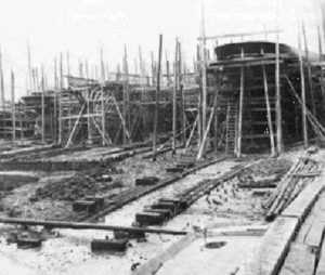
Soon after his forces recaptured Gia Định from the Tây Sơn in 1788, Lord Nguyễn Phúc Ánh founded a Naval workshop just to the north of the royal wharf, in the area between modern Mê Linh square and the Thị Nghè creek. It was here, with the assistance of French engineers, that a fleet of modern warships was assembled, tipping the military balance in Nguyễn Phúc Ánh’s favour throughout the remaining years of the Tây Sơn War. After Nguyễn Phúc Ánh ascended the throne in 1802 as Emperor Gia Long, this naval workshop was expanded into a large shipbuilding facility and cannon foundry, which at its height employed several thousand workers of various professions.

Following the arrival of the French, Saigon’s location 83km or 45 nautical miles from the sea – an accident of history resulting from its excellent harbour, closeness to the rice mills of Chợ Lớn and long-established customs and excise infrastructure – was believed by many colonial commentators to be one of the key factors preventing its port from competing effectively with Hong Kong, Singapore and even Jakarta. In the 1860s and again in the 1880s, colonial officials debated at length whether the Cochinchina capital and its principal seaport should be relocated to Cap Saint-Jacques (now Vũng Tàu) with a view to realising its full potential, but on each occasion this idea came to nothing and both capital and seaport remained where they were.

The French opened the port of Saigon to navigation and commerce on 22 February 1860.

Cochinchine – Saigon – Les sampans des passeurs, près de la pointe des blageurs

In February 1861, the Compagnie des Messageries Impériales (known after 1871 as the Compagnies des Messageries maritimes) was entrusted with postal and passenger services from Marseille to Saigon, and part of the existing mercantile port in Khánh Hội (now District 4), the Messageries maritimes wharf or Dragon house wharf (Bến Nhà Rồng), became its headquarters. Thereafter, the company’s courrier vessels conveyed mail and passengers from Marseilles via Ceylon (Sri Lanka) to Saigon and then onward to Hong Kong, Shanghai and Yokohama, with connecting services from Saigon to Manila. These courrier vessels were operated initially on a monthly basis, but their frequency increased to once per week following the opening of the Suez canal in 1869. The Compagnie des Messageries maritimes enjoyed a monopoly until 1901, when the Compagnie de Navigation des Chargeurs Réunis was permitted to launch rival services and share the Messageries maritimes terminal.

During the early years of colonial rule, the Mercantile port (Port de commerce) continued to use wharves in the area immediately north of the arroyo Chinois (Bến Nghé creek) extending as far as the Rond-point (modern Mê Linh square). In subsequent years, this quayside area was known variously as quai de Donnaï, quai Napoléon, quai du Commerce, quai Francis-Garnier and latterly quai le-Myre-de-Vilers. However, in 1881 these wharves – known to the French as the “appontements de Canton” and “appontements de Charner” – were entrusted were transferred to the control of the river courriers (see below), so replacement mercantile port facilities had to be provided in Khánh Hội (modern District 4). By the mid 1880s, these new mercantile port facilities extended nearly 1km southeast along the riverbank beyond the Messageries maritimes compound.

Saigon – Vue générale sur le Port de commerce, 1930s

Further expansion of the Port de commerce took place in the period 1900-1912. In 1903, the Société de constructions de Levallois-Perret built a Swing Bridge (Pont tournant) across the arroyo Chinois to connect the port with the city. This carried not only a road, but also a rail freight spur which connected the Saigon-Mỹ Tho railway line on rue Krantz/rue Duperré (modern Hàm Nghi) with both the Messageries maritimes wharf and mercantile port. Then in 1906, the canal de Dérivation (now the Tẻ Canal which separates District 4 from District 7) opened to shipping, providing merchant shipping with an alternative to the overloaded arroyo Chinois. By 1912, additional wharves, warehouses and loading equipment had been installed, extending the Port de commerce as far as its mouth.

The final phase of expansion came in 1925-1929, following the relocation of Xóm Chiếu Parish Church from its former compound on rue Jean-Eudel (modern Nguyễn Tất Thành) to its current site. At this time, the mercantile port was increased further in size and equipped with new wharves, cranes, and administrative buildings, a Decauville narrow gauge railway network and a set of nine iconic hangar buildings, all built by the Société Levallois-Perret.

In 1881, as noted above, all of the wharves between the arroyo Chinois and the Rond-point (including the former royal wharf) were transformed into the River port (Port fluvial) and entrusted to the management of the Compagnies des Messageries fluviales, which subsequently ran postal and passenger services to Phnom Penh and later to other destinations in French Indochina, as well as along the coast to Bangkok. Sadly, this company’s grand former headquarters, the Halles des Messageries fluviales, built in 1889 by the Maison Eiffel, was remodelled beyond recognition in the early 2000s by its current occupant, the Riverside Hotel at 18-20 Tôn Đức Thắng.

Saigon – Le “Donaï” des Messageries fluviales à l’appontement

From the early 1860s, the Messageries maritime wharf, Mercantile port and River port all came under the control of a French Commercial Port Directorate (Direction du port de commerce). In 1879-1880, a grand new colonial headquarters building was constructed for this department on the headland near the Signal Mast. Rebuilt again in 1918, the Commercial Port Directorate building survived until 2007, when it was demolished to make way for the Saigon One tower.

After the arrival of the French, the quayside immediately to the north of the River port, between the Rond-Point (known after 1878 as the place Rigault de Genouilly) and the arroyo de l’Avalanche (Thị Nghè creek), became the Naval port (Port de la marine), under the control of the French Navy (Marine nationale française).

The southernmost section of this naval port, extending nearly 600m north along the river from the Rond-Pont and known initially as quai Primauguet and later as quai de l’Argonne, housed the Naval Commander’s headquarters (Hôtel du Commandant de la Marine), the Naval Artillery (Artillerie de Marine) and the Naval Barracks (Caserne de la Marine, later Caserne Francis-Garnier). This area was initially intersected by the cross-town “Junction canal” and several smaller waterways, but by the late 1860s these had all been filled to make way for further expansion.

The Arsenal de Saigon (Ba Son Shipyard) in the late 18th century

Beyond that, in the 22-hectare compound previously occupied by the former royal naval workshop which bordered the mouth of the arroyo de l’Avalanche (Thị Nghè creek), the French established their Naval Arsenal and Shipyard. Founded in 1864, it was gradually equipped with state-of-the-art repair workshops, and by 1888 it boasted several boat repair docks, including a dry dock of 168m which “could receive the largest ships of war, ensuring our squadrons a perfectly safe and convenient refuelling and rehabilitation point.” (Eugène Bonhoure, Indo-Chine, 1900). After the reorganisation of the French navy in 1902, the Naval Arsenal became the headquarters of the “Naval Forces of the Oriental Seas” under the control of a Vice Admiral, comprising 38 vessels, 183 officers and 3,630 troops. Thanks to further upgrades in the early 20th century, by 1918 the Naval Arsenal could not only maintain and repair the French fleet, but also build new vessels of up to 3,500 tonnes in weight.

After 1956, the former Messageries maritimes, River and Mercantile ports were taken over by the Saigon Port Authority (Thương Cảng Sài Gòn). In 1966-1967, the US Navy built additional military cargo facilities at Newport (Tân Cảng), Camp Davies (Tân Thuận), Cát Lái and Vũng Tàu and a large combat/logistics base and fuel storage facility in Nhà Bè. In 1973, following the Paris Peace Accords, these military installations were taken over by the Saigon Port Authority, which in the following year launched a joint project funded by Taiwan to establish a 65-hectare Export Processing Zone (EPZ) in Tân Thuận (modern District 7), southeast of Khánh Hội merchant port. However, due to the fall of Saigon in April 1975, this project was never implemented. The existing mercantile ports have since continued to be administered by the Saigon Port Authority.

Container ship at Cái Mép-Thị Vải Deepwater Port (image by TCIT)

In 2005, due to lack of expansion capacity and increasing river and road congestion around the city-centre port facilities, the government decided gradually to relocate the existing ports at Tân Cảng, Khánh Hội, Tân Thuận downriver. Since then, larger dedicated port facilities have been developed at Cát Lái (District 2), Hiệp Phước (Nhà Bè) and Cái Mép-Thị Vải (Bà Rịa–Vũng Tàu). The opening of the latter in 2009 finally realised the fleeting French idea of building a major port in Cap Saint-Jacques, and by 2016 that installation was handling over 62 million tonnes of freight and container cargo. While some small and medium-sized cruise ships may still navigate upstream to Khánh Hội, larger passenger vessels are now obliged to dock at Phú Mỹ (Bà Rịa–Vũng Tàu), some 2.5 hours by road from Saigon. At the time of writing, the Nhà Rồng-Khánh Hội port area is earmarked for redevelopment as an up-market residential area.

After the departure of the French, the Naval port was managed first by the RVN and latterly by the DRV Ministries of National Defence. The colonial naval barracks and artillery buildings in the riverside area north of Mê Linh square (initially Bạch Đằng, now Tôn Dức Thắng street) continued to house naval personnel right down to the 1990s, but since that time the old artillery compound has been vacated by the military and completely redeveloped with new hotels and office blocks. Today, the only surviving operational naval installation in this area is the old Caserne Francis Garnier barracks at 1A Tôn Đức Thắng.

In 1955, the Arsenal was renamed Ba Son Shipyard (a name derived from the French bassin de radoub) and subsequently functioned both as naval shipyard and commercial enterprise, building vessels of up to 10,000 deadweight tonnage (DWT) and repairing vessels of up to 35,000 DWT for both foreign and Vietnamese ship owners.

Ba Son Shipyard pictured before its destruction (Alexandre Garel)

However, in 2005 it was also decided to relocate all ship repair and construction from Ba Son to Cái Mép-Thị Vải and other down-river facilities, leading in 2015 to the decommissioning of Ba Son. Despite the fact that the Ba Son compound incorporated many excellent examples of French industrial architecture dating back to the 1880s, the complex as a whole was never recognised as a heritage site. In recent years, several Vietnamese heritage specialists argued publicly that “the cultural and historical relics of Ba Son Shipyard, large dry dock and related works should be listed as national heritage site,” while travel and tourism practitioners voiced the hope that the old Ba Son buildings might one day be transformed into a world-class maritime heritage and leisure complex. Instead, a decision was taken in 2015 to sell the 25-hectare compound to a developer, which proceeded to demolish its surviving heritage buildings to make way for another “deluxe residential zone.”

Tim Doling

Saigon – The Compagnie des messageries maritimes

Tim Doling is the author of the guidebook Exploring Saigon-Chợ Lớn – Vanishing heritage of Hồ Chí Minh City (Nhà Xuất Bản Thế Giới, Hà Nội, 2019)

A full index of all Tim’s blog articles since November 2013 is now available here.

Join the Facebook group pages Saigon-Chợ Lớn Then & Now and Huế Then & Now to see historic photographs juxtaposed with new ones taken in the same locations, and Đài Quan sát Di sản Sài Gòn – Saigon Heritage Observatory for up-to-date information on conservation issues in Saigon and Chợ Lớn.

The first public motor vehicle in Indochina, 1901

The first public motor vehicle put into circulation in Indochina (open bus used for postal and passenger services between Saigon and Tây Ninh)

Published in La Dépêche coloniale illustrée, 15 April 1907

We publish here a photograph depicting the first public motor vehicle in Indochina, which was put into circulation here in Saigon in 1901 by a motor transport company whose engineer and director was M. V. Ippolito. The latter, now the agent-général of Établissements Peugeot in Indochina, took over the management of the Services postaux et de transports de voyageurs, which now provides services between Saigon and several provinces.

The present government of Cochinchina has also provided certain administrators and officials with cars and even with motor boats. Some colonial critics have exercised their cheeky humour against a regime which, in order to encourage its provincial heads to maintain or develop the road network of roads, distributed motor vehicles to them. However, it’s certain that this has been to our great advantage in the development of the colony, not only because the ownership of motor vehicles has encouraged their users to ensure the construction and upkeep of good and long roads, but also because it has enabled provincial administrators to exercise personal supervision, control and direct influence over territories which hitherto could only be traversed once a year, and with great difficulty.

From the dual perspective of our prosperity and the security of the provinces, therefore, the administrative or private development of motoring throughout Indochina will surely have the happiest results.

Tim Doling is the author of the guidebooks Exploring Huế (2018), Exploring Saigon-Chợ Lớn – Vanishing heritage of Hồ Chí Minh City (2019) and Exploring Quảng Nam (2020), published by Nhà Xuất Bản Thế Giới, Hà Nội

A full index of all Tim’s blog articles since November 2013 is now available here.

Join the Facebook group pages Saigon-Chợ Lớn Then & Now and Huế Then & Now to see historic photographs juxtaposed with new ones taken in the same locations, and Đài Quan sát Di sản Sài Gòn – Saigon Heritage Observatory for up-to-date information on conservation issues in Saigon and Chợ Lớn.

“The Court of Annam modernises,” Les Annales coloniales: organe de la “France coloniale modern,” 14 December 1912

“Annam – Hue – Tribunes et cavalier du roi, vue des jardins”

Packed with the usual colonial arrogance and assumptions of western superiority, this short 1912 article by Henri Cosnier sheds interesting light on French Governor General Paul Doumer’s policy towards the royal court in Huế

The powerful breath of modernism carries off, one after the other, the sumptuous traditions of the court of Hue.

Emperor Thành Thái in 1898 (Le Monde illustré, 11 December 1898)

The republican simplicity of the representatives of France accredited to that city seems to have affected the sovereigns of Annam and their entourage. The era of melon hats and varnished court shoes is finally at an end, for the greater good of the princes and mandarins, whose manners and dress tend to simplify ever more each day.

Where are the splendour and the regalia with which the Asiatic monarchs once surrounded themselves when they left their palaces to mingle with the flood of the populution? All ancient rites have long since disappeared; western civilisation has chased before it that grandiose spectacle which once accompanied even the smallest walks by Gia-Long, Minh-Mang and Tu-Duc. The present sovereign of Annam [Duy Tân], whom we raised in an atmosphere of extreme civilisation, is still too young to indulge in modernism, but his predecessor, the sinister Thanh-Thai, often ventured out alone into his capital, on foot or on horseback, on a bicycle or in an automobile, just like a mere mortal.

He was the first to modernise, to cut his hair short, to dine at the Résidence Supérieure, and to do the American square dance in the salons of the Cercle de Hué.

He also began to travel, visiting Cochinchina and Saigon several times, where, incidentally, he gave the chiefs of protocol something of a headache.

“The cyclist emperor of Annam,” from L’Empereur d’Annam en Cochinchine, L’Illustration, 22 January 1898

He then came to Tonkin to inaugurate the railway line from Hanoi to Haiphong, the Doumer Bridge and the Grand Palais de l’Exposition.

He attended military parades, the Philharmonic, parties at the Palais du Gouvernement général, and, as a mere mortal forgetting his divine origin, made innumerable yet futile purchases in our houses of commerce.

He also revelled in royal gallantry, earnestly asking the officers attached to his person if, for a great deal of money, he could not be permitted a tête-à-tête with one of our female compatriots!

In a word, he did just as Alfonso XIII or Edward VII had done when travelling to Paris: he modernised himself.

I dare not affirm that, in the eyes of his people and of the old mandarin guardians of millennial rites and historical traditions, he had plumbed new depths.

It is a certain fact that he lost the greater part of his prestige. And I have heard that the first trip which he made with M. Doumer had no other aim.

Paul Doumer, Governor General of Indochina from 1897 to 1902

The former governor wished to show him to his people, and at the same time to destroy the legend which represented the Emperor of Annam as a superman, a demi-god living in the mysteries and prodigies of a palace populated by spirits, inaccessible even to the gaze, and in constant relations with the divinity.

The popular imagination, so thirsty for marvels, had imagined him in a fairy-like setting, walking on clouds, as beautiful as the divinity itself, wise as a Buddha, on familiar terms with the immortals whose images are seen in the dim light and sandalwood smoke of pagodas.

The visit of H M Thanh-Thai to Hanoi was a disenchantment. The crowd, massed for his arrival on the banks of the Red River, was astonished and disappointed to see a small boat laden with tricolour flags appear, instead of a royal barge with a hundred oarsmen decorated with heavy banners featuring flaming dragons on yellow brocade.

Was that it? That was all? A vulgar gunboat, like the ones which carried our own chiefs of service. He was dressed in national costume, like a simple scholar or a modest interpreter, comprising a long “cai-ao” of black silk that did not fit the grand cordon de la Légion d’honneur, his head crowned with a turban of black grenadine and his feet shod in the French style.

Emperor Thành Thái and Governor General Paul Doumer inaugurate the Doumer (now Long Biên) Bridge on 28 February 1902

Thus did the great emperor of the East step ashore beside Monsieur Doumer, his eyes roaming somewhat astray, astonished to find himself before this crowd.

He climbed into the Governor’s carriage, sat down opposite a general wearing a white feathered hat, and that was all.

The effect was instantaneous: The ancient prestige of the emperors of Hue had sunk in the eyes of their people.

Annamite plebeians repeated, skeptically: “So this is the Emperor!” They understood that henceforth, the absolute sovereign of the land of their ancestors was indeed the French Republic, and at the moment when the Emperor crossed the threshold of the Pagode des Pinceaux on the Little Lake [Hoàn Kiếm Lake], a coolie threw a stone into his face.

Henri Cosnier
Deputy for the département de l’Indre

Emperor Thành Thái and Governor General Paul Doumer pictured in Hà Nội in February 1902

Tim Doling is the author of the guidebook Exploring Huế (Nhà Xuất Bản Thế Giới, Hà Nội, 2018).

A full index of all Tim’s blog articles since November 2013 is now available here.

Join the Facebook group page Huế Then & Now to see historic photographs juxtaposed with new ones taken in the same locations, and Đài Quan sát Di sản Sài Gòn – Saigon Heritage Observatory for up-to-date information on conservation issues in Saigon and Chợ Lớn.