
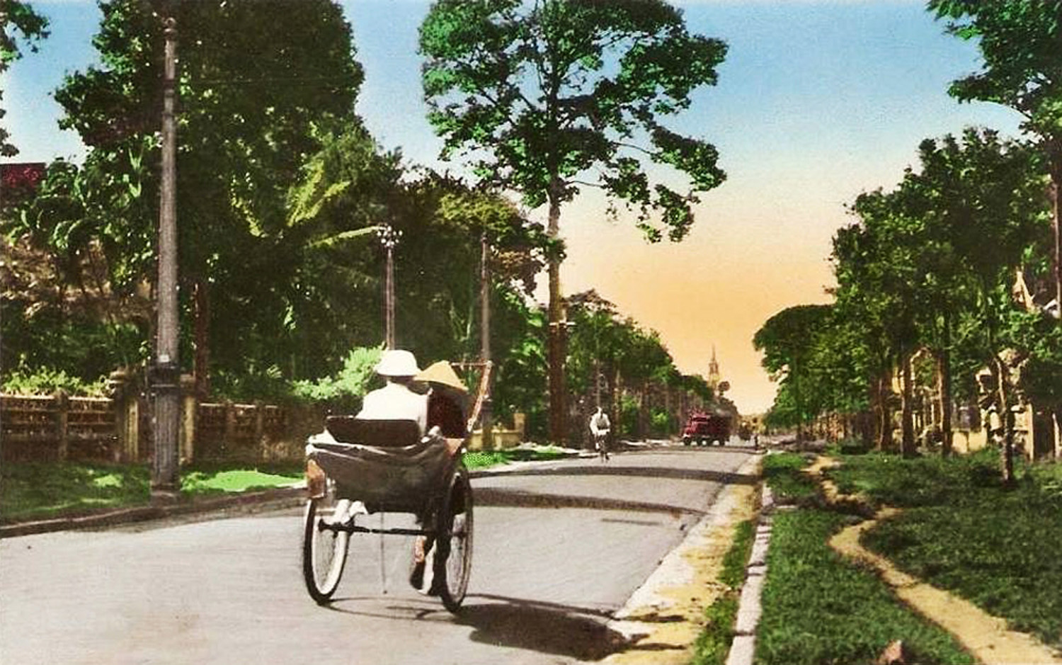
Rue Paul-Blanchy in 1947
This article was published previously in Saigoneer.
One of Saigon’s longest and busiest streets, Hai Bà Trưng is a thoroughfare of great antiquity which dates back more than 200 years.
As early as 1772, the modern Hai Bà Trưng-Lý Chính Thắng junction was the location of an important gate in the Lũy Bán Bích city walls.
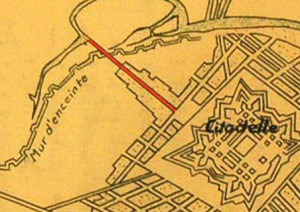
The northern end of what would later become Hai Bà Trưng street, leading north from the first Gia Định Citadel on a 1793 map
After the construction of the first Gia Định Citadel in 1790, the section of the street north of the modern Nguyễn Đình Chiểu junction became the main road leading out of the citadel’s principal northern entrance, the Khảm Hiền Gate.
This early street led north across the Thị Nghè Creek to Phú Nhuận, and during the existence of the first citadel (1790-1837), that ancient village became a residential area for royal mandarins. Today, no fewer than four Nguyễn dynasty mandarin tombs may still be found in Phú Nhuận district.
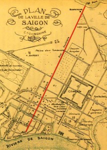
The rue Impériale on a Saigon map of 1867
After the demolition of the first Gia Định Citadel in 1835, the street was extended southwards, all the way to the Sài Gon River.
In the wake of the French conquest, the colonial administration named it rue No 14. A “blockhaus” fortification was built within a surviving section of the old city walls on the modern Hai Bà Trưng-Lý Chính Thắng junction, to guard the Kiệu Bridge, which was known throughout the colonial era as the Troisième pont de l’Avalanche (Third Bridge over the arroyo de l’Avalanche, or Thị Nghè Creek).
By 1863, the street had been renamed rue Impériale. Its northern section, designated rue Impériale prolongée, initially formed the easternmost border of a vast ancient cemetery known as the Plaine des tombeaux (Plain of tombs).
The first Governor’s Palace
During the first decade of colonial rule, the French established several important institutions on the rue Impériale, including the first Governor’s Palace (located on the site of the later Institution Taberd, now the Trần Đại Nghĩa High School), the Imprimerie coloniale or Colonial Printers (located on the site of the Intercontinental Hotel), the first Colonial Infantry Barracks (which stood either side of the road in the area now occupied by the modern “Lavenue Crowne” construction site and the French Consulate General), and further north the European Cemetery (now the Lê Văn Tám Park).
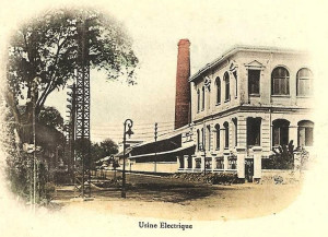
The first Usine éléctrique of 1896
In 1870, the street was renamed rue Nationale and its northern section rue Nationale prolongée. In subsequent years, it became home to the Église de Tan-Dinh (Tân Định Church, 1876, rebuilt 1896-1898), the Manufacture d.Opium (Opium Factory, 1881, rebuilt early 1900s) and the Usine éléctrique (Electricity Station, 1896).
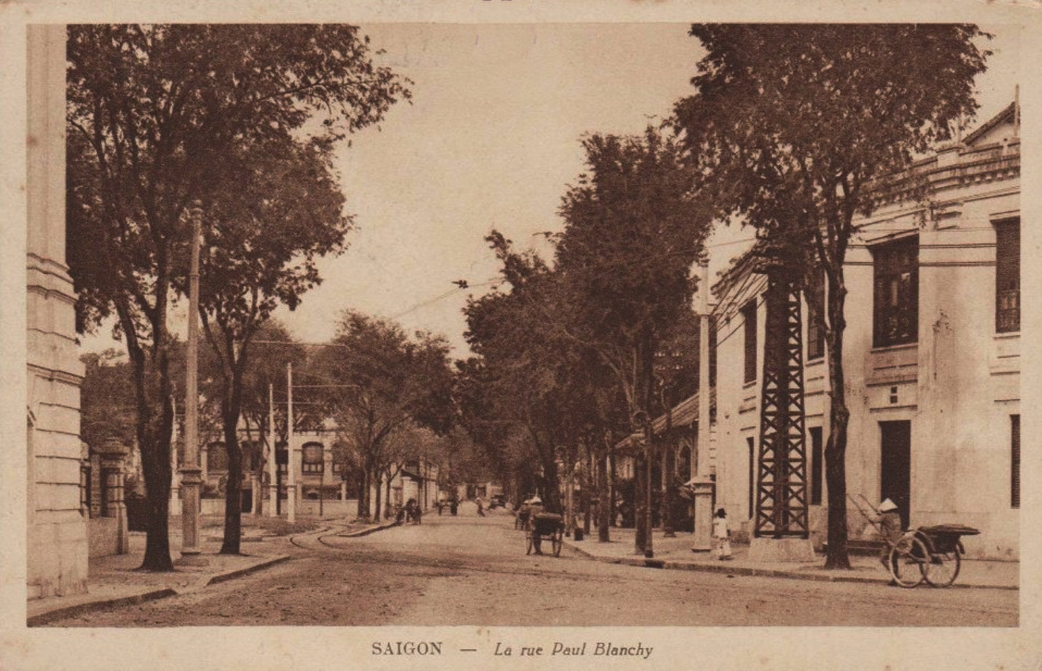
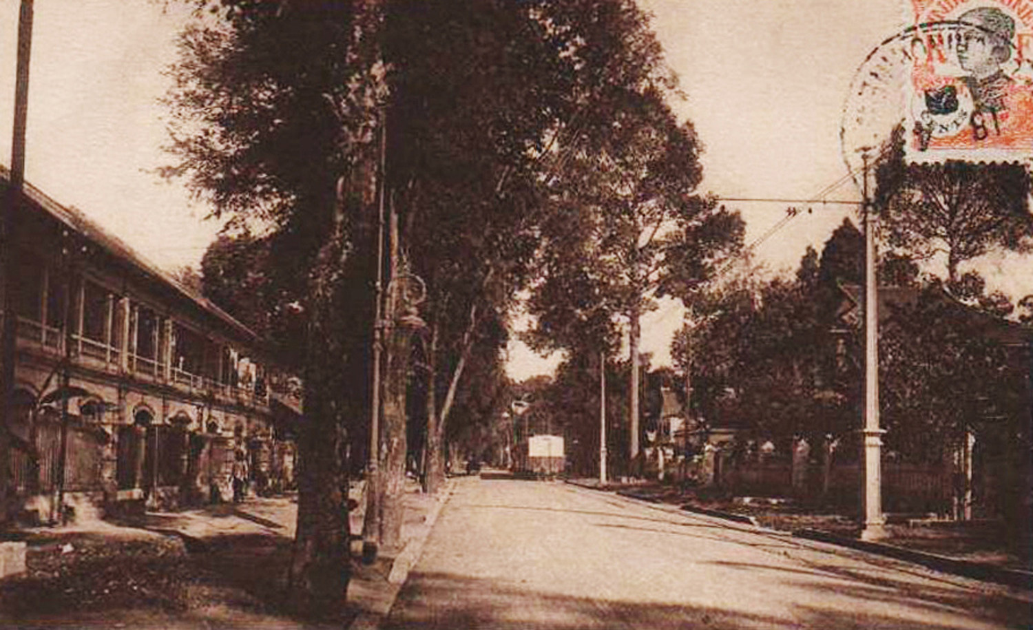
The rue Nationale was renamed yet again in 1902, this time as rue Paul Blanchy, after the popular city mayor and pepper farmer Paul Blanchy (1895-1901), who had died unexpectedly in the previous year.
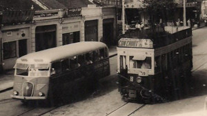
An electric tram in Saigon in 1951
Before the 1920s, the street was largely by-passed by the Saigon tramway system, apart from a 1km spur installed in 1895-1897 along boulevard Paul-Bert (Trần Quang Khải street) to connect Đa Kao with the Kiệu Bridge. However, this situation changed with the tramway electrification scheme of 1923, under which a new city-centre tramway line emanating from the Halles centrales (Bến Thành Market) was installed along the rue Paul Blanchy.
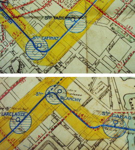
The route of the electric tramway on rue Paul Blanchy after 1923
The line ran north from the square behind the Municipal Theatre to the rue Legrand-de-la-Liraye (Điện Biên Phủ), where it turned northeast towards Đakao and Gia Định. Three new tramway stations known as Taberd (modern Hai Bà Trưng/Nguyễn Du junction), Larclauze (modern Hai Bà Trưng/Trần Cao Vân junction) and Paul Blanchy (modern Hai Bà Trưng/Điện Biên Phủ junction) were built along this section of the street.
In 1952, Bảo Đại’s State of Việt Nam government rechristened the northern section of the street from boulevard Norodom (Lê Duẩn) to the Kiệu Bridge as Trưng Nữ Vương, while retaining the name rue Paul Blanchy for the southern section.
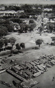
An aerial view of Mê Linh square and the southern end of Hai Bà Trưng street in the late 1950s
However, in March 1955, the Ngô Đình Diệm government gave the entire street its current name Hai Bà Trưng (“Two Trưng Sisters”), in honour of siblings Trưng Trắc and Trưng Nhị who rebelled against Chinese rule in the 1st century CE. At the same time, the square where it met the quayside, known for most of the colonial era as place Rigault de Genouilly, was renamed Mê Linh square, after the sisters’ home prefecture. Nearby rue Cornulier-Lucinière was also renamed Thi Sách street after Trưng Trắc’s husband General Thi Sách, whose murder by the Chinese drove the two sisters to revolt.
After so many early changes of name, the street has now been designated Hai Bà Trung for over 60 years. Today this vital artery connecting District 1 with Districts 3 and Phú Nhuận is home to some of the city’s most popular shops and restaurants.

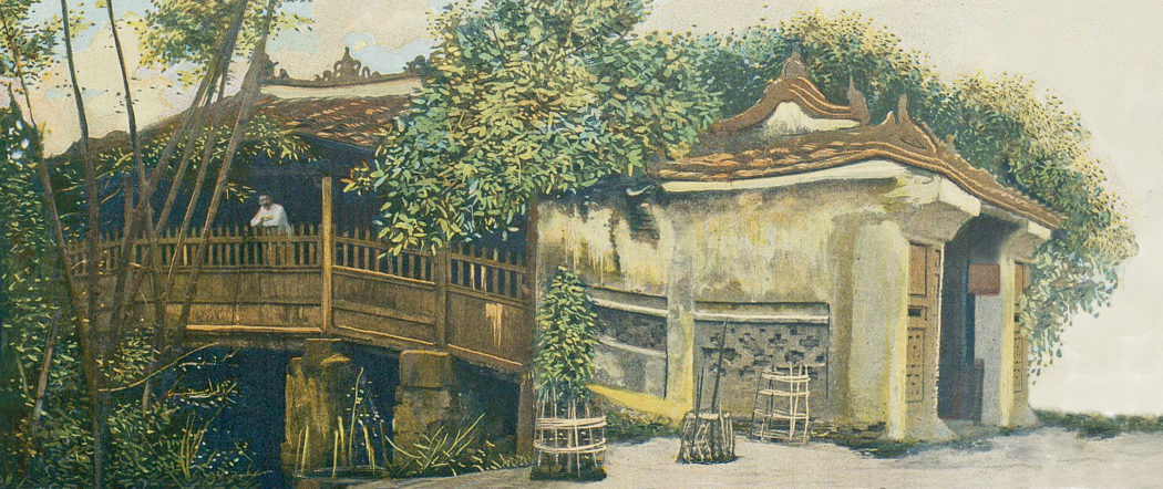
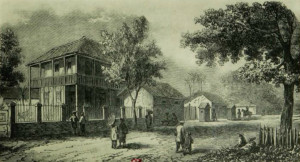
Rue Nationale in the late 19th century
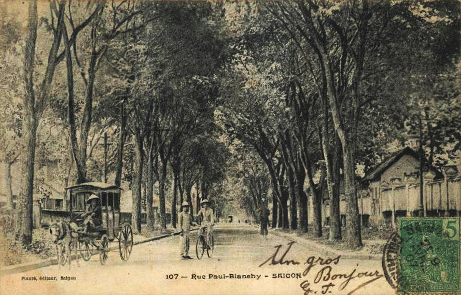
Rue Paul Blanchy in the early 20th century
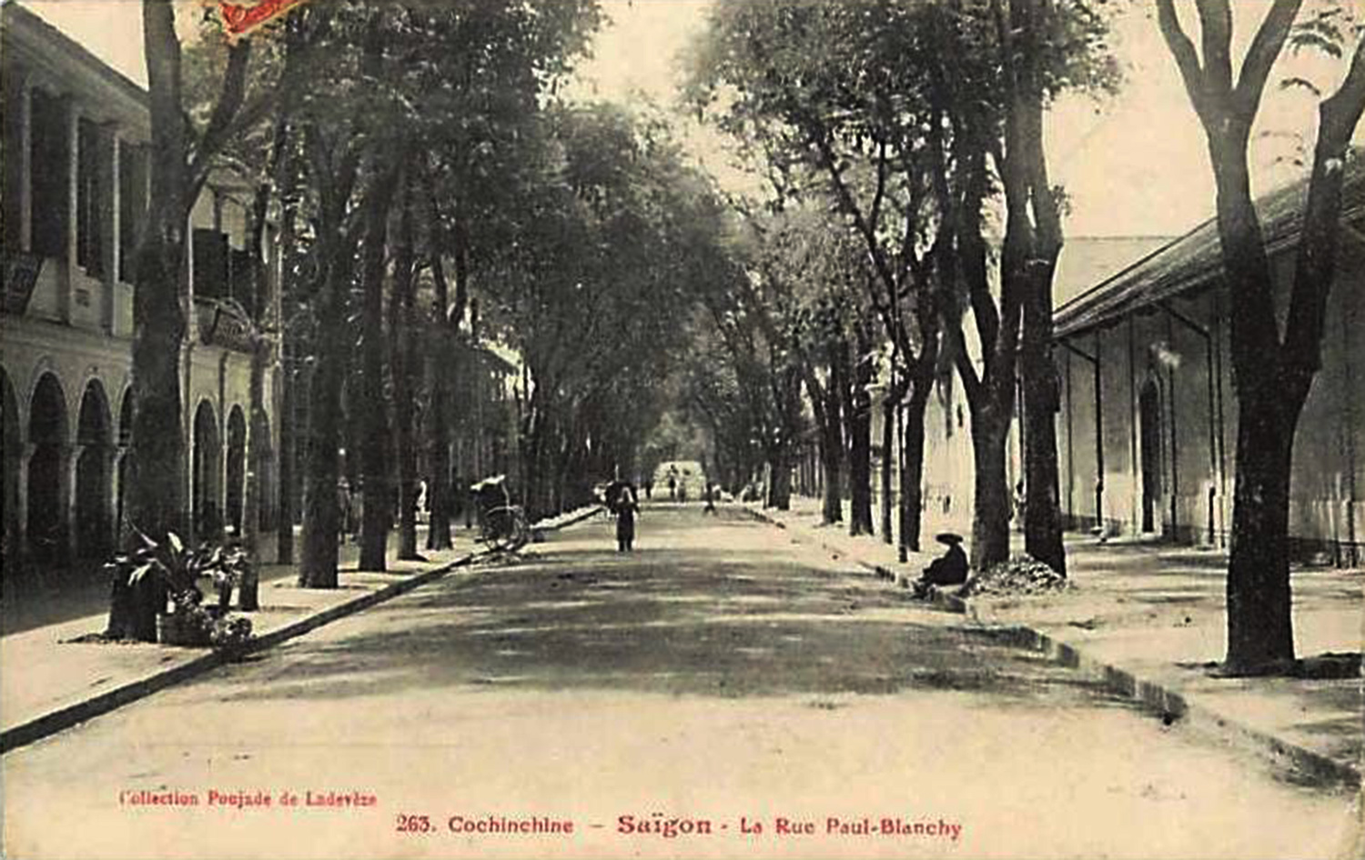
Another view of rue Paul Blanchy in the early 20th century
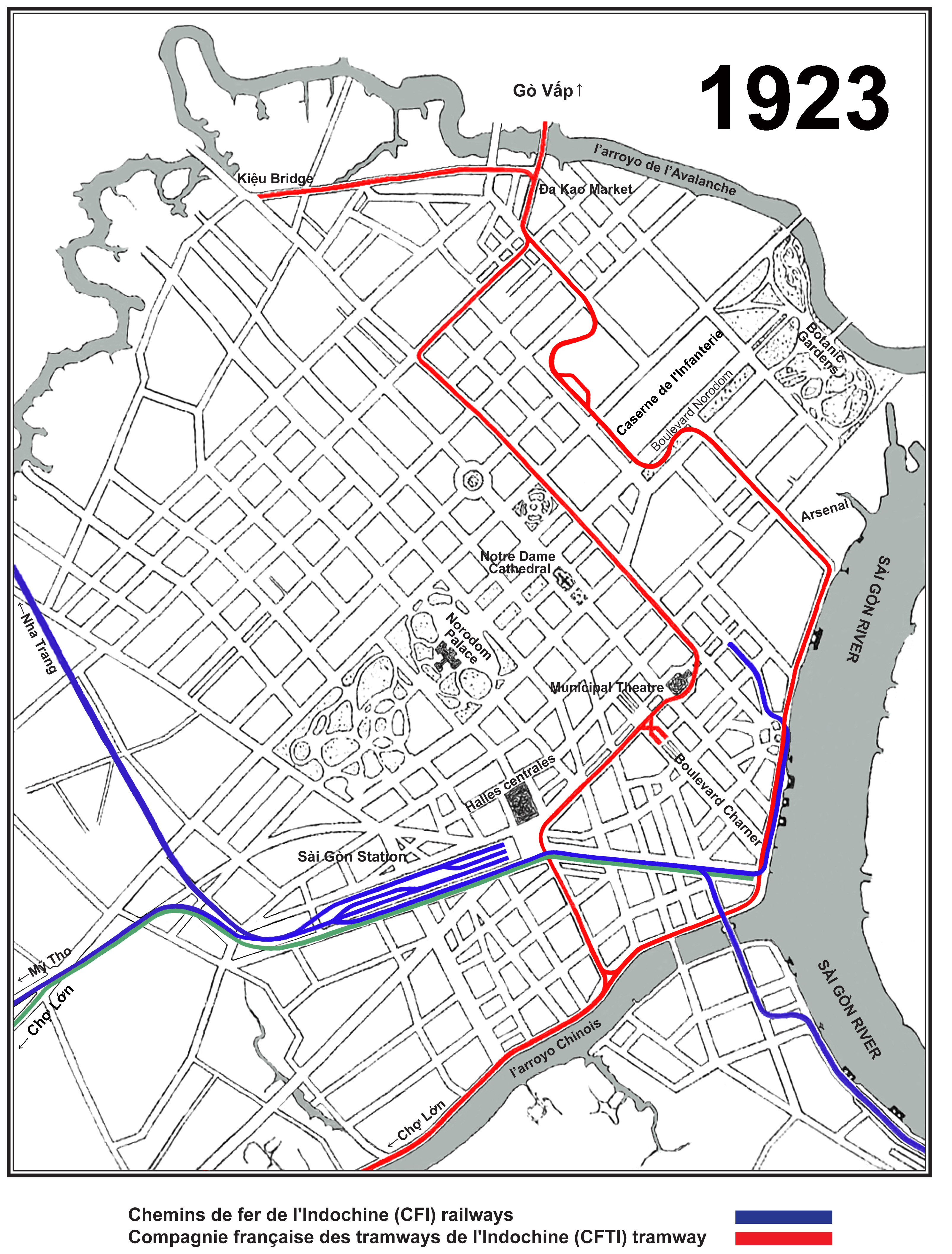
The Saigon tramway and railway network in 1923
Rue Paul Blanchy viewed from the Municipal Theatre in the late 1920s after the installation of the electric tramway
An electric tram on rue Paul Blanchy in the 1930s
Tim Doling is the author of the guidebook Exploring Saigon-Chợ Lớn – Vanishing heritage of Hồ Chí Minh City (Nhà Xuất Bản Thế Giới, Hà Nội, 2019)
A full index of all Tim’s blog articles since November 2013 is now available here.
Join the Facebook group pages Saigon-Chợ Lớn Then & Now to see historic photographs juxtaposed with new ones taken in the same locations, and Đài Quan sát Di sản Sài Gòn – Saigon Heritage Observatory for up-to-date information on conservation issues in Saigon and Chợ Lớn.