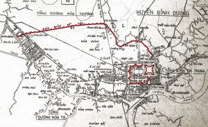
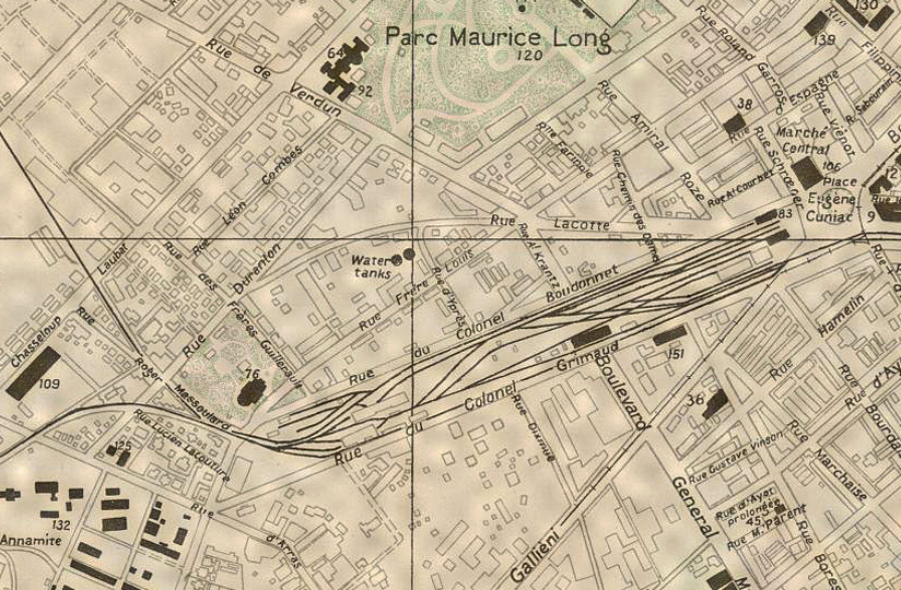
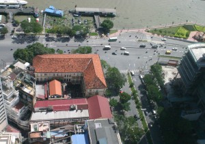
The second Saigon Railway Station (1915-1983) depicted on a 1946 map
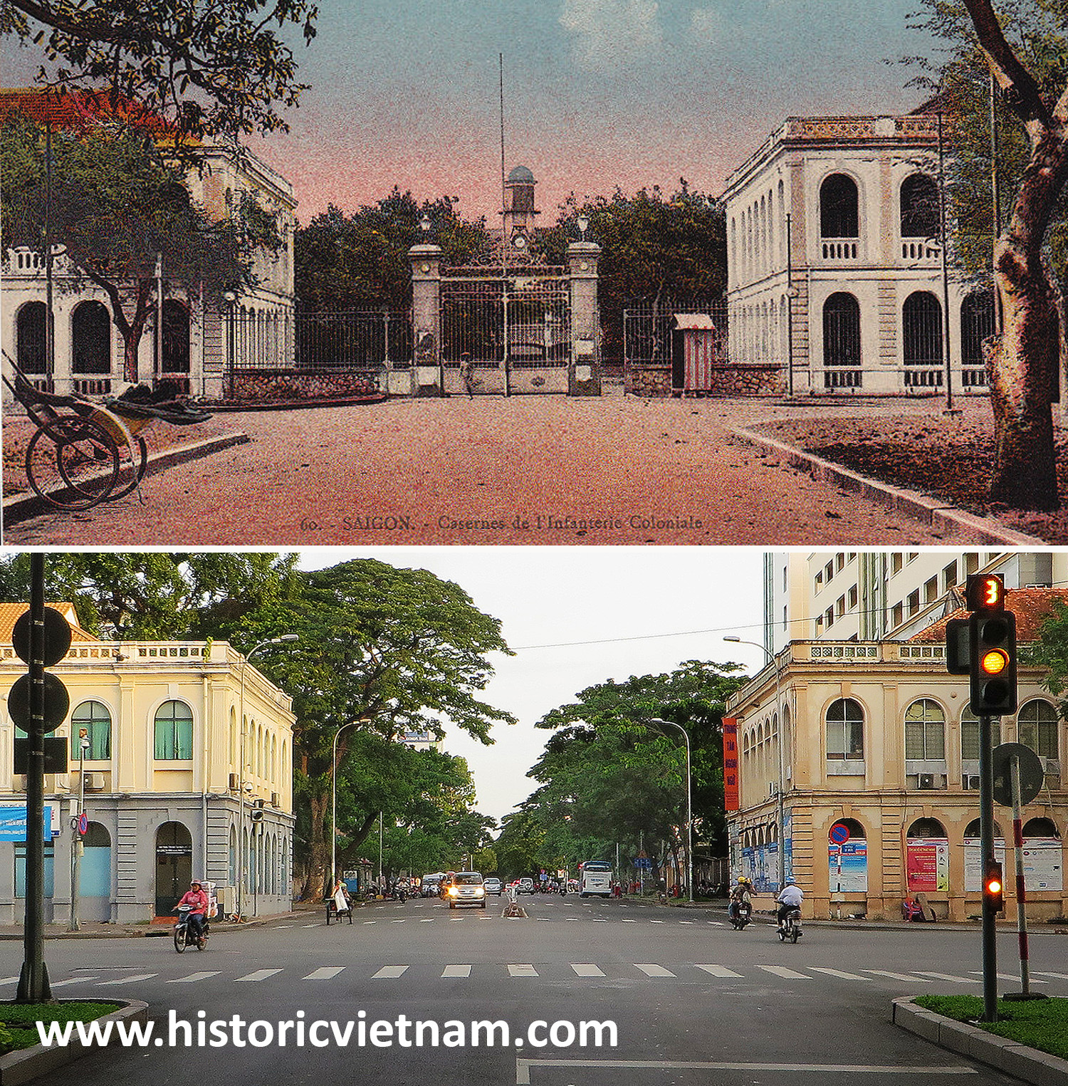
Travellers arriving by train in Hồ Chí Minh City sometimes express surprise that the main Sài Gòn Railway Station is located in Hòa Hưng, some distance from the Central Business District. In fact, this is the third railway terminus in a city where each successive station has been built further away from the river.
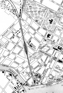
The location of the first Sài Gòn Railway Station
Opened in 1885 to serve Indochina’s earliest railway line from Sài Gòn to Mỹ Tho, the first Sài Gòn Railway Station was located at the riverside end of rue du Canton (modern Hàm Nghi boulevard). From there, the rail track ran west along the centre of the boulevard, cutting through what is now Quách Thị Trang square and following the path of modern Phạm Hồng Thái and Lê Thị Riêng streets en route for Chợ Lớn and Mỹ Tho.
The line’s first operator, the Compagnie des chemins de fer garantis des colonies françaises (CCFGCF), built a large dépôt-atelier next to the line, in the area now occupied by the west end of Hàm Nghi street and Quách Thị Trang square.
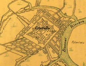
A map of 1900 showing the route of the Sài Gòn–Mỹ Tho and Sài Gòn–Nha Trang lines
After 1903, CCFGCF’s successor, the Société générale des tramways à vapeur de Cochinchine (SGTVC), added a freight spur which branched west from the station throat along rue d’Adran (now Hồ Tùng Mậu street) to connect with Sài Gòn docks via the pont tournant (Khánh Hội) swing bridge.
When construction of the Sài Gòn–Nha Trang line got underway in 1901, its route initially followed the existing Sài Gòn–Mỹ Tho line from rue du Canton – by then known as boulevard Krantz-Duperré – as far as the present-day Phù Đổng junction, where it branched northward along the route de Thuan-Kieu (now Cách mạng Tháng 8 street) to Hòa Hưng and onward to Biên Hòa.
Realising that the existing terminus was too small to serve two railway lines, the authorities drew up plans to build a larger station on the site of the existing dépôt-atelier at the western end of boulevard Krantz-Duperré. However, when this scheme fell through, a temporary terminus had to be set up next to the modern Hàm Nghi/Nam Kỳ Khởi Nghĩa intersection. Consequently, when the first 29km section of the Sài Gòn–Nha Trang line was inaugurated on 13 January 1904, trains on the new line departed from this temporary terminus, while Sài Gòn–Mỹ Tho line trains continued to use the old riverside station.
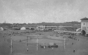
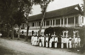
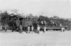
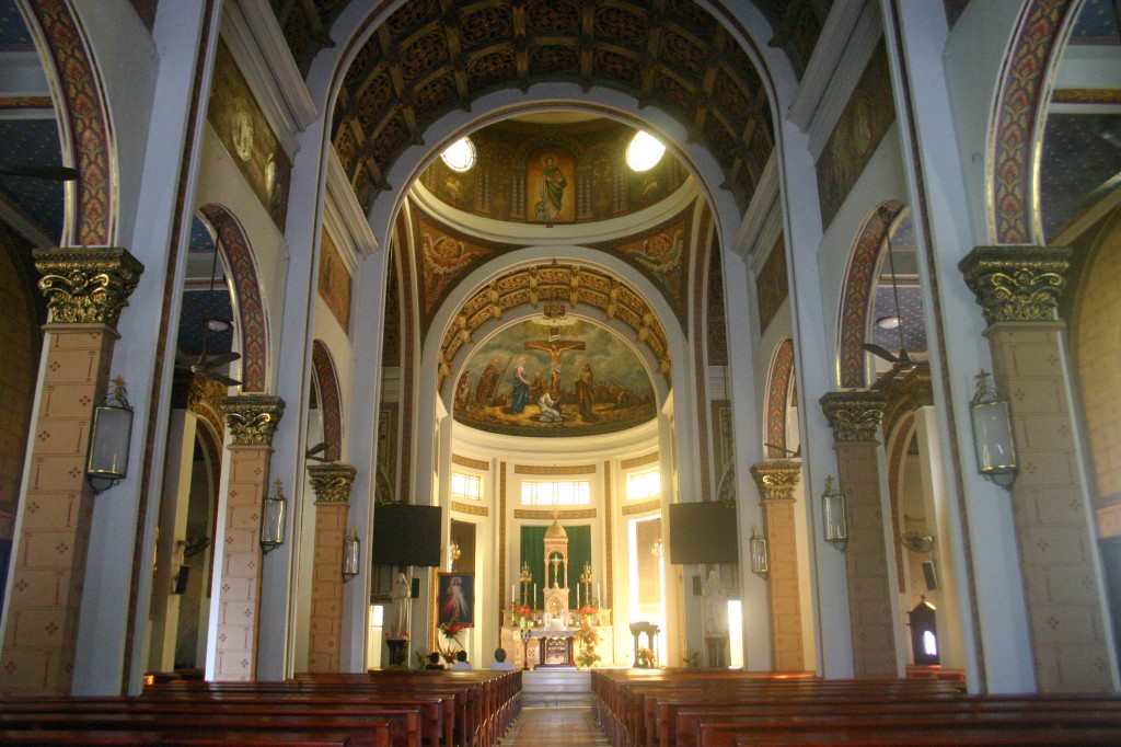
The second Sài Gòn Station (pictured left) in 1916
The redevelopment which accompanied the construction of the new Halles centrales (Bến Thành Market) from 1910 onwards gave the colonial authorities the chance to rectify this unsatisfactory state of affairs by rerouting both the Sài Gòn–Mỹ Tho and Sài Gòn–Nha Trang railway lines into a single terminus southwest of the new market.
Construction of this second Sài Gòn Railway Station got under way in 1911 and it opened in September 1915. Its southwest-facing alignment — preserved to this day in the shape of 23-9 Park on Hồ Chí Minh City’s popular “backpacker street,” Phạm Ngũ Lão — necessitated only minor modifications to the route of the Sài Gòn–Mỹ Tho line, but the Sài Gòn–Nha Trang line had to be completely realigned southward from Hòa Hưng along what is now Nguyễn Thượng Hiền street.
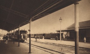
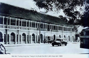
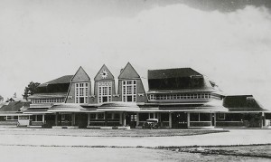
A “platform’s eye view” of the second Sài Gòn Station
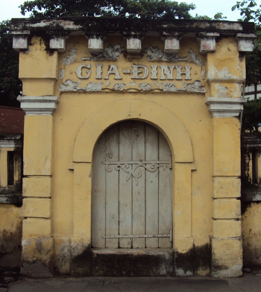
At the same time, the old dépôt-atelier was demolished, permitting boulevard Krantz-Duperré to be extended westward into a spacious new square named place Eugène Cuniac (now Quách Thị Trang square), where a grand southern headquarters for the Chemins de fer de l’Indochine (CFI) was built opposite the station entrance.
A single-track line was left in place along boulevard Krantz-Duperré to maintain freight access to the Saigon port and this was connected to the new station by a rail spur across place Cuniac.
Unfortunately in subsequent years the colonial authorities realised that the new railway station blocked several main traffic arteries and in the mid 1920s its location was deemed to be “the cause of deplorable circulation and atrophication” in the city centre.
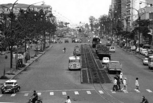
The old freight track on Hàm Nghi boulevard pictured during the 1960s
By this time too, as the construction of the Transindochinois from Sài Gòn to Hà Nội neared completion, it was increasingly felt that the new station had insufficient capacity to deal with the anticipated increase in both passenger and freight traffic. Plans were therefore drawn up to relocate the terminus yet again – this time out of the city centre to Hòa Hưng.
North of Hòa Hưng, the original path of the Sài Gòn-Nha Trang line took it along rue Capitaine Faucon (modern Trần Quang Diệu and Trần Huy Liệu streets). However, a 3.6 million-piastre project of 1931 recommended that the line should be rerouted to the west of this alignment to terminate at Hòa Hưng, where a new Sài Gòn Railway Station would be built, along with a locomotive depot and a Gare de marchandises (freight depot). To access the new station, the final stretch of the Sài Gòn–Mỹ Tho line would also be diverted northward from Phú Lâm. In fact, the project ran into various difficulties and was only partially completed.
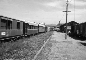
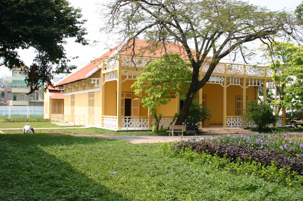
Sài Gòn Railway Station pictured in 1968
By 1938 the Sài Gòn-Nha Trang line north of Hòa Hưng had been rerouted along its current path and new freight and locomotive depots had been built on the deviation. However, for the time being Sài Gòn Railway Station was left where it was.
Following the closure of the Sài Gòn–Mỹ Tho branch line in 1958, CFI’s successor, the South Vietnamese Department of Railways (Sở Hỏa xa Việt Nam, HXVN), drew up its own scheme to close the unloved city centre railway terminus and relocate it to Hòa Hưng. However, since it was unable to secure the necessary funds, the long-mooted northward relocation of the southern rail terminus would not be realised until after Reunification.
From 1967 onwards, National Liberation Front and North Vietnamese army attacks on the southern railway network intensified and in the wake of the Tết Offensive of 1968 the HXVN found it increasingly difficult to maintain train services. By 1971 scheduled services in and out of Sài Gòn had effectively ceased.
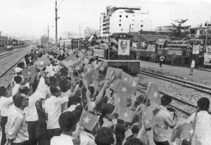
The first “Unification Express”arrives in Saigon from Hà Nội on 4 January 1977
After Reunification in 1975, the restoration of the entire North-South railway to operation became a political priority. In December 1976, the first through train services since 1945 was launched between Hà Nội and Sài Gòn, now known as Hồ Chí Minh City.
Construction of the current terminus – the third Sài Gòn Railway Station – began in 1978 on the site of the old French Gare de marchandises. It was completed in November 1983 and after its inauguration the old railway track into the city centre was removed. The site of the old city-centre terminus became “23-9 Park,” named in memory of those patriots killed while resisting the British Indian forces who helped the French to reoccupy Sài Gòn on 23 September 1945.
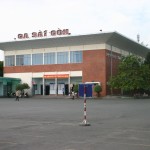
The third and current Sài Gòn Railway Station
Interestingly, current plans for the future development of Hồ Chí Minh City as a rail hub call for the southernmost stretch of the North-South line from Bình Triệu into Hồ Chí Minh City to be rebuilt as an elevated fast line and extended through the city to a new terminus in the southwest suburb of Tân Kiên. Perhaps in future the sound of railway trains will one day be heard in the heart of the southern capital.
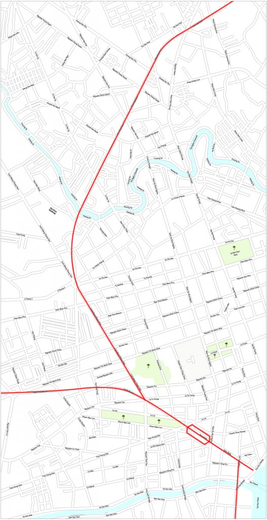
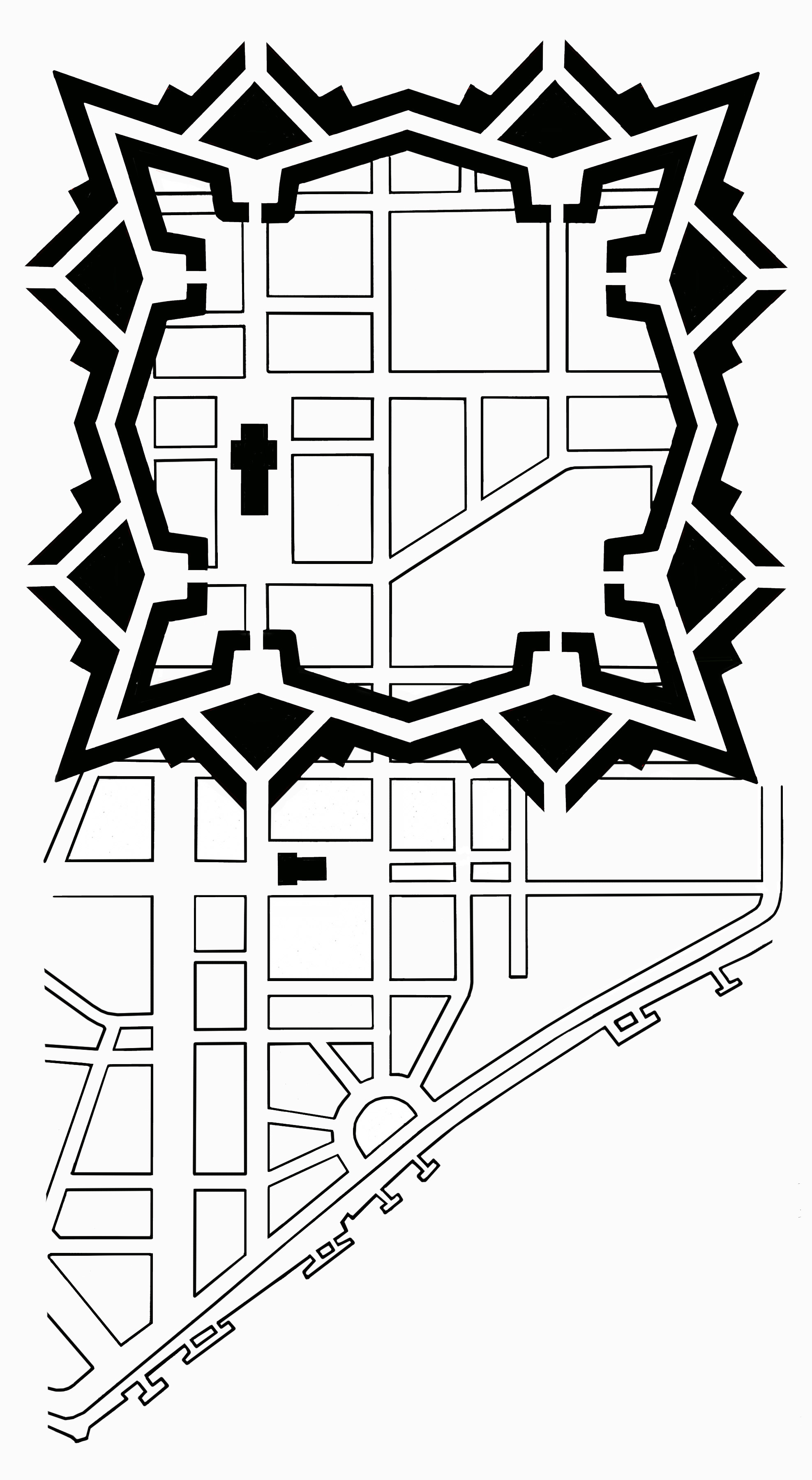
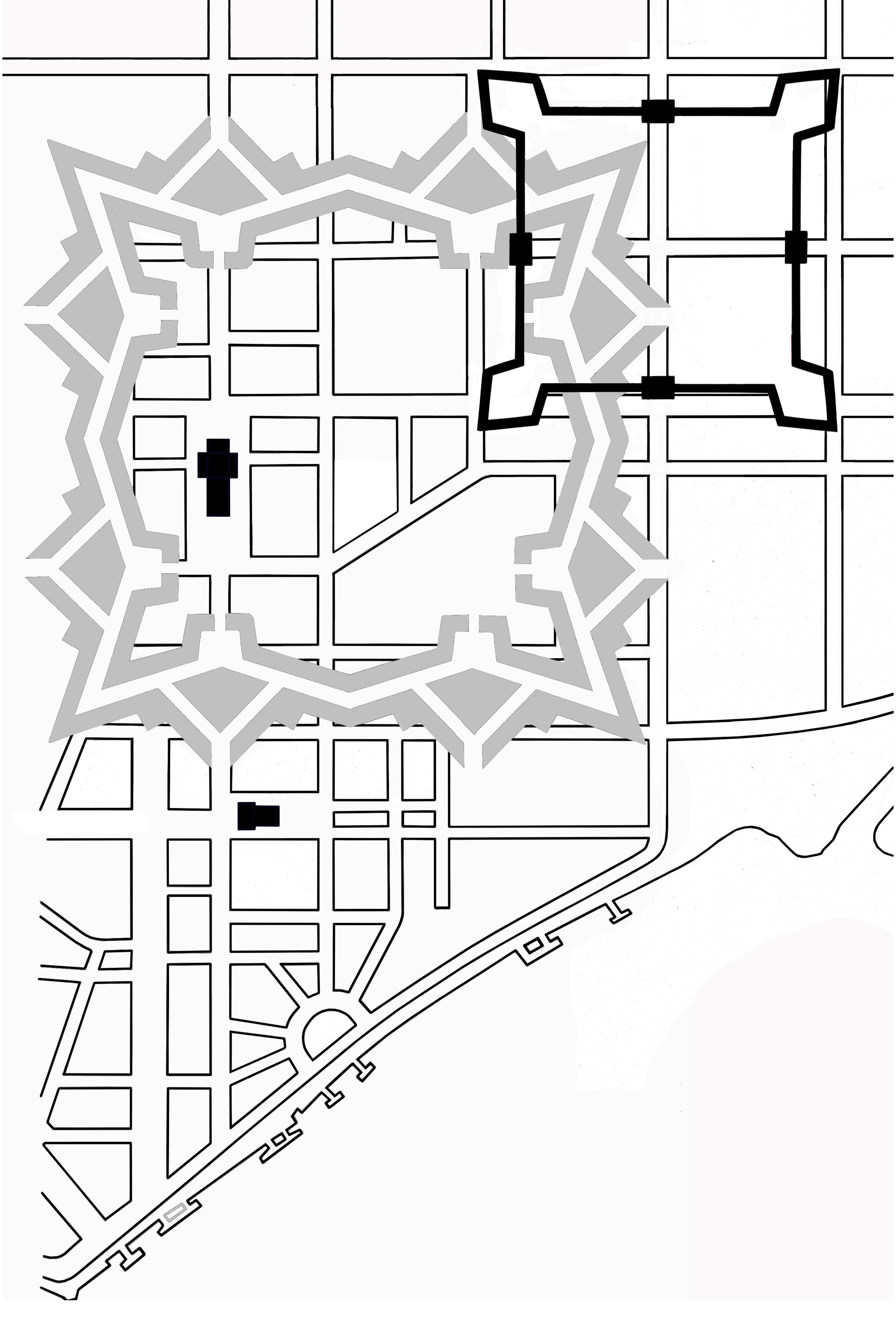
The paths of the Sài Gòn–Mỹ Tho and Sài Gòn–Nha Trang lines from 1904 until 1915, superimposed on the modern street map
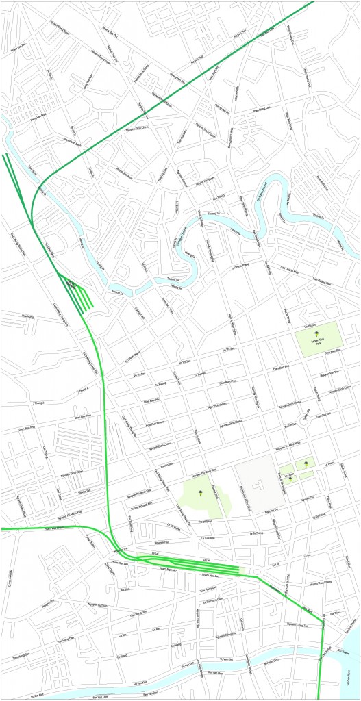
The paths of the Sài Gòn–Mỹ Tho and Sài Gòn–Nha Trang lines after 1938, superimposed on the modern street map
Tim Doling is the author of The Railways and Tramways of Việt Nam (White Lotus Press, Bangkok, 2012) and also gives talks on Việt Nam railway history to visiting groups.
Tim is also the author of the guidebook Exploring Saigon-Chợ Lớn – Vanishing heritage of Hồ Chí Minh City (Nhà Xuất Bản Thế Giới, Hà Nội, 2019)
A full index of all Tim’s blog articles since November 2013 is now available here.
Join the Facebook group Rail Thing – Railways and Tramways of Việt Nam for more information about Việt Nam’s railway and tramway history and all the latest news from Vietnam Railways.
You may also be interested in these articles on the railways and tramways of Việt Nam, Cambodia and Laos:
A Relic of the Steam Railway Age in Da Nang
By Tram to Hoi An
Date with the Wrecking Ball – Vietnam Railways Building
Derailing Saigon’s 1966 Monorail Dream
Dong Nai Forestry Tramway
Full Steam Ahead on Cambodia’s Toll Royal Railway
Goodbye to Steam at Thai Nguyen Steel Works
Ha Noi Tramway Network
How Vietnam’s Railways Looked in 1927
Indochina Railways in 1928
“It Seems that One Network is being Stripped to Re-equip Another” – The Controversial CFI Locomotive Exchange of 1935-1936
Phu Ninh Giang-Cam Giang Tramway
Saigon Tramway Network
Saigon’s Rubber Line
The Langbian Cog Railway
The Long Bien Bridge – “A Misshapen but Essential Component of Ha Noi’s Heritage”
The Lost Railway Works of Truong Thi
The Mysterious Khon Island Portage Railway
The Railway which Became an Aerial Tramway
The Saigon-My Tho Railway Line